Cammal, Pennsylvania
Top Spots in and near Cammal
-
Wellsboro, Pennsylvania
Turkey Path
4.31.72 mi / 748 ft gainThis is a fairly steep trail with many switchbacks, which makes it an easy hike down and a tough one back. But don't worry there are bridges and stairs to help you out. It is also family friendly, but make sure you plan on taking on the added weight if you have young children with you. We went wi...Read more -
Wellsboro, Pennsylvania
Hike Leonard Harrison SP's Overlook Trail to Otter View
4.30.6 miThis is a simple .6 mile trail that starts around the bathrooms and loops past Otter View.The trail itself is an easy hike. Otter View is a great spot for a family hike. By the bathrooms are different spots to get amazing views. The upper level is handicap accessible and there are steps down to a...Read more -
Wellsboro, Pennsylvania
Barbour Rock Loop
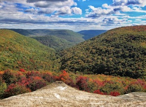
2.64 mi / 331 ft gainThe parking can be found along Colton Road heading toward Colton Point State Park. There is a large sign opposite the parking and the trail is a wide gravel path through the woods. It is 0.7 miles walk on the path to the vista suitable for anyone. You then have the option to head back or create ...Read more -
Wellsboro, Pennsylvania
West Rim Trail
4.027.97 mi / 4065 ft gainHiking north to south, the trailhead is just off of Colton Road at a gravel parking lot with bathrooms. The trail is marked with orange blazes and has the largest elevation gain at the beginning and then has relatively moderate elevation change throughout the remainder of the hike. At 2.6 mile...Read more -
Wellsboro, Pennsylvania
Kayak Camp the Pennsylvania Grand Canyon
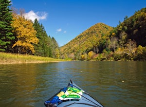
5.0Start at the Big Meadows parking area in Ansonia. The water access is at Marsh Creek but almost immediately meets up with Pine Creek. Arrange a shuttle service with Pine Creek Outfitters to either pick you up or shuttle your vehicle to the take out at Blackwell and also pick up one of their wate...Read more -
Trout Run, Pennsylvania
Hike the Frozen Run Gorge
5.05 miOne of the most remote hikes in the beautiful Loyalsock State Forest, this loop through the Frozen Run Gorge is a fantastic hike for an experienced hiker looking to see a place that few other hikers do.There are no official trails through the gorge and this hike is a bushwhack. There are a couple...Read more -
Williamsport, Pennsylvania
Kayak from Susquehanna State Park
This adventure can be started from the boat launch at Susquehanna State Park in Williamsport, PA. The river is slow moving and calm in this section. Since the river is slow you can easily paddle up river and then return to the same boat launch. A short round trip can be made by paddling west ...Read more -
Trout Run, Pennsylvania
Fish at Rose Valley Lake
4.0Rose Valley Lake, if you did not know is not a natural lake, it is man made. Construction of the 389-acre lake was completed in 1972. I prefer to fish for bass from the boat, but I will not hesitate to go out ice fishing in the winter either. On the lake, boats are limited to electric motors or g...Read more -
Coudersport, Pennsylvania
Camp at Cherry Springs State Park
4.61 miCherry Springs State Park was my first ever International Dark Sky Park and it stole my heart, and I promise it will steal yours too.The park itself is very quaint, but don't let it's size deter you! The park is still as remote and wild as it was nearly two centuries ago, and that's nearly imposs...Read more -
Trout Run, Pennsylvania
Hike the Katy Jane Trail in Rider Park
4 mi / 560 ft gainHiking, trail running, mountain bike riding, cross country skiing and other low impact recreational activities are all part of what Rider Park has to offer. My personal favorite is the 3.6 mile Katy Jane Trail with a 560 vertical rise. It begins on the right side of the parking area. The trails a...Read more -
Trout Run, Pennsylvania
Jacoby Hollow
5.03.2 mi / 545 ft gainJacoby Hollow is an out-and-back trail that takes you by a waterfall located near Trout Run, Pennsylvania.Read more -
Montoursville, Pennsylvania
Hike to Jacoby Run Falls
4.03.3 mi / 341 ft gainThe trailhead is at a large gravel parking area off of Wallis Run Road. The trail begins on a boardwalk over a wetland that leads into hemlock forest and mixed hardwoods.The yellow blazed trail follows Jacoby Hollow at a steady slight incline and leads to the 45 foot Jacoby Falls. Best times to...Read more -
McIntyre Township, Pennsylvania
Explore Rock Run
5.0Rock Run is a place that I would not turn down a chance to explore again and again. It is easy to get lost in your own thoughts reflecting on the beauty of the surroundings, swim in the always chilled waters, or get out your fishing pole and catch some trout during the season.After making your w...Read more -
Montgomery, Pennsylvania
Hike through SGL 252
4.76 mi / 400 ft gainWhat was once known as the town of Alvira PA, is now known as State Game Lands number 252. During WWII the land was seized by the army and used as an army ordnance. Because of its past, while you are exploring, be on the lookout for old ammunition bunkers that have succumb to years of neglect, an...Read more -
Williamsport, Pennsylvania
Hike Smith's Knob Hike via the Loyalsock Trail
5.08.3 mi / 1400 ft gainSmith's Knob is a short, but fairly challenging section of the overall Loyalsock Trail. Smith's Knob has a distinctively round peak, and viewed from Rider Park, sticks out to all very easily. The trail starts off very steep, and will require some effort right away. However, it soon becomes more o...Read more -
Mifflinburg, Pennsylvania
Stroll along the Rapid Run Nature Trail
1.09 miThere are multiple ways to access and start the trail, there is a small parking area near the intersection of McCall Dam Road and Route 192 or you can access from the other end near the beach at Halfway Lake. The trail is well marked with yellow blazes and easy to fall. This is a simple hike, b...Read more

