Tygh Valley, Oregon
Looking for the best chillin in Tygh Valley? We've got you covered with the top trails, trips, hiking, backpacking, camping and more around Tygh Valley. The detailed guides, photos, and reviews are all submitted by the Outbound community.
Top Chillin Spots in and near Tygh Valley
-
Mosier, Oregon
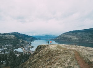
Mosier Plateau Trail
2.79 mi / 600 ft gainThe Columbia River Gorge is full of hidden gems, especially for new folks like me. I just found out about this little trail right in the middle of Mosier Oregon. The trail is great for new hikers, and if you have some friends visiting this would be the perfect trail to take them on if they don'...Read more -
Rhododendron, Oregon
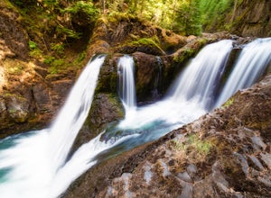
Frustration Falls
3.08.26 mi / 1854 ft gainThe hike and possible rappel to Frustration Falls begins at the Salmon River trailhead right outside of Welches, Oregon. From the trailhead you follow the trail for about 4 miles at which point you reach Canyon View (Shown in pictures 5-6 above). From the main trail this is the only view of Frust...Read more -
Shaniko, Oregon
Explore Shaniko's Ghost Town
Heading south from Wasco, the scenery trades off between new farms and old abandoned homesteads. Most areas are fenced off along the road to keep in the roaming cattle, but now and then there is access to adventure off and visit the places that the settlers decided on in the 18-1900's.About 50 mi...Read more -
White Salmon, Washington
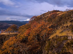
Coyote Wall Loop
3.56.29 mi / 1962 ft gainCoyote Wall is a relatively uncrowded trail system in the Columbia River Gorge that provides outstanding views of the Columbia River. The trail system is made up primarily of user-created mountain biking trails, allowing hikers a choose-your-own-adventure approach to exploring the area. Start o...Read more -
Clackamas County, Oregon
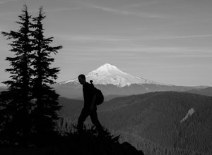
Tumala (Squaw) Mountain
4.74.51 mi / 1099 ft gainOn a clear day, this short, secluded hike offers breath-taking views of Mt. St. Helens, Mt. Rainier, Mt. Adams, Mt. Hood, and Mt. Jefferson, as well as of downtown Portland, Coast Range, and the Roaring River Wilderness. Begin the hike from the Twin Springs Trailhead and immediately take your fi...Read more -
Estacada, Oregon
Raft the Wild and Scenic Clackamas River
5.0The Wild and Scenic Clackamas River above the North Fork Reservoir is a great destination for paddlers and only about an hour drive from downtown Portland. This popular 13.5 mile section of river lies within the Mt. Hood National Forest and offers continuous class II-III boating with a little cla...Read more -
Stevenson, Washington
Wind Mountain
5.02.5 mi / 1037 ft gainOnce you reach the parking lot, walk down the hill and find the trail head, which is easily seen as it is marked. Begin your trek up the trail. The way up is pretty much all uphill, and is a great workout for the legs. You will walk through forests and over many rocks on the way up. As soon as y...Read more -
Cascade Locks, Oregon
Indian Point via Herman Creek Trailhead
5.08.08 mi / 3658 ft gainPark at the Herman Creek Trailhead in Cascade Locks 2 miles from the exit. Remember to bring your Northwest Forest pass or a $5 payment to park. Start ascending on the Herman Creek trail a little over a mile until you hit a three-way junction for Gorton Creek Trail #408, Trail #400, and Herman ...Read more -
Cascade Locks, Oregon
Explore Government Cove
4.7From downtown Portland follow I-84 East for about 50 miles until you reach mile marker 51. Get back on the highway but Westbound until you reach mile marker 47 pull off and take a right over the train tracks and you're there.Beautiful scenery all around and if you get there early enough, you can...Read more -
Marion County, Oregon
Hike Mt. Jefferson's Park Ridge
5.07.4 mi / 1500 ft gainFrom the Breightenbush Lake PCT trailhead (5,600ft Elevation) you hike through a thick forest until you reach an old burn area. This area was burned from a forest fire and has rebirthed lush green plants and bushes to help feed all the animals in the area. After a mile of climbing through the bur...Read more -
Cascade Locks, Oregon
Backpack the Mark. O Hatfield Wilderness Via Eagle Creek
1.026 mi / 2300 ft gainThis is a somewhat incomplete report because we did not venture too far into the Mark O. Hatfield Wilderness. The sky had been threatening us with rain for the duration of our hike along Eagle Creek and we did not want to push our luck too far since we were hoping for an early start on our drive ...Read more -
Cascade Locks, Oregon
Ruckel Creek Falls
4.01.21 mi / 194 ft gainPark at the Eagle Creek Trailhead, and backtrack out towards the highway. Take the path to the right and walk alongside the highway for nearly a half mile. Stop when you are on the bridge and see the Ruckel Creek Trail to your right. If you look left, you will notice a waterfall dropping below yo...Read more -
Cascade Locks, Oregon
Upper McCord Creek Falls
4.71.98 mi / 617 ft gainStarting at the John B Yeon Trailhead parking lot, begin to walk into the forest. After a little more than a quarter mile, you will see a fork in the road, with one way leading to Elowah Falls, and the other way leading to Upper McCord Creek Falls. Take the trail leading to Upper McCord Creek. Th...Read more -
Corbett, Oregon
Hike to Upper Bridal Veil Falls
5.00.5 miAt the parking lot for Angel's Rest, turn left uphill on to Palmer Mill Road. Drive for about a mile, and park right past a tributary stream/small waterfall (pictured above) on your left that flows through a small pipe under the road. You will see a small space to park on the right. Park here and...Read more -
Clackamas County, Oregon
Bagby Hot Springs
4.32.91 mi / 397 ft gainBagby Hot Springs is actually a set of amazing bathhouses nestled in the forest outside of Estacada. They are one of Oregon’s most poplar hot springs, and for good reason. The hike into the hot springs is easy and quite scenic. You’ll cross a bridge over Nohorn Creek and follow the Hot Springs Fo...Read more -
Detroit, Oregon
Boca Cave & Triangulation Peak
4.04.75 mi / 1053 ft gainTriangulation Peak, Spire Rock and Boca Cave TH #3372 The trail starts on level ground where you travel east along the top of the ridge. There are multiple trees that have fallen across the trail making the hike quite adventurous. Some trees you'll go over and some you will need to go under. Dep...Read more

