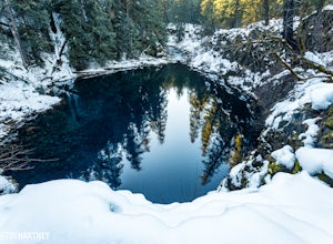
Pleasant Hill, Oregon
Looking for the best hiking in Pleasant Hill? We've got you covered with the top trails, trips, hiking, backpacking, camping and more around Pleasant Hill. The detailed guides, photos, and reviews are all submitted by the Outbound community.
Top Hiking Spots in and near Pleasant Hill
-
Cascade Summit, Oregon
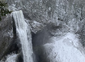
Diamond Creek Falls
5.02.92 mi / 443 ft gainThe beginning of this trail starts at the parking lot of Salt Creek Falls, right off of the 58 freeway. During the winter months, there's a gate blocking the road to the parking lot. You can park at the gate and it's a 0.6 mile walk to the beginning of the Salt Creek Falls trailhead. If you haven...Read more -
Corvallis, Oregon
Hike the Fitton Green Natural Area Trail
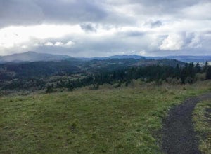
5.05 mi / 1190 ft gainThis is a moderately trafficked trail near Corvallis, OR. It is great for rainy days as much of the trail is paved or has gravel. It is a popular spot for mountain bikers and hikers alike. Some parts of the trail have little shade. There are amazing views of the tall grassy hills and the town...Read more -
Lane County, Oregon
Summit Diamond Peak
9 mi / 3600 ft gainAt 8,743 feet, Diamond Peak is almost as tall as the other iconic volcanoes of the Oregon Cascades, but sees just a fraction of the people. Outside the range of casual Portland day hikes and hard to see from the highway and from other peaks, Diamond Peak and the spectacular wilderness surrounding...Read more -
Mapleton, Oregon
Hike to Sweet Creek Waterfall
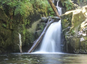
4.82.2 mi / 100 ft gainMake sure you add this hidden gem to your waterfall chasing plans on your road trip to Oregon. This underrated Oregon waterfall is the perfect hike for the entire family. The trail offers four different falls from 10-30 feet high. The trail slowly climbs 2.2 miles through a beautiful thick forest...Read more -
Corvallis, Oregon
McCulloch Peak Loop
5.07.17 mi / 1719 ft gainMcCulloch Peak Loop is a loop trail where you may see local wildlife located near Corvallis, Oregon.Read more -
Foster, Oregon
Iron Mountain
4.71.79 mi / 610 ft gainGetting There There are a couple of different routes to the summit of Iron Mountain. This adventure article focuses on the shorter but more strenuous hike to the summit of Iron Mountain. To get there, drive to the upper trailhead (Trail # 3389) via Highway 20. Take Forest Service Road (FSR) 035 ...Read more -
Corvallis, Oregon
Baker Creek Loop
9.42 mi / 1936 ft gainBaker Creek Loop is a loop trail that takes you by a river located near Adair Village, Oregon.Read more -
Corvallis, Oregon
Dimple Hill Via Patterson Road 600
4.86 mi / 715 ft gainDimple Hill Via Patterson Road 600 is a loop trail where you may see local wildlife located near Corvallis, Oregon.Read more -
Corvallis, Oregon
Vineyard Mountain Loop
3.36 mi / 505 ft gainVineyard Mountain Loop is a loop trail located near Corvallis, Oregon.Read more -
Corvallis, Oregon
Lewisburg Saddle Upper Horse Trail Loop
4.53.17 mi / 630 ft gainLewisburg Saddle Upper Horse Trail Loop is a loop trail in McDonald-Dunn Forest located near Adair Village, Oregon. The trail is dog, horse, and Mountain Bike friendly. If bringing your pup, please be sure to keep in on-leash with horses and other wildlife potentially on the trail. The loop sin...Read more -
Crescent, Oregon
Fuji Mountain Summit via Waldo Road
11.3 mi / 2329 ft gainBackground Fuji Mountain has been known by mountain bikers for years, since it sits just off the circuit of popular biking routes around Waldo Lake and makes for a notoriously difficult climb on a bike. Word hasn't spread to the hiking community yet, despite the spectacular views from the summit...Read more -
Linn County, Oregon
Tamolitch Blue Pool
5.03.56 mi / 253 ft gainThe hike out to Tamolitch Pool, or "Blue Pool," is 2 miles each way and follows the McKenzie River to a lava flow pool. Off Highway 126 14 miles east of McKenzie Bridge, turning into the Trailbridge Campground, drive right 1/3 of a mile to the trailhead. The trail is relatively flat, which gives ...Read more

