Philomath, Oregon
Top Spots in and near Philomath
-
Stayton, Oregon
Shellburg Falls
3.23.7 mi / 520 ft gainThis hike is currently closed due to fire damage. Please check the Oregon.gov website or the call the Oregon Department of Forestry (503-859-4344) for updates. The hike, including the initial 1.25 mile gravel road to the trailhead, is easy to complete within 1-2 hours and only requires a modera...Read more -
Eugene, Oregon
Spencer Butte Loop
4.51.6 mi / 564 ft gainGetting There Searching Spencer Butte Trailhead Parking Lot on Google Maps will direct you to exactly where you need to go. From downtown Eugene/ UO you'll drive south on Willamette St. until you see an official park sign for Spencer Butte Park. Take a left on the gated road (will be locked duri...Read more -
Florence, Oregon
Hike the Captain Cook Trail
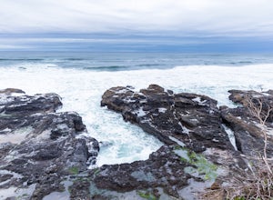
5.00.75 mi / 50 ft gainThe Oregon cost is some of the most dramatic coastline in the Western United States, and the Cape Perpetua Scenic Area hosts an array of unique features arches, chasms, and blowholes like Thor's Well. The Captain Cook Trail is a quick way to take in some of the best features of the Scenic Area, a...Read more -
Florence, Oregon
Catch the Sunset at Thor's Well
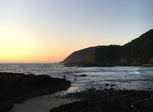
4.5First check out the tide books and find out when low tide is. At low tide, head to Cape Perpetua State park about 2 miles South of Yachats.Park at the Captain Cook Trail Head and head down the trail South to the tide pools. Look for a hole or well in the rock with plumes of spray shooting up with...Read more -
Florence, Oregon
Photograph Neptune State Park Scenic Viewpoint
5.0This state park, just off the 101 near Florence, Oregon, is a cool spot to turn out and check out! Great place to just stop and watch the waves crashing into the rocks as well as all the different wildlife in the area. If you walk further south, Cummins Creek flows into the ocean. Also not to b...Read more -
Lincoln City, Oregon
Relax at Siletz Bay
3 mi / 0 ft gainThe Siletz Bay region of Lincoln City offers a wide variety of activities. With miles of public beach, there is a lot to see and explore. Despite being the "quiet" part of town, getting here and finding parking will be your biggest issue this whole trip. Parking although free, is very limited, s...Read more -
Silverton, Oregon
South Silver Falls
5.02.14 mi / 361 ft gainSouth Silver Falls is a loop trail that takes you by a river located near Silverton, Oregon.Read more -
Drake Crossing, Oregon
Trail of Ten Falls Loop
4.77.16 mi / 1178 ft gainThe unique feature of South Falls, Lower South Falls, and Middle North Falls are the paths that pass behind the falls providing an amazing visual and auditory experience; however, be sure to have a good bag for your equipment to avoid water damage and a decent jacket (preferably water-resistant)....Read more -
Silverton, Oregon
Camp in Silver Falls State Park
4.68.7 mi / 1300 ft gainIf you're thinking of hiking the Trail of Ten Falls Loop and staying overnight, there are 42 tent campsites (available from April – Oct) as well as 14 rustic cabins. With multiple beds, heat, electricity, a covered porch, and a small fridge, they provide the perfect respite after a long day of ex...Read more -
Lincoln City, Oregon
Explore the Oregon Coast at Wecoma Beach
3.0Wecoma Beach is a district of Lincoln City and the beach actually stretches along all of the districts in Lincoln City. This means you can access the beach from practically anywhere, but the beach by Wecoma offers a bit more solitude. The beach is dog-friendly, so take your four-legged-friend ou...Read more -
Cascadia, Oregon
Hike to Soda Creek Falls
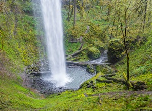
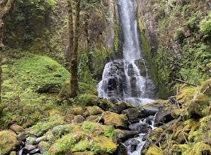
5.01.5 mi / 370 ft gainSoda Creek Falls flows 150 feet down a curvy basalt rock groove at Cascadia State Park. The trail follows Soda Creek through a lush Oregon rain forest. The site was a former hotel and health spa with the mineral water from the creek as the main attraction. The park has a small campground, and pic...Read more -
Lincoln City, Oregon
Hike to God's Thumb
4.02 mi / 800 ft gainFrom Road's End State Park, map your way to the end of NE Port Street and park on a pull off next to the described gate: on your right you'll see the gate with three skinny trees to the right of it. You'll want to park as close to this gate as possible, this will be in between some houses on a hi...Read more -
Otis, Oregon
Hike to Cascade Head
4.56.8 mi / 1200 ft gainCascade Head on the Oregon Coast sits a top a 270 acre preserve protected by the Nature Conservancy and is a National Scenic Research Area and a United Nations Biosphere Reserve. From the south trail head at Knight Park the trail winds through an old growth coastal forest before climbing 1200 ver...Read more -
Yachats, Oregon
Heceta Head Lighthouse to Hobbit Beach
5.03.76 mi / 1040 ft gainHeceta Head Lighthouse to Hobbit Beach is an out-and-back trail that provides a good opportunity to view wildlife located near Florence, Oregon.Read more -
Florence, Oregon
Explore Heceta Head Lighthouse State Scenic Viewpoint
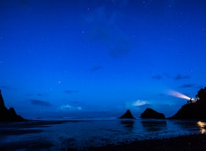
5.01 mi / 150 ft gainAt the mouth of Cape Creek sits a beautiful cove with one of the best views in Oregon. Above the sandy beach and sea stacks, rises the Heceta Head Lighthouse, a 100-year-old+ structure that's been laboriously restored and kept in working condition. At night, this quiet piece of the Oregon coast g...Read more -
Reedsport, Oregon
Kentucky Falls Trail
5.03.72 mi / 778 ft gainKentucky Falls Trail is an out-and-back trail that takes you by a waterfall located near Mapleton, Oregon.Read more

