Marmot, Oregon
Looking for the best camping in Marmot? We've got you covered with the top trails, trips, hiking, backpacking, camping and more around Marmot. The detailed guides, photos, and reviews are all submitted by the Outbound community.
Top Camping Spots in and near Marmot
-
Yacolt, Washington
Hike Silver Star Mountain via Grouse Vista
4.56 mi / 2000 ft gainThe Grouse Vista Trailhead is located through the town of Washougal off of highway 14 just past Camas. Once you leave the city, the road will turn to gravel and dirt though it is fairly well maintained until snow arrive and accessible by most cars so long as you're willing to get drive over loose...Read more -
Hood River County, Oregon
Camp at Elk Meadows
4.54.5 mi / 1200 ft gainThis is a great trip for those who are new to backpacking. The hike to the quiet, peaceful Elk Meadows is relatively short, but the Newton Creek crossing presents enough difficulty to make this a fun and challenging adventure.Start at the Hood River Meadows Trailhead parking lot. Though there are...Read more -
Clackamas County, Oregon
Bike the Timothy Lake Trail
4.515 miLocated about 2 hours outside of Portland, Timothy lake is a great home base to adventure from. It has many campgrounds, lots of lake access and great loop around the lake that is open to both hiking and Mt biking. While the hiking loop is 13 miles, the Mt. bike loop is 15 since you need to make ...Read more -
Stevenson, Washington
Three Corner Rock
4.03.86 mi / 1093 ft gainFrom the Rock Creek Pass Trailhead, begin the short hike to Three Corner Rock by heading south on the Pacific Crest Trail from its crossing of Road CG 2090. After a steady 1.5-mile climb of roughly 600 feet, look for a large fallen sign marking the junction to Three Corner Rock. Shortly after, an...Read more -
Government Camp, Oregon
Camp at Clear Lake
4.0Located just 1.5 Hours from Portland and on the east side of clear lake, this campground offers multiple water activities such as Kayaking, SUP, Fishing, and Swimming. What's great about this campground is that the sites are large and are shaded by the old growth trees which makes it feel more s...Read more -
Clackamas County, Oregon
Little Crater Lake to Timothy Lake Campground
3.42 mi / 338 ft gainLittle Crater Lake to Timothy Lake Campground is an out-and-back trail that takes you by a lake located near Government Camp, Oregon.Read more -
Mount Hood, Oregon
Snowshoe to the Tilly Jane A-Frame
5.02.7 mi / 1900 ft gainBuilt in the 1930's, the Tilly Jane A-Frame sits on the North side of Mount Hood at around 6,000ft. The cabin is very popular during winter months as it is located only 1,000ft below the tree line and offers beautiful snowshoeing, hiking, skiing and snowboarding opportunities, yet is also a popul...Read more -
Clackamas County, Oregon
Camp at Timothy Lake
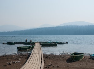
4.5Timothy Lake is one very large, man-made lake in the heart of Mt. Hood National Forest, and can be considered one of the best summer camping spots in the area. With more than ten campgrounds to choose from, this area can accommodate almost every type of camping possible - everything from cabin re...Read more -
Cascade Locks, Oregon
North Lake via Wyeth Trail
1.012.36 mi / 4505 ft gainPark at the Wyeth Trailhead parking lot and start hiking south along the old road bed. At the junction with the Gorge-Wyeth Trail, bear left and follow the Wyeth Trail as it goes beneath several power lines. Follow the trail as it goes back into the woods and crosses Harphan Creek. Continue on an...Read more -
Cascade Locks, Oregon
Mount Defiance
3.712.55 mi / 5167 ft gainThis hike starts at the Starvation Creek Rest Area. After parking, head west back along the shoulder of the freeway, where you’ll see a wooden sign stating “Mt. Defiance Trail.” Continue heading west along the abandoned Columbia River Highway. Keep going west as you pass the junction with the Sta...Read more -
Lyons, Oregon
Cedar Flat and Kopetski Trail Loop
9.62 mi / 958 ft gainOn Saturday, I slid into the backseat alongside weekend belongings crammed in the car trunk. Backpacks with patches and streaks of dust. Bags of food that could be cooked over the flames of a fire. We drove south on the 5, leaving Portland and crossing through Salem, as Lake Street Dive albums p...Read more -
Amboy, Washington
Siouxon Trail to 14 Mile Falls
5.013.03 mi / 2310 ft gainWhen you park at the top of the trail, all you see is layers and layers of emerald trees and ground clear of any underbrush. Once on the trail, you start on a rapid decline that brings you to the first of the many streams along this hike. Cross the bridge made out of logs and head towards the ma...Read more -
Detroit, Oregon
Battle Ax Mountain
5.05.09 mi / 1594 ft gainWith no officially marked trailhead, this hike begins slightly west of Elk Lake in Marion County. Take Highway 22 to Detroit, OR. East of the bridge over Breitenbush River, turn onto (FR) Forest Road 46, with signs pointing to Breitenbush River. After 4.5 miles turn left at a sign for Elk Lake, a...Read more -
Skamania County, Washington
Camp Forlorn Lakes & Explore Guler Ice Cave
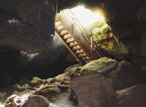
Camp at scenic and easily-accessible Forlorn Lakes, where the 25 campsites ($10/night) are both isolated and roomy. Sites have a picnic table and fire ring and provide access to the series of lakes, as well as the East Crater Trailhead which leads into the Indian Heaven Wilderness.Nearby, explore...Read more -
National Forest Development Road 4220, Oregon
Olallie Lake North Basin Loop
12.05 mi / 2021 ft gainBegin at the Lower Lake Campground and take the Lower Lake trailhead. The best direction to hike is counter clockwise, however you can do either. Continue along Trail #717 and very shortly you come out to Lower Lake featuring Mt. Jefferson as the backdrop. From here keep hiking and you reach yo...Read more -
Skamania County, Washington
Indian Heaven to Blue Lake
4.56.71 mi / 997 ft gainCrowds and mosquitoes were nonexistent as we went a bit early in the season. The trails were all covered in snow, but we were able to do some way finding with a GPS and topo map. 3.5 miles in we found a dry spot next to Blue Lake and set up shop. After dropping off our gear we climbed up Gifford...Read more

