Drake Crossing, Oregon
Top Spots in and near Drake Crossing
-
Detroit, Oregon
Dome Rock via the Upper Trailhead
2.36 mi / 479 ft gainFrom Highway 22 at the Breitenbush River Bridge, in Detroit, turn north on to French Creek Rd. Drive up French Creek about 7.7 miles to the Upper TH #3379/3381 to Dome Rock and Tumble Lake. The trail can be found on the left side of the road and is easily seen after you pass it. It's best to pass...Read more -
Saint Paul, Oregon
Hike the Champoeg SP Loop
5.03.4 mi / 120 ft gainChampoeg was the first town to be settled in the Willamette Valley and the site of the formation of the first government in the northwest. The park offers historical sites as well as plentiful camping and some short day hikes. I decided to do the Townsite loop with my family on black friday #opto...Read more -
Detroit, Oregon
Battle Ax Mountain
5.05.09 mi / 1594 ft gainWith no officially marked trailhead, this hike begins slightly west of Elk Lake in Marion County. Take Highway 22 to Detroit, OR. East of the bridge over Breitenbush River, turn onto (FR) Forest Road 46, with signs pointing to Breitenbush River. After 4.5 miles turn left at a sign for Elk Lake, a...Read more -
Marion County, Oregon
Gold Butte Fire Lookout
4.32.44 mi / 741 ft gainGold Butte Fire Lookout is a real gem in the Willamette National Forest. At 4618 feet elevation, the nearby Cascade Mountain views are nothing short of spectacular! At the summit, sits a L-4 Ground Structure Type Fire Lookout that was built in1934 to be used as a Fire Lookout. Additionally, durin...Read more -
Oregon City, Oregon
Walk the Canemah Bluff Loop
4.51.6 mi / 200 ft gainYou'll never stumble upon Canemah Park unless you're really looking for it. Tucked away in the hills of Oregon City above the Locks, this residential park has a miniature-sized set of everything you'd expect in a children's park: Playground, picnic benches, bathrooms, and wide, forested trails. D...Read more -
Gladstone, Oregon
Run the Clackamette Park Loop
1.2 mi / 10 ft gainClackamette Park is known for its prime destination right off of the freeway and across from Oregon City's most popular shopping area, but it's frequented for its public boat dock, RV facilities, and handicap-accessible picnic benches. While the rest of Portland's parks freeze over or flood, Clac...Read more -
Estacada, Oregon
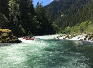
Raft the Wild and Scenic Clackamas River
5.0The Wild and Scenic Clackamas River above the North Fork Reservoir is a great destination for paddlers and only about an hour drive from downtown Portland. This popular 13.5 mile section of river lies within the Mt. Hood National Forest and offers continuous class II-III boating with a little cla...Read more -
West Linn, Oregon
Run Old River Road to George Rogers Park
5.04.8 mi / 100 ft gainPortland and its surrounding suburbs are filled with trails and hidden treasures, including this stretch along the Willamette River. This road is a super popular pedestrian path and can be accessed from West Linn, the Mary's Woods and Marylhurst Development, or from Lake Oswego off of Highway 43....Read more -
Lebanon, Oregon
Hike McDowell Creek County Park
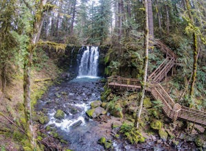
4.9GPS coordinates Lat: 44.46389 Long: -122.68278Exit off I-5 in Albany onto Highway 20 and proceed for approximately 20 miles to McDowell Creek Road and turn left, follow McDowell Creek Road - watching for signs for the park - for about 6 ½ miles, to the first of three parking areas within the park...Read more -
Tualatin, Oregon
Kayaking the Lower Tualatin River
4.0The Tualatin River runs from Hagg Lake, near Forest Grove, then travels through many small towns before it empties into the Willamette River at Willamette Park.Start at the Tualatin Community Park in Tualatin and paddle down to Willamette Park in West Linn. This section offers a few miles of easy...Read more -
Corvallis, Oregon
420, 300, and 400 Trails Loop
4.06.64 mi / 1043 ft gain420, 300, and 400 Trails Loop is a loop trail that takes you through a nice forest located near Corvallis, Oregon.Read more -
Foster, Oregon
Bouldering on the Siren
This boulder is to the right of Garden Variety...if you know then you know.An excellent problem with a lot of movement. Works up the stand alone prow near Garden Variety. Start low and heal out right on a good ledge. From there work up to the inverted V pinch and left to the arete. From there it ...Read more -
Portland, Oregon
Tryon Creek Outer Loop
4.55.12 mi / 554 ft gainTryon Creek State Park has a fantastic, well-maintained trail system that’s a great alternative to Portland’s downtown Washington Park and Forest Park. It’s a super family-friendly area with a Nature Center that hosts kid’s events year-round. This entire area is relatively small and therefore eas...Read more -
Portland, Oregon
Tryon Creek Triple Bridge Loop
3.35 mi / 479 ft gainTryon Creek Triple Bridge Loop is a scenic approximately 3.5-mile loop with bridge crossings near downtown Portland. This trail is a great way to get outside, stretch your legs, and feel like you're away from the hustle and bustle of the city. This trail is dog-friendly on-leash. If you're look...Read more -
Portland, Oregon
Run Springwater Corridor Trail
4.07 mi / 50 ft gainSpringwater Corridor is a 40-mile paved trail that stretches from downtown Portland all the way to Boring. This trail is wide, virtually flat, and yes, paved - but there is a clear manmade path on the dirt shoulders that's friendlier to knees. Any given day, you'll see dozens of cyclists and pede...Read more -
Linn County, Oregon
Coffin Mountain Fire Lookout
5.02.67 mi / 873 ft gainCoffin Mountain Fire Lookout is a beautiful day hike that takes you to its summit at 5771 feet elevation, covering roughly 1070 feet elevation gain. To get to the Coffin Mt. trailhead from Detroit OR, travel east on Highway 22 for approximately 19.5 miles to Forest Road 11 (Straight Creek Road)....Read more


