Crook County, Oregon
Looking for the best hiking in Crook County? We've got you covered with the top trails, trips, hiking, backpacking, camping and more around Crook County. The detailed guides, photos, and reviews are all submitted by the Outbound community.
Top Hiking Spots in and near Crook County
-
Mitchell, Oregon
Walk the Painted Cove Loop Trail
4.00.2 mi / 40 ft gainTo get to the trailhead, use the US highway 26 which is the only way you can go to the Painted Hills Unit. Make a turn when arriving at Burnt Ranch Rd junction. Drive up and follow the sign around 6 miles. The trail junction is where you passed the Carroll Rim Trail and Painted Hill Overlook. Tur...Read more -
Terrebonne, Oregon
North Point Loop
5.00.43 mi / 13 ft gainNorth Point Loop is a loop trail that takes you by a river located near Terrebonne, Oregon.Read more -
Terrebonne, Oregon
Canyon Trail and Homestead Trail
2.38 mi / 466 ft gainCanyon Trail and Homestead Trail is an out-and-back trail that takes you by a river located near Terrebonne, Oregon.Read more -
Terrebonne, Oregon
Misery Ridge Loop
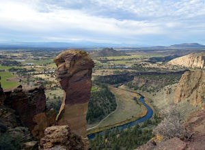
5.02.57 mi / 774 ft gainThis hike takes you on a tour of the park, starting out with a steep climb up to the top of the formations and then back down past Monkey Face and to the canyon floor. It's a very popular place so if you're hoping for solitude start early -- the light on the rock walls will be worth rising earl...Read more -
Terrebonne, Oregon
Summit Trail Loop at Smith Rock
4.66.87 mi / 1506 ft gainSmith Rock State Park is an iconic PNW canyon that's become one of the rock climbing capitals of the country, and known worldwide for its sport climbing routes. And while climbing draws crowds year-round, adventurers also visit for its trail system boasting sweeping Central Oregon volcano views. ...Read more -
Terrebonne, Oregon
Snow Camp at Smith Rock
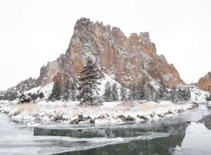
5.03 mi / 350 ft gainJust 140 miles southeast of Portland, and 27 miles north of Bend, lies a clustering of rocks more prominently referred to as Smith Rock.This intricate rock formation is a mecca for climbers during the warm summer months, however the landmark unveils a new face during the snowy season that few eve...Read more -
Terrebonne, Oregon
Misery Ridge Trail
5.02.58 mi / 919 ft gainMisery Ridge Trail is an out-and-back trail that takes you past scenic surroundings located near Terrebonne, Oregon.Read more -
Terrebonne, Oregon
Smith Rock State Park Canyon Trail
5.03.27 mi / 587 ft gainSmith Rock State Park Canyon Trail is an out-and-back trail that takes you past scenic surroundings located near Terrebonne, Oregon.Read more -
Terrebonne, Oregon
Smith Rock State Park Loop
4.95.55 mi / 1325 ft gainPark your vehicle in the bivouac parking area and hike 200 yards west to the tent campsites. Set up your home away from home at one of the undesignated cliff side campsites overlooking the park. Although it is famous for rock climbing, Smith Rock also boasts an extensive trail system. The best h...Read more -
Terrebonne, Oregon
Steelhead Falls
1.98 mi / 148 ft gainSteelhead Falls is an out-and-back trail that takes you by a waterfall located near Terrebonne, Oregon.Read more -
Terrebonne, Oregon
Hike to Steelhead Falls
4.81 mi / 120 ft gainFollowing along the Dechutes river for half a mile you will see where the river progressively gets more aggressive. On both sides of the trail you will see beautiful mountain inclines and jagged cliffs. If your lucky you might just see a bald eagle soaring high above! Along with Steel Head being ...Read more


