Bend, Oregon
Surrounded by world-class outdoor adventures and brimming with great craft beer, coffee, and food, Bend is an all-season destination worthy of inclusion on your must-visit list.
Top Spots in and near Bend
-
La Pine, Oregon
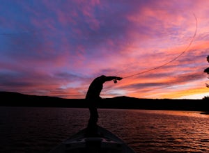
Camp and Fish on East Lake
East Lake is located in a very scenic part of Central Oregon about 30 miles East of the town of La Pine. At 6,400 feet in elevation, the lake is fed by snowmelt and underground springs. East Lake is know for it's trophy Brown Trout, Kokanee, Rainbow Trout and Atlantic Salmon. Because of the deep...Read more -
La Pine, Oregon
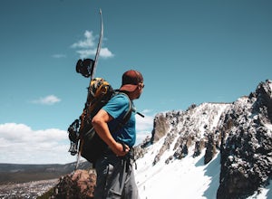
Hike up Paulina Peak
5.06 mi / 1800 ft gainDistance: 6 miles, out-and-back (Can also be done as a 12 mile loop via Crater Rim Trail). Starting at Paulina Lake, just past the Visitor Center lies a marked trailhead for Paulina Peak. The trail starts close to the road and winds through the forest around the back of some lake maintenance fac...Read more -
La Pine, Oregon
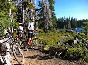
MTB the Crater Rim Trail
Paulina Peak with an elevation of 7,984 feet, and is about 4,000 feet higher than the terrain surrounding the volcano. There is a gravel fire road that winds to the top. This is a grueling climb with an 8000 foot elevation. Air please!The trail head starts about 1000 feet from the peak. It is a p...Read more -
La Pine, Oregon
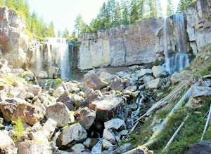
Paulina Falls Hike to Paulina Lake
0.6 mi / 300 ft gainFirst take the short 1/4 mile hike down to the lower lookout. Get there early to beat the crowd and get unobstructed views. The Paulina Falls is an 80 ft. twin waterfall. It's gorgeous. After you see the falls from the lower lookout, you can walk back up to the upper lookout for a different view....Read more -
Bend, Oregon
Hike to Lucky Lake
5.02.5 mi / 405 ft gainLocated just 4.36 miles past the popular Elk Lake Day Use turnoff, the trailhead is on the right side of the highway, marked by a small 'trailhead' sign. The hike begins at the Senoj Lake Trailhead and climbs up to the lake for 1.26 miles. Once you reach the lake, you can choose to go left or rig...Read more -
Bend, Oregon
Hike the Fall River Trail
5.9 mi / 101 ft gainThe Fall River Trail follows meanders through an old growth ponderosa pine forest along the banks of the Fall River. There are several pull-out parking spots along Forest Service Road 42 but probably the easiest is to start at the Fall River Campground day-use area. The day-use area has pit toile...Read more -
Deschutes County, Oregon
Camp at Lava Lake
4.5Beautiful spot to set your tent up for a night or longer.About 12 spots scatter the immediate campground area, but while hiking we spotted several more dispersed throughout the towering Ponderosa Pine trees. Most of the spots circle a small lake. The ground in this site is a VERY soft dirt, perfe...Read more -
Deschutes County, Oregon
Summit Black Crater
5.08 mi / 2211 ft gainThe Black Crater Trailhead parking lot is accessed off the McKenzie Pass (Hwy 242). The trailhead starting elevation is 5,040ft. (using the iPhone app "Topo Maps". Great app) with a 3.8 Mile hike one way to the Black Crater Summit at 7,251ft of elevation. Some parts of the trail are steep and g...Read more -
Deschutes County, Oregon
Matthieu Lakes via Lava Camp Lake Trail
2.06 mi / 922 ft gainBegin your hike at the Lava Camp Lake Trailhead. The trail winds through a forest flush with hemlock and fir while opening up into black lava flows. Continue for a little over two miles until you reach North Matthieu Lake. This is your first stop. Go for a swim out to the little island and have a...Read more -
Deschutes County, Oregon
Dee Wright Observatory
4.70.93 mi / 20 ft gainOn your way to Proxy Falls from Bend? Stop by the Dee Wright Observatory to take some photos of the gorgeous mountains. The Observatory is at the summit of McKenzie Pass in Oregon's Cascade Mountains. Built right in the middle of a large lava flow, the open structure itself is actually construct...Read more -
Deschutes County, Oregon
Skylight Cave
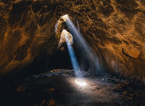
4.40.2 mi / -25 ft gainThe hardest part about getting to Skylight Cave is the drive. Start by coming from Sisters, Oregon, and use the driving directions below to find it. The Google Maps pin is accurate, and if you like coordinates, you can use 44°20'55.3"N 121°42'55.9"W as well. It's recommended you download an offl...Read more -
Camp Sherman, Oregon
Black Butte
4.53.94 mi / 1493 ft gainJust outside of Sisters Oregon is the stunning and popular day hike to the summit Black Butte (Elevation 6,436 feet). At the top, spectacular views of the surrounding Cascades await the intrepid hiker. To get to the trailhead, turn off of Highway 22 onto National Forest Road (NFR) 11, also known...Read more -
Prineville, Oregon
Fly Fish Crooked River
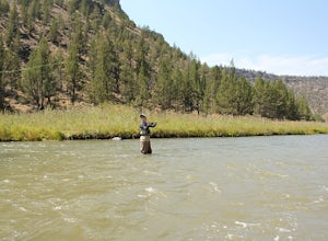
5.0Head East out of Bend, Oregon towards Prineville Reservoir State Park and Highway 27, which runs along the Crooked River. It is about an hour outside of Bend. Once you reach Highway 27 (Crooked River Highway), there are several campgrounds and pull-outs along the side of the road where you can st...Read more -
Lane County, United States
Backpack the Obsidian Area
4.46 mi / 1800 ft gainThe Obsidian area is at least six miles from the closest trail head and 1800 feet of elevation gain. The best way to see the area is to plan a multi-day backpacking adventure. It is limited entry which is strictly enforced by the Forest Service. Only 30 day hikers and 40 overnight hikers are al...Read more -
Lane County, Oregon
Summit Middle Sister via Renfrew Glacier
20 mi / 6000 ft gainIf you’ve been anywhere near Central Oregon, you’ve seen the Three Sisters Mountains dominate the skyline. Each of these volcanoes exceeds 10,000 ft. and are some of the highest peaks in the state of Oregon. Though they are truly considered sister peaks to one another, each has unique climbing ro...Read more -
Lane County, Oregon
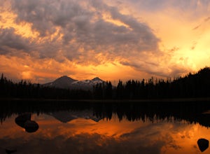
Camp at Scott Lake
Scott Lake Campground is truly a hidden gem off the McKenzie Pass Scenic Drive. Nestled right next to the Mt Washington Wilderness Area, this small campsite with only 20 primitive sites lining the lake gives spectacular views over toward the Three Sisters to the South-East.To get there - turn ont...Read more

