Bagby Hot Springs, Oregon
Looking for the best photography in Bagby Hot Springs? We've got you covered with the top trails, trips, hiking, backpacking, camping and more around Bagby Hot Springs. The detailed guides, photos, and reviews are all submitted by the Outbound community.
Top Photography Spots in and near Bagby Hot Springs
-
Camas, Washington
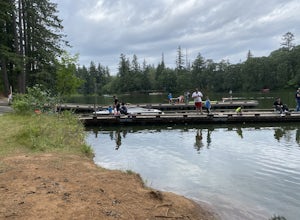
Kayak Lacamas Lake
5.0Lacamas Lake is popular for all types of water activities with easy access because of it’s dock and free public parking. This area is family and dog friendly and has picnic tables for a place to sit down and have a nice lunch after swimming. Rope swings can be found along the beach if you’re the ...Read more -
Camas, Washington
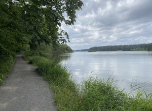
Hike Lacamas Heritage Trail
5.03.5 mi / 139 ft gainUsed often for cross country practice, the Lacamas Heritage Trail is a popular gem in Camas, Washington for all citizens. It is family and dog friendly and comes with endless scenic views of the beautiful Lacamas Lake. Parking is free and there are bathrooms at the entrance.Read more -
Portland, Oregon
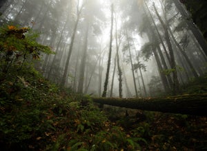
Wildwood Trail in Washington Park
5.07.63 mi / 1503 ft gainTake the train to Washington Park and hike through Hoyt Arboretum. This will bypass a few miles of Wildwood Trail, but you won't miss much. In the arboretum, the trail twists and turns through the trees, will smaller trails jutting off to the sides, through other groups of trees (each trail is a...Read more -
Portland, Oregon
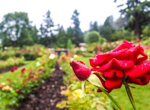
International Rose Test Garden
4.6The International Rose Garden located in Washington Park near downtown Portland is a must stop on your visit to the Rose City. The City of Roses, as Portland is known, won't let you down. Portland is host to the largest Rose Test Garden in the U.S. The 5 acre park, with over 7,000 rose bushes, an...Read more -
Portland, Oregon
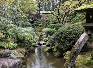
Portland Japanese Garden
4.02 mi / 50 ft gainWhile the Portland Japanese Garden is a popular place for tourists, it's also a favorite for Portland residents as it's located right in Washington Park close to trails and across from the Rose Garden. The Japanese Garden also just unveiled its Cultural Crossing expansion in April 2017, which inc...Read more -
Portland, Oregon
Hoyt Arboretum
1.4 mi / 148 ft gainFounded in 1928 to conserve endangered species and educate visitors, Hoyt Arboretum is a 190-acre park in the forest above Portland's NW area. It's only 15 minutes from downtown! There are 12+ miles of trails to explore, my favorite is the Redwood Trail that takes you through towering redwoods a...Read more -
Cascade Locks, Oregon
Chinidere Mountain
4.83.18 mi / 1150 ft gainThe easy version of the Chinidere Mountain hike starts Wahtum Lake Trailhead. The road to the parking lot for Wahtum Lake is paved and thus very easy to access in summer and before snowfall in autumn! The mountain sits across the lake from the parking lot and there are several trails that will ta...Read more -
Portland, Oregon
Photograph Downtown Portland From Pittock Mansion
4.7Pittock Mansion offers a one of kind view of downtown Portland. This is a historic site that allows public access throughout the day and night. Parking is available at Pittock until 9pm but if you wish to visit the grounds after hours you can park at the bottom of the driveway, walk around the ga...Read more -
Stevenson, Washington
Hardy and Rodney Falls
4.02.17 mi / 699 ft gainLocated along the Hamilton Mountain Trail, the Hardy and Rodney falls out and back hike is a good alternative for those looking for a shorter hike compared to the 7.6-mile hike to the top of Hamilton Mountain. From the Hamilton Mountain Trailhead, you will follow the trail through thick trees fo...Read more -
Portland, Oregon
Lower Macleay Park to Pittock Mansion
3.04.7 mi / 965 ft gainLower Macleay Park is one of most easily accessible trailheads in the city, especially during one of Portland’s rare snow years where even driving up to 500 feet of elevation can challenge your car. You can park within the park entrance cul-de-sac, around the intersection of Upshur St. & NW 2...Read more -
Cascade Locks, Oregon
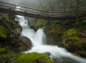
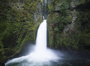
Wahclella Falls
4.71.74 mi / 410 ft gainThis is a very short and fairly easy, 1 mile in – 1 mile out, hike with a little bit of elevation gain. I took my time hiking and enjoying the scenery with the intention of this being a photo heavy trip. When I got to the end I spent at least an hour shooting from every angle I saw fit. Once you ...Read more -
Cascade Locks, Oregon
Munra Point
4.94.12 mi / 1870 ft gainThis trail is temporarily closed. Please visit the Forest Service website for updates to trails in the Columbia River Gorge. This hike starts at the Wahclella Falls trailhead, but does not use that trail. Instead, walk back towards the freeway and take a left onto the Columbia River Highway Tr...Read more -
Cascade Locks, Oregon
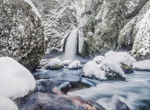
Snow Hike to Wahclella Falls
4.02 miThe wooden bridges, Munra Falls, beautiful canyon walls, and the mossy grotto at the end of the canyon itself would be enough of a draw for this hike, but you round the last corner and 65 foot Wahclella Falls comes in full view.The big snow covered river rocks looked like giant marshmallows, and ...Read more -
Deschutes County, Oregon
Summit Black Crater
5.08 mi / 2211 ft gainThe Black Crater Trailhead parking lot is accessed off the McKenzie Pass (Hwy 242). The trailhead starting elevation is 5,040ft. (using the iPhone app "Topo Maps". Great app) with a 3.8 Mile hike one way to the Black Crater Summit at 7,251ft of elevation. Some parts of the trail are steep and g...Read more -
Cascade Locks, Oregon
Tunnel Falls
4.411.87 mi / 2874 ft gainThis hike begins at the Eagle Creek Trailhead. This is the same trailhead that goes to popular Punchbowl Falls. The trail to reach Tunnel Falls is 12 miles roundtrip on an out and back trail. If you continue another 0.5 miles on the trail after Tunnel Falls you will reach Twister Falls. The hike ...Read more

