West Liberty, Ohio
Looking for the best hiking in West Liberty? We've got you covered with the top trails, trips, hiking, backpacking, camping and more around West Liberty. The detailed guides, photos, and reviews are all submitted by the Outbound community.
Top Hiking Spots in and near West Liberty
-
Cedarville, Ohio
Hike to Cedar Cliff Falls
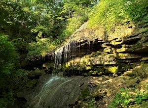
4.42.6 mi / 250 ft gainStarting from the Indian Mound Reserve parking lot, follow the private drive back until the signs indicate to follow the trail through the woods to the right, about 1/4 mile. Make sure you stay right of the painted yellow line on the road, trespassers on the private land surrounding the park are ...Read more -
Cedarville, Ohio
Hike the Gorge Trail at Indian Mounds
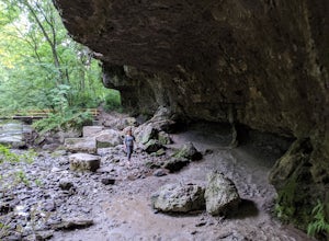
5.0Cedarville, Ohio is known for its expansive farmland, but in the Indian Mounds Park you'll find several unique features, such as the cavern located on the Gorge Trail! This cave is formed out of the side of a cliff and is perfect for easy exploration and climbing. When the water is low enough yo...Read more -
Galloway, Ohio
Hike the Darby Creek Greenway
9.6 mi / 50 ft gainStarting your hike from the Cedar Ridge Picnic Area, head north along the Darby Creek Greenway, a well-maintained gravel path that is a multi-use trail alongside cyclists and trail runners. The trail switches between a number of different settings during the 4.7 mile one-way trek, including fores...Read more -
Vandalia, Ohio
Waterfall Loop at Englewood MetroPark
5.02.25 miThis adventure begins at a parking lot within the Englewood East MetroPark, right at the trailhead for the white trail. Begin the hike into the woods, following the well-marked path through points 1 and 2. Continue straight on the white path until you hit point 7, where you will switch over to th...Read more -
Lewis Center, Ohio
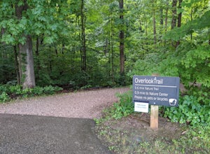
Hike the Overlook-Dripping Rock Loop
5.04.8 mi / 100 ft gainStarting at the nature center near the entrance of the park, the 2.5 mile long Dripping Rock Trail heads off in two directions, to the south and to the west. Either way will take you back to the nature center at the end of the day. Going west takes you past an observation deck and then along a de...Read more -
Lewis Center, Ohio
Out of Africa Trail
3.15 mi / 131 ft gainOut of Africa Trail is an out-and-back trail that takes you by a lake located near Galena, Ohio.Read more -
Dayton, Ohio
Hike the Adirondack Trail at Hills & Dales MetroPark
2.92 mi / 230 ft gainHills & Dales MetroPark is surprisingly large, spanning 63 acres and nestled between two golf courses. When hiking here, it is quite easy to forget that it is surrounded by a city and is just a couple miles south of Dayton. The Adirondack Trail is the most prominent trail in the park, winding...Read more -
Sugarcreek Township, Ohio
Trail Run at Sweet Arrow Reserve
4.03.1 mi / 164 ft gainLike forests? Like fields? How bout running in them? If so, this is the park for you! There's a map at the parking lot to help you navigate each trail and plan your route. The parking lot also has plenty of space and a porta-john. Trails are short, but you can mix and match them to create the dis...Read more -
Grove City, Ohio
Hike through Scioto Grove Metro Park
4.07 miNew in May 2016, the Scioto Grove Metro Park has about 600 acres of land in Grove City, OH. There are more than 7 total miles of connecting trails as well as picnic areas and jungle gyms.Easy to navigate, there are park maps at all major trail junctions, which makes this hike enjoyable for all. ...Read more -
Dayton, Ohio
Hike at Bill Yeck Park
5.03 mi / 177 ft gainTake the whole family out on an afternoon adventure to Bill Yeck Park! This park has over 6 miles of hiking trails, spanning all levels of difficulty and terrain, including pavement, crushed gravel, mowed grass, and dirt paths. They range from 0.5 miles (red trail) to 3.0 miles (yellow trail), w...Read more -
Westerville, Ohio
Hike the Overlook-Hickory Ridge-Brookside Trail
4.01.6 miThis gravel woods path at Blendon Woods Metropark, just over 1.5 miles, is perfect for a quick hike when visiting the city! You may be close to Ohio's capitol city, but you feel far away in the woods of this park. Come into the main entrance and turn right at the Ranger Station. Park near the n...Read more -
Columbus, Ohio
Blendon Woods Loop
1.97 mi / 112 ft gainBlendon Woods Loop is a loop trail that takes you through a nice forest located near Columbus, Ohio.Read more


