Woodfin, North Carolina
Top Spots in and near Woodfin
-
Morganton, North Carolina
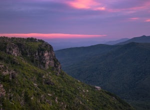
Camp on Shortoff Mountain in the Linville Gorge
5.0The Linville Gorge Wilderness Area, also known as the Grand Canyon of the East, is one of the wildest, most rugged gorges in the eastern United States. It's also an outdoor paradise for hikers and backpackers. Camping here is always a treat and you are sure to enjoy your time spent in the gorge.D...Read more -
Linville, North Carolina
Shortoff Mountain Summit
4.84.64 mi / 1178 ft gainStart your hike from the Shortoff Mountain Trail off of Wolf Pit Road at the base of Lake James. From the summit there is a small grassy area off a side trail that provided awesome cliff side views of the Gorge and Linville River! You can setup after making the hour and a half trek (maybe just in...Read more -
Bakersville, North Carolina
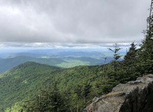
Cloudland Trail
5.02.46 mi / 276 ft gainCloudland Trail is an out-and-back trail offering up expansive views of the surrounding area especially from Roan Bluff. This trail is located near Bakersville, North Carolina. With minimal ups and downs, this makes for a decent family-friendly option. The trail is also dog friendly on-leash.Read more -
Glenville, North Carolina
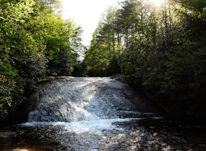
Hike to Frolictown Falls
1.5 mi / 350 ft gainThis is an awesome hike to do if you're short on time or have hours to kill. Because it is so easy to access, it doesn't take very long to get down to it and can be accessed by two separate trails. Both trails are well maintained, however, while there are some blazes, it is not heavily marked. Th...Read more -
Glenville, North Carolina
Hike to Granny Burrell Falls
2.4 mi / 440 ft gainPanthertown Valley has a unique system of trails, with each trail having a specific number. Some of the trails listed at the information hut in the parking lot are accessed by taking one or two other trails to get to the start of the trail you are seeking. That is the case when hiking to Granny B...Read more -
Glenville, North Carolina
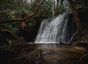
Hike to Wilderness Falls
1.4 mi / 300 ft gainWilderness Falls offers a beautiful hike with a simple yet captivating falls. All of the maintained trails in Pantertown Valley are marked by a number system (there is an information hut in the parking lot with information about other local trails, distance of different trails, and emergency cont...Read more -
Glenville, North Carolina
Hike to Blackrock Overlook
3 mi / 700 ft gainThis is probably one of my favorite hikes I've done in Panthertown Valley. Its also one of the easier views to access. You start from the Salt Rock Gap Parking lot, taking the Blackrock Trail (447) up Blackrock Mountain. This trail is located about 100 yards to the left if you are standing lookin...Read more -
Cherokee, North Carolina
Drive the Blue Ridge Parkway from the Southern Terminus
5.0The pinpoint for this particular entrance starts just outside of Cherokee, North Carolina, following the Parkway North. They say the Blue Ridge Parkway is more than just a road, it's a beautiful journey. Start this journey and you will quickly find this to be true. This 469 mile gateway connects...Read more -
Unicoi, Tennessee
Pinnacle Mountain Trail
8.81 mi / 2700 ft gainPinnacle Mountain is a long, grinding climb to the top. The singletrack winds up 1,500 feet of elevation for nearly 5 miles with few downhill sections. Once at the top, take a rest and climb the fire tower that overlooks the Downtown Johnson City area, Elizabethton, Erwin, and the rest of the Buf...Read more -
Bakersville, North Carolina
Appalachian Trail: Carvers Gap to Yellow Mountain Barn
12.28 mi / 2720 ft gainAppalachian Trail: Carvers Gap to Yellow Mountain Barn is a loop trail where you may see beautiful wildflowers located near Bakersville, North Carolina.Read more -
Bakersville, North Carolina
Grassy Ridge Bald in the Roan Highlands
5.04.84 mi / 932 ft gainOnce you've parked at Carver's Gap (5500'), the trailhead is pretty easy to find. Simply cross the highway and jump onto the Appalachian Trail, right on the border of North Carolina and Tennessee. Head north on the AT as you head through the Roan Mountain Balds. In the very beginning of the hike,...Read more -
Bakersville, North Carolina
Round Bald via Carver's Gap
4.31.72 mi / 338 ft gainThis super easy hike to the campsites near Round Bald is the perfect intro to backpacking for kids or newbies, but serves just as well for the more experienced backpackers who can't squeeze a longer trip in over the weekend. This short (.5 mile) hike in leads to a grassy opening with amazing vie...Read more -
Bakersville, North Carolina
Backpack to Overmountain Shelter in the Roan Highlands
5.05.5 mi / 900 ft gainStarting from the Carver Gap Parking area (do not leave belongings visible in your vehicle) head North on the Appalachian Trail (cross the road and head up the hill past the kiosk). Stay on the Appalachian Trail for 5.5 miles climbing across open balds and treking through forests and wildflower p...Read more -
Bakersville, North Carolina
Appalachian Trail: Carvers Gap to Roan Mountain
5.06.98 mi / 1204 ft gainAppalachian Trail: Carvers Gap to Roan Mountain is an out-and-back trail near Bakersville, North Carolina. This trail is not too crowded, so don't be surprised if you're the only one taking in the view. Keep in mind the 1200+ foot climb along this trail if you're accustomed to hiking a longer dis...Read more -
Roan Mountain, Tennessee
Roan Highlands: Carvers Gap to US 19E via Appalachian Trail
5.015.47 mi / 2598 ft gainThe Roan highlands, possibly one of the best sections of the Appalachian Trail, is a section of grassy balds that range from 5000-6000 feet following the A.T. Start at Carvers Gap ( Highway 261 NC / Highway 143 TN) on the TN/NC border. You can either leave a car at Highway 19E or arrange for a s...Read more -
Roan Mountain, Tennessee
Jane Bald via Appalachian Trail
4.82.64 mi / 581 ft gainThis journey begins at Carvers Gap, on the border of North Carolina and Tennessee. At a beginning elevation of 5512 ft. you will cross the road from the parking area to the trailhead, on the Appalachian Trail, northbound. The trail climbs gently through grasslands and rhododendron before enter...Read more


