Woodfin, North Carolina
Looking for the best chillin in Woodfin? We've got you covered with the top trails, trips, hiking, backpacking, camping and more around Woodfin. The detailed guides, photos, and reviews are all submitted by the Outbound community.
Top Chillin Spots in and near Woodfin
-
Cherokee, North Carolina
Drive the Blue Ridge Parkway from the Southern Terminus
5.0The pinpoint for this particular entrance starts just outside of Cherokee, North Carolina, following the Parkway North. They say the Blue Ridge Parkway is more than just a road, it's a beautiful journey. Start this journey and you will quickly find this to be true. This 469 mile gateway connects...Read more -
Bakersville, North Carolina
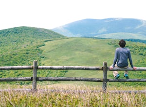
Round Bald via Carver's Gap
4.31.72 mi / 338 ft gainThis super easy hike to the campsites near Round Bald is the perfect intro to backpacking for kids or newbies, but serves just as well for the more experienced backpackers who can't squeeze a longer trip in over the weekend. This short (.5 mile) hike in leads to a grassy opening with amazing vie...Read more -
Morganton, North Carolina
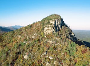
Camp at the Chimneys in the Linville Wilderness
5.01 mi / 138 ft gainThe Chimneys area is a lesser-known camping destination within the Linville Wilderness. The Chimneys are a series of rock formations that rise above Linville Gorge and provide unobstructed panoramic views of the gorge and surrounding mountains. These rocks sit adjacent to Table Rock which hosts w...Read more -
Pickens, South Carolina
Paddle on Lake Oolenoy
5.0Part of Table Rock State Park, Lake Oolenoy is a 67-acre lake providing private boat access for kayaks, canoes, or small boats with electric trolling motors.To get to the boat ramp, when traveling on scenic Highway 11, turn Sah Ka Na Ga View Road on the opposite side of the road as the Table Rock...Read more -
Morganton, North Carolina
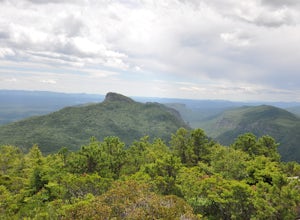
Hike to the Summit of Table Rock Mountain
4.62.2 mi / 572 ft gainOff of Highway 181, the trailhead is very clearly marked with a large parking lot. Although the trail is fairly short, make sure you have your footing, because the trail does switch back and forth in addition to gaining elevation -- it's pretty steep in some places! It's all worth it when you get...Read more -
Sunset, South Carolina
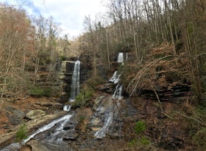
Virginia Hawkins Falls (Double Falls)
4.02.6 mi / 456 ft gainA moderate to advanced 2.6 mile hike has many stairs and a lot of ascents and descents along the way. The hike may not be the easiest but the payoff is worth it. The trail is easily marked so no need to worry about getting lost.Read more -
Morganton, North Carolina
Hike to Hawksbill Mountain
5.02.1 mi / 660 ft gainStarting at the Hawksbill Mountain Trailhead, which is clearly marked start hiking up! The trail starts out with some easy uphill switchbacks and leads you to the first lookout point. Enjoy sometime at the lookout point, but you'll want to keep going for a more incredible view. Keep hiking uphill...Read more -
Cullowhee, North Carolina
Hike to High Falls
3.51.5 mi / 600 ft gainThis is an awesome hike if you're up for a challenge! The hike in isn't bad at all and the trail itself isn't super long but the climb back out will be a little more difficult due to the rock steps and lengthy uphill. This hike starts from a parking lot, just across the road from Lake Glenville a...Read more -
Newland, North Carolina
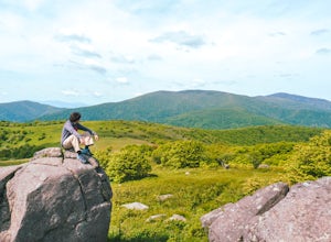
Big Hump Mountain via the Appalachian Trail
4.57.83 mi / 2021 ft gainTowering over Little Hump Mountain, Big Hump Mountain offers one of the clearest views on the Appalachian Trail. Big Hump Mountain is located in the Roan Highlands North of Bradley Gap. This peak is not as traveled as other popular hikes in the area despite its massive size because of the intense...Read more -
Newland, North Carolina
Hike to Bradley Gap along the Appalachian Trail
4.6 mi / 1339 ft gainBradley Gap rests along the Appalachian Trail overlooking North Carolina and Tennessee mountains. Part of the Roan Highlands, Bradley Gap can be accessed via Yellow Mountain Gap Trailhead. Follow the Roaring Fork Trail from the trailhead until you intersect the Appalachian Trail (White Blaze) app...Read more -
Sunset, South Carolina
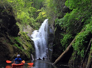
Kayak to Laurel Fork Falls
4.0This stunning waterfall tumbles down 80 feet before spilling into Lake Jocassee between a slot of shear rock cliffs. However, the catch is not many people see this beautiful location unless you have a boat or are willing to hike a streneous 8-mile hike one-way along the Foothills Trail.But I am s...Read more -
Sunset, South Carolina
Hike to Twin Falls, SC
5.01 mi / 0 ft gainOnce you get to the destination there should be a small parking area. At the end of this parking area you will see the start of the Twin Falls trail that will be mostly a flat walk. Follow this trail approximately 0.5 miles to the falls. You will know you are in the right place if the creek is r...Read more -
Cashiers, North Carolina
Hike to Chimney Top
3.31.7 mi / 1000 ft gainUpon entering High Hampton Inn, follow the entrance road past the registration building, cart shed and parking lot. Take a right down a gravel road that follows alongside Hampton Lake. This gravel road continues for half a mile, even winding through part of the golf course and crossing over the c...Read more -
Johnson City, Tennessee
Sunset Point
5.00.65 mi / 223 ft gainSunset Point is an overlook located in Buffalo Mountain State Park. The trail is a short hike up along the White Rock loop trail then a short walk off the trail to get to the overlook. There is a clearing with a few benches that has wide open views to the west. The short hike up to the point shou...Read more -
Johnson City, Tennessee
White Rock Overlook
5.02.85 mi / 876 ft gainThe White Rock trailhead is less than a 10 minute drive from downtown Johnson City. When pulling up Highbridge Road, take a left at the fork. You will shortly encounter a vehicle gate where you will park to the side of the road (do not block the yellow vehicle gate). You have the option to walk ...Read more -
Sevierville, Tennessee
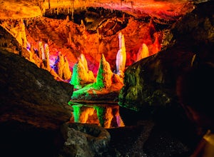
Spelunking in Forbidden Caverns
5.0When exploring all that Tennessee has to offer, it’s hard to ignore the fact it is home to more caves than any other state in America. So when picking one, of more than 10,000, to explore it is hard to go wrong. Forbidden Caverns happens to be one of the most popular spots and is only a few minut...Read more

