Waynesville, North Carolina
Looking for the best hiking in Waynesville? We've got you covered with the top trails, trips, hiking, backpacking, camping and more around Waynesville. The detailed guides, photos, and reviews are all submitted by the Outbound community.
Top Hiking Spots in and near Waynesville
-
Dillard, Georgia
Hike to Rabun Bald
5.03 mi / 4696 ft gainStarting at the trailhead you begin by following the yellow blazes. The trail isn't well marked so keep an eye out for the blazes you see. The trailhead starts at the dead end of Kelsey Mountain Trail. The path immediately starts to incline and doesn't stop. A few minutes in you will come to a fo...Read more -
Franklin, North Carolina
Nantahala National Forest via the Appalachian Trail
4.027.11 mi / 5420 ft gainWinding Stair Gap on Highway 64 is the starting point for this spectacular backpacking trip through the Nantahala National Forest. It's right outside the hiker friendly town of Franklin, NC, so the town is your last chance for a hot meal and any last minute supplies. There is a parking lot at the...Read more -
Franklin, North Carolina
Siler Bald from Wayah Gap
5.03.66 mi / 1060 ft gainThe Appalachian Trail does not need a lot of hype beyond its existing legendary status. However, there are certain parts of it that do stand out as being a little extra special. Siler Bald is one of those spots. A large clearing starting from Snowbird Gap and going all the way up to Siler Bald...Read more -
Montreat, North Carolina
Hike Lookout Mountain, Montreat
5.01.1 mi / 623 ft gainNestled in the Blue Ridge Mountains is Montreat, North Carolina. Just down the road from Asheville, it neighbors Black Mountain and doesn't disappoint for views. Montreat itself houses a plethora of hiking trails, but the cream of the crop HAS to be Lookout Mountain. After a weekend of checking o...Read more -
Marshall, Tennessee
Appalachian Trail: Jones Meadow to Jerry Cabin Shelter
7.58 mi / 909 ft gainAppalachian Trail: Jones Meadow to Jerry Cabin Shelter is an out-and-back trail that provides a good opportunity to view wildlife located near Greeneville, Tennessee.Read more -
Townsend, Tennessee
Spruce Flats Falls
4.81.64 mi / 495 ft gainTo get to Spruce Flats Falls, you will want to drive down 2.2 miles down the scenic Tremont Road to the Great Smoky Mountains Institute and park in the visitor center parking area. You will then want to ascend up the gravel road past the sign that says restricted to unrestricted traffic (meaning ...Read more -
Bryson City, North Carolina
Hike Ledbetter Creek
5.0Leaving the Nantahala Outdoor Center, drive upriver for 6.5 miles until you see a pull off on the right. Walk past the picnic tables, cross the railroad tracks, then follow the trail to arrive at the creek. Once you're there, it's up to you on what to do next.One of the most popular activities he...Read more -
Otto, North Carolina
Hike to and Climb Pickens Nose
4.81.5 mi / 200 ft gainFrom the parking area (fits about 6 cars) follow the trail on the same side of the road up the ridge through dense rhododendron. Several spur trails branch off of the main trail and lead to rock outcroppings with excellent views. Getting to the parking area is slow. The narrow gravel road winds...Read more -
Tamassee, South Carolina
Hike to Lee Falls
4.01.6 miThe Hike: Head out through the middle of the first of three fields, crossing creeks two times as you come to them. At the end of the last field, the trail enters the woods. Hike through the woods for 0.3 mile and take the left fork, crossing a creek , and head toward the larger branch of Tamassee...Read more -
Hendersonville, North Carolina
Hike along The World's Edge
0.7 mi / 40 ft gainPark at the end of The World's Edge Road, but be aware that parking is very limited. There is a private residence up to the right so do not block their driveway/gate. Begin your hike by going through the leftmost gate, and continue straight until you reach the first view less than half a mile in....Read more -
Franklin, North Carolina
Backpack the Standing Indian Loop on the Appalachian Trail
24 miBegins at the parking lot for the Standing Indian Campground. (No permits are needed to park here) For the first 3.7 miles, take Kimsey Creek Trail, which runs along the water, until you meet up with the AT at Deep Gap. Rolling hills and lots of foliage throughout, leading up to Standing Indian M...Read more -
Lake Lure, North Carolina
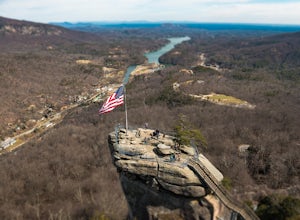
Explore Chimney Rock
4.00.5 miChimney rock is a beautiful slab of weather granite that is visible from miles around. To get to this hike you'll want to head to Lake Lure in North Carolina, a beautiful lake located in the mountains of western North Carolina. Follow the signs for Chimney Rock and take the switchback road up t...Read more -
Lake Lure, North Carolina
Exclamation Point and Skyline Trail to Hickory Nut Falls
5.02.98 mi / 1204 ft gainExclamation Point and Skyline Trail to Hickory Nut Falls is an out-and-back trail that takes you by a waterfall located near Chimney Rock, North Carolina.Read more -
Lake Lure, North Carolina
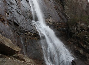
Hike to Hickory Nut Falls
5.02 mi / 200 ft gainThis waterfall is located inside of the Chimney Rock State Park. There is a fee of 15 dollars to go to the State Park but it is very worth it because of the beautiful scenery and beautiful views. The hike to the waterfall is partially uphill on the way. When you get to the waterfall there are a f...Read more -
Black Mountain, North Carolina
Eagle Rock
0.7 mi / 151 ft gainEagle Rock is located in Chimney Rock State Park and is a hot spot for climbers and hikers! The hike to the overlook at Eagle Rock is 0.4 miles, and it's one of the most bang-for-your-buck trails in the area. We love to picnic out on the rock as it's in the sun most of the day. If you decide to...Read more -
Saluda, North Carolina
Hike Bradley Falls
4.82.3 mi / 312 ft gainThis is a really nice hike along Cove Creek that leads to a beautiful, 100 foot waterfall. While most of the trail is a relaxing stroll, the end of the hike provides a little adventure for those who feel up for it. Starting from the parking lot, follow the main trail into the woods. Early in the ...Read more


