Union Mills, North Carolina
Top Spots in and near Union Mills
-
Bakersville, North Carolina
5.0
4.84 mi
/ 932 ft gain
Once you've parked at Carver's Gap (5500'), the trailhead is pretty easy to find. Simply cross the highway and jump onto the Appalachian Trail, right on the border of North Carolina and Tennessee. Head north on the AT as you head through the Roan Mountain Balds. In the very beginning of the hike,...
Read more
-
Bakersville, North Carolina
4.3
1.72 mi
/ 338 ft gain
This super easy hike to the campsites near Round Bald is the perfect intro to backpacking for kids or newbies, but serves just as well for the more experienced backpackers who can't squeeze a longer trip in over the weekend.
This short (.5 mile) hike in leads to a grassy opening with amazing vie...
Read more
-
Bakersville, North Carolina
Starting from the Carver Gap Parking area (do not leave belongings visible in your vehicle) head North on the Appalachian Trail (cross the road and head up the hill past the kiosk). Stay on the Appalachian Trail for 5.5 miles climbing across open balds and treking through forests and wildflower p...
Read more
-
Bakersville, North Carolina
Appalachian Trail: Carvers Gap to Yellow Mountain Barn is a loop trail where you may see beautiful wildflowers located near Bakersville, North Carolina.
Read more
-
Roan Mountain, Tennessee
5.0
15.47 mi
/ 2598 ft gain
The Roan highlands, possibly one of the best sections of the Appalachian Trail, is a section of grassy balds that range from 5000-6000 feet following the A.T.
Start at Carvers Gap ( Highway 261 NC / Highway 143 TN) on the TN/NC border. You can either leave a car at Highway 19E or arrange for a s...
Read more
-
Roan Mountain, Tennessee
4.8
2.64 mi
/ 581 ft gain
This journey begins at Carvers Gap, on the border of North Carolina and Tennessee. At a beginning elevation of 5512 ft. you will cross the road from the parking area to the trailhead, on the Appalachian Trail, northbound. The trail climbs gently through grasslands and rhododendron before enter...
Read more
-
Bakersville, North Carolina
5.0
2.46 mi
/ 276 ft gain
Cloudland Trail is an out-and-back trail offering up expansive views of the surrounding area especially from Roan Bluff. This trail is located near Bakersville, North Carolina.
With minimal ups and downs, this makes for a decent family-friendly option. The trail is also dog friendly on-leash.
Read more
-
Newland, North Carolina
4.5
7.83 mi
/ 2021 ft gain
Towering over Little Hump Mountain, Big Hump Mountain offers one of the clearest views on the Appalachian Trail. Big Hump Mountain is located in the Roan Highlands North of Bradley Gap. This peak is not as traveled as other popular hikes in the area despite its massive size because of the intense...
Read more
-
Newland, North Carolina
Bradley Gap rests along the Appalachian Trail overlooking North Carolina and Tennessee mountains. Part of the Roan Highlands, Bradley Gap can be accessed via Yellow Mountain Gap Trailhead. Follow the Roaring Fork Trail from the trailhead until you intersect the Appalachian Trail (White Blaze) app...
Read more
-
150 Asbury Drive, South Carolina
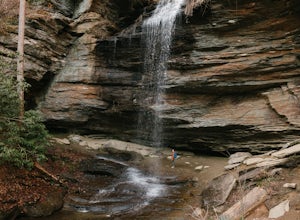
The trail to the Matthews Creek cable bridge crossing is easy. The cable crossing is fine - fun for some and a do-able challenge for others.
After the creek, to get to Moonshine Falls, turn RIGHT at the post which indicates a trail both left and right. This is the Naturaland Trail in Caesars Hea...
Read more
-
Seven Devils, North Carolina
Calloway Peak via Profile Trail is an out-and-back trail with waterfall views located near Banner Elk, North Carolina in Grandfather Mountain State Park.
Read more
-
Linville, North Carolina
5.0
6.2 mi
/ 2300 ft gain
If you're looking for a challenge and hoping to escape the crowds at Grandfather Mountain, this is the hike for you.
Climbing up the back side of the mountain (opposite the famed mile-high swinging bridge) this trail is fee-free and easy-to-access with its own parking lot.
The trail, marked w...
Read more
-
Brevard, North Carolina
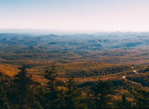
Looking Glass Rock located along the Blue Ridge Parkway (North) is one of the largest masses of granite in the Eastern US. It got it's name for the way the sunlight hits its rocky surface when wet, creating a shimmering, reflective, mirror-like effect. The views from this overlook are vast and cl...
Read more
-
Brevard, North Carolina
4.3
1.28 mi
/ 223 ft gain
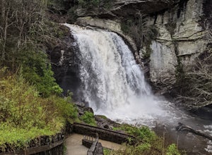
The hike relatively quick and has minimal elevation gain, making it a great hike for the family or a quick stop off if you're planning to do another hike in the same day. This part of the Pisgah National Forest is filled with scenic hikes.
Once you've parked your car, cross over the stream via a...
Read more
-
Banner Elk, North Carolina
5.0
6.31 mi
/ 1991 ft gain
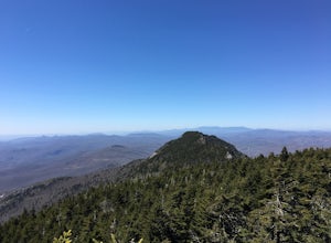
At 5,946 feet, Calloway Peak provides hikers with perhaps the best view of North Carolina's Blue Ridge Mountains. You'll have to earn this view - it is a tough climb up, although not terribly long.
Begin at the trailhead for Tanawha Trail in the Boone Fork Parking Area on the Blue Ridge Parkway....
Read more
-
Banner Elk, North Carolina
Boone Fork Bridge and creek is situated at the base of Grandfather Mountain, on the Blue Ridge Parkway, milepost 299.9. Elevation 3905'.The trailhead is at the left side of Boone Fork Creek parking area and the trail is a gentle meander through Rhododendrons and a hardwood forest.As you head tow...
Read more

