Union Mills, North Carolina
Top Spots in and near Union Mills
-
Cleveland, South Carolina
Getting there
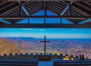
Fred W. Symmes (aka Pretty Place) Chapel is perched near the
top of Standing Stone Mountain at 3000 feet above sea level. That being said,
expect a long and winding drive up the mountain. It takes about 30 minutes
starting from the bottom of the mountain to arrive to the chapel.
Th...
Read more
-
Carlisle, South Carolina
Croft State Park, called Tour de' Dump by locals, is a 7,000 acre state park containing a lake, a river, horse back riding, recreational fields, etc. but it is more commonly known for its mountain biking. Made up of a little more than 16 miles of trails you can enter the Southside Loop Trail fro...
Read more
-
Pisgah Forest, North Carolina
You can drive this highway getting different views during the different seasons. Along the drive, have your camera ready for beautiful vistas, Looking Glass Falls, and many adventures along the highway. The views are especially beautiful in the autumn with the leaves changing colors. This route d...
Read more
-
Linville, North Carolina
5.0
7.49 mi
/ 1280 ft gain
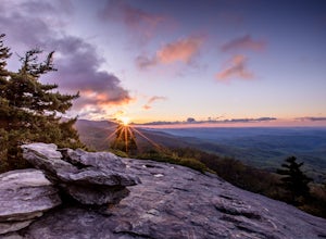
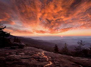
If you're feeling frisky, set your alarm for the early am and park at the Beacon Heights Parking area about 30 minutes before dawn. Put on your head lamp and hike the short trip to Beacon Heights, bask in the glory of the warm morning sun, then head back down and connect with the Tanawha Trail. A...
Read more
-
Newland, North Carolina
5.0
0.71 mi
/ 105 ft gain
Beacon Heights is the perfect hike when you're on the Blue Ridge Parkway near Linville and Grandfather Mountain, Milepost 305.2. The trail is a steady climb uphill for less than a half mile. The last section being fairly steep and rocky. Once at the top, there are several rock outcroppings, but...
Read more
-
Cleveland, South Carolina
3.0
1.03 mi
/ 266 ft gain
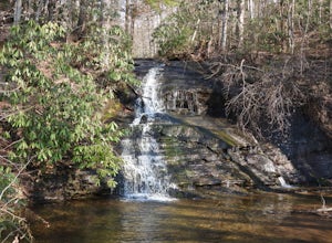
Wildcat Wayside Nature Trail is a loop trail that takes you by a waterfall located near Cleveland, South Carolina.
Read more
-
Cleveland, South Carolina
5.0
0.27 mi
/ 144 ft gain
The Drive: Head North on SC Highway 11 "Cherokee Foothills Scenic Highway" towards Table Rock State Park. Follow SC 11 past Table Rock approximately 8 miles where it will merge with SC 8 at Pumpkin Town. Follow SC 8 for another 3-4 miles until you see the intersection for SC Highway 276 on the le...
Read more
-
Brevard, North Carolina
Pisgah National Forest, in my opinion, is one of the best national forests in the United States. Being just a short drive from Great Smokey Mountain National Park it has all the feel of being in the smokies with more to explore. Pisgah has anything you could want to see or do from tens of water...
Read more
-
Brevard, North Carolina
4.8
30.07 mi
/ 7467 ft gain
Start at The Davidson River Campground just outside of Brevard, NC (276 Pisgah Ranger District). Have a shuttle car or a friend waiting at the Daniel Boone Boy Scout camp for the finish line.
Hop on the 30.1 mile long Art Loeb Trail at the trailhead in the Davidson River Campground. Pull into th...
Read more
-
Cleveland, South Carolina
For Caesar's Head State Park access, head North from Pickens on HWY 178 until it intersects with HWY 11. Turn right onto HWY 11 North and continue for 10 miles until the 276 intersection where you veer off to the left. Follow 276 to the top of the mountain. 1 miles past the Caesars Head Visitors ...
Read more
-
Cleveland, South Carolina
4.5
7.76 mi
/ 2185 ft gain
Location: From the intersection of US276 & SC11, head Northwest on US276. Drive to the top of the mountain, 1 mile past the visitor's center, and The Raven Cliff Falls Parking Area and trail head will be on your right.
After parking in the Raven Cliff Falls Parking Area, the trailhead is l...
Read more
-
Canton, North Carolina
The Mt. Pisgah campground is nestled right off of the Blue Ridge Parkway near Canton, NC. Since it is at an elevation of 4,980 feet the campground is a perfect destination to beat the heat and humidity that the region can be known for in the summer months. Reservations and information can be fo...
Read more
-
Linville, North Carolina
The trailhead for Rough Ridge will be on your righthand side when driving the Blue Ridge Parkway from Boone, NC. This trail gets busy in the warmer months, but parking usually is not too much of an issue. This trail is not open in the winter.
Rough Ridge will take you around 30-45 minutes to rea...
Read more
-
Canton, North Carolina
This is an extremely easy trail with a minimal incline. The tower, built in 1941, standing 70 feet above the summit, can be nerve wracking, even for those who aren't scared of heights. However, most feel it's worth the view. Expect to see fellow hikers. On pretty days there can be a few people w...
Read more
-
Bakersville, North Carolina
5.0
6.98 mi
/ 1204 ft gain
Appalachian Trail: Carvers Gap to Roan Mountain is an out-and-back trail near Bakersville, North Carolina. This trail is not too crowded, so don't be surprised if you're the only one taking in the view. Keep in mind the 1200+ foot climb along this trail if you're accustomed to hiking a longer dis...
Read more
-
Bakersville, North Carolina
The AT from Carver's Gap to HWY 19 is about 14.5 miles, but with side adventures, it could be roughly 20 miles. The trail crosses the road and continues up about a 400 ft. elevation gain to the first of the balds. This section of the AT is beautiful at near 6000 ft. above sea level and you will g...
Read more

