Tellico Plains, North Carolina
Looking for the best photography in Tellico Plains? We've got you covered with the top trails, trips, hiking, backpacking, camping and more around Tellico Plains. The detailed guides, photos, and reviews are all submitted by the Outbound community.
Top Photography Spots in and near Tellico Plains
-
Blairsville, Georgia
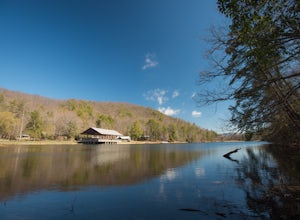
Camp at Vogel State Park
5.0Nestled at the foot of Blood Mountain is one of Georgia's most scenic State Parks. With over 90 campsites and 35 charming cottages, 17 miles of hiking trails, a beautiful alpine lake, and a charming waterfall, Vogel State Park highlights all of the best things that North Georgia has to offer. T...Read more -
Blairsville, Georgia
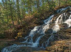
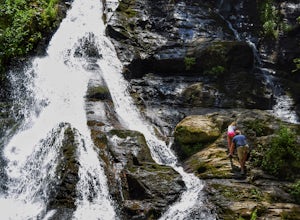
Hike the Trahlyta Lake Trail to Trahlyta Falls
1 mi / 30 ft gainLake Trahlyta in Vogel State Park offers a truly unique combination of natural beauty and opportunity for recreation. The easy one-mile Lake Trahlyta trail circles the emerald colored lake and has a short deviation that leads to a calming, yet impressive waterfall. The trail starts on the edge...Read more -
Blairsville, Georgia
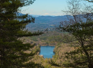
Hike the Bear Hair Gap Trail
4.55.5 mi / 675 ft gainVogel State Park is one of the many beautifully preserved wilderness parks of Northern Georgia. With a stunning alpine lake and 17 miles of trails, you cannot go wrong. The Bear Hair Trail is the perfect mid-distance option that will reward you with both great views of the lake from a high vant...Read more -
Hiawassee, Georgia
Blue Hole and High Shoals Creek Falls
4.82.45 mi / 479 ft gainLocated just a few miles north of Helen, Georgia is this hidden gem. The road that leads up to the starting point of the hike is a bit tricky to find so make sure you have your GPS to help a little, its a gravel road that winds up the mountain for a about a mile. The dirt trail winds down throug...Read more -
Clayton, Georgia
Camp at Tallulah River Campground
Tallulah River Campground is located in the Chattahoochee-Oconee national forest. It is just outside of Clayton, Georgia. The campground has about 15 spots that are big enough for a small to medium sized RV. Each camping spot also has a nice tent pad for a big tent. Most spots are also on the riv...Read more -
Blairsville, Georgia
Hike to Horsetrough Falls
5.00.4 mi / 10 ft gainTo get to the trail head you will follow Wilks road five miles to Upper Chattahoochee River Campground. The five miles down the gravel road should be doable for a majority of cars as the gravel road is in good condition. Pretty much if you feel comfortable driving your car on a regular gravel roa...Read more -
Gatlinburg, Tennessee
Hike the Chimney Tops
4.94.03 mi / 1487 ft gainThe Chimney Tops Trail is one of the most visited trails in the Smokies, which is why I recommend going up just before sunset to beat the crowd! During the summer and fall months, it's common to see a hundred people taking in the views on the same trail, but if you scramble on out after hours, y...Read more -
Blairsville, Georgia
Hike to Helton Creek Falls
4.50.6 mi / 22 ft gainGetting to Helton Creek Falls can be a little bit tricky. You can either access the trailhead from 348 (the less popular, more adventurous route), or you can access the trailhead easily off of highway 19. The reason why access from 348 is a bit tricky is that the road actually has two creek cros...Read more -
Blairsville, Georgia
Appalachian Trail from Blood Mountain to Cowrock Mountain
4.014 mi / 2907 ft gainNorth Georgia is packed with awesome mountain trails, but few boast the beauty and magnitude of the Appalachian Trail. The hike from Blood Mountain to Cowrock Mountain is one of the more scenic sections of the AT in Georgia, in terms of mountain views. Do this hike as a full day hike, or spread ...Read more -
Blairsville, Georgia
Blood Mountain via Byron Reece Trailhead
4.74.34 mi / 1447 ft gainThe Chattahoochee National Forest and Cohutta Wilderness make up the wild and scenic southern tip of the Blue Ridge Mountains. The Blood Mountain trail offers the day hiker a taste of the Appalachian Trail that does not disappoint. The hike starts at the Byron Reece trailhead at Neels Gap where ...Read more -
Gatlinburg, Tennessee
Mt. LeConte via Alum Cave Bluff
5.010.68 mi / 3982 ft gainThe Alum Cave trailhead is on Newfound Gap Road, 8 miles from the Sugarlands Visitor Center. Mt. LeConte is the third highest peak in the Smokies, and this is an extremely popular hike, so arrive early to get a parking spot and beat the crowds. Starting from the parking lot the trail gently wind...Read more -
35.629385,-83.450994
Camp out at Mt. LeConte Lodge via Alum Cave
5.09.96 miAt the summit of Mt. LeConte in the Great Smoky Mountains National Park, the lodge sits at a elevation of 6400 feet. It is the only "accommodations" inside the park boundaries. It is the highest lodge in the eastern United States. Accessible only by hiking one of the five trails to the summit,...Read more -
Sylva, North Carolina
Hike to Cowee Bald Fire Tower
4.4 mi / 400 ft gainThe Cowee Bald Fire Tower is located in the Nantahala National Forest near Bryson City North Carolina. To get there you can either drive almost all the way to the top about .2 miles from the top but to get there you will need to have a 4WD or a higher clearance vehicle to cross a small stream. Ho...Read more -
Gatlinburg, Tennessee
Mount LeConte-Cliff Tops via Rainbow Falls Trail
4.513.37 mi / 3993 ft gainBegin at the Rainbow Falls trail parking lot. This is very popular area especially in the summer. If the parking area at the trail head is full there is additional parking located just past the main lot. From here the Rainbow Falls trail is just under 14 miles to the summit of Mount Leconte. Elev...Read more -
35.675929,-83.485764
Roaring Fork Motor Nature Trail
5.05.83 miThis 6 mile drive is a great way to spend a scenic day in the Smokies. The road is open to cars only (no trucks or RVs) and runs one-way. There are no visitors centers after you head out, so be sure to bring everything you need along. The drive begins at the historic Ogle farmstead, which is als...Read more -
35.610235,-83.426410
Myrtle Point via Alum Cave
5.015.43 mi / 3100 ft gainThis hike can be started at the Alum Cave trailhead or the Boulevard Trailhead. For this particular adventure, the starting point is Alum Cave. If you're lucky enough to stay the night at the backcountry shelter on top of Mt. LeConte, (add 0.2 miles if coming from the Lodge), head east on the Bou...Read more

