Spruce Pine, North Carolina
Top Spots in and near Spruce Pine
-
Hendersonville, North Carolina
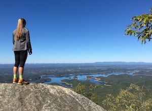
Park at the end of The World's Edge Road, but be aware that parking is very limited. There is a private residence up to the right so do not block their driveway/gate. Begin your hike by going through the leftmost gate, and continue straight until you reach the first view less than half a mile in....
Read more
-
Greeneville, Tennessee
To reach the trail head, take exit number 39 to Erwin/Jonesborough and turn onto State Route 81/107 west and stay on this for 6.5 miles. Then you will turn left to stay on Route 107 and continue on for 16 more miles. Then you will take a left on Route 351 and drive 4.5 miles. Then you will take a...
Read more
-
Bluff City, Tennessee
Worley’s Cave, also known as Morrill Cave, lies just outside of Boone across the Tennessee border. It is the second longest cave in the state of Tennessee at a whopping 4.4 miles in total length. It is a non-lit cavern that’s path is lit only by those who venture in its depths (i.e. headlamps, la...
Read more
-
Johnson City, Tennessee
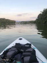
Picken's Bridge has a parking area and boat drop that is accessible to place kayaks or paddle boards. From the boat drop there is a large open area of the lake to paddle around and explore. Northwest from the boat drop there are some cliffs that can easily be climbed up to cliff jump.
Please rem...
Read more
-
Elizabethton, Tennessee
5.0
2.44 mi
/ 1302 ft gain
Flint Mill Trail is an approximately 2.4 mile out-and-back trail in the Cherokee National Forrest. The trailhead is located on Flatwoods Road in Elizabethton, TN. The trail has a rather steep incline and is considered challenging. There is a 1,264 foot altitude change from the base to the top . T...
Read more
-
Bluff City, Tennessee
There is a mud parking area on Lakeview Drive underneath the 11E bridges with a cleared mud parking area with access to the the South Fork of the Holston River. There is a gradual drop to the water where kayaks, canoes, or SUPs can be placed in the water. To the east, the river is more narrow at ...
Read more
-
Hickory, North Carolina
5.0
2.65 mi
/ 354 ft gain
Geitner Rotary Park Loop is a loop trail that takes you by a lake located near Hickory, North Carolina.
Read more
-
Johnson City, Tennessee
Gray Quarry is a perfect destination for scuba diving in TN! The quarry is about 70 feet deep with ~3 acres of clear water. They have sunk a plane, bus, truck, firetruck, boat, seedoos, and more to the bottom. There is also a large variety of aquatic animals in the quarry. This is an awesome, loc...
Read more
-
Purlear, North Carolina
5.0
0.86 mi
/ 220 ft gain
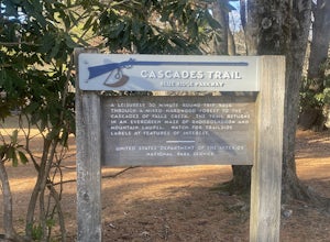
Cascades Trail is an out-and-back trail that takes you by a waterfall located near Deep Gap, North Carolina.
Read more
-
Bristol, Tennessee
5.0
1.45 mi
/ 157 ft gain
The Bouton Trail Loop is an approximately 1.5 mile round trip on TVA land. There is a gravel parking lot with an information sign and trail map. Sections of the trail are gravel and sections are dirt. There are multiple places along the trail that cut off and lead down to the river for prime fish...
Read more
-
Hot Springs, North Carolina
Rich Mountain fire tower is located in the Cherokee National Forest just outside of Hot springs North Carolina. Getting there is pretty easy once you get off of US 25W you drive up a gravel road for about 5 miles until you get to the tower. Once you get to the top its about a 100 foot walk until ...
Read more
-
Bristol, Tennessee
Little Oak is a campground in Sullivan County, TN in the Cherokee National Forrest. There are 69 campsites located in three separate sections of the campground. Each section has a vault toilet and there is a shower house for the whole campground. There is a host in each section to help ensure you...
Read more
-
Bristol, Tennessee
5.0
3.54 mi
/ 869 ft gain
Spillway Trail is an out-and-back trail that takes you by a lake located near Bristol, Tennessee.
Read more
-
Bristol, Tennessee
5.0
2.16 mi
/ 194 ft gain
The Emmett Trail is one of the TVA South Holston Tailwater Trails. This trail began as a footpath created by anglers. The trail now has gravel, which makes for easier access for families and pets. The trailhead begins on Piney Hill Road where it the traverses down to the waters edge and leads to ...
Read more
-
Arden, North Carolina
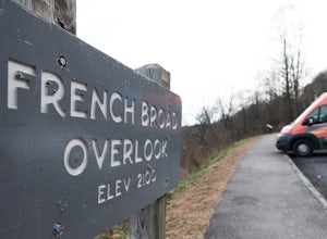
The French Broad Overlook is one of several overlook spots along the Blue Ridge Parkway. It's not known to be the most breathtakingly scenic spot of the batch, but it's still a nice viewpoint that will offer you sights of the French Broad River, one of the few north flowing rivers in the US.
Yo...
Read more
-
Bristol, Tennessee
The Osceola Island Loop is a 1.50 mile gravel loop on an island in the South Holston River. There are multiple benches along the loop to stop and observe the wildlife. Fishing is a common activity along the edge of the trail. There is a large parking area and bathrooms at the start of the trail.
Read more


