Spruce Pine, North Carolina
Top Spots in and near Spruce Pine
-
Hampton, Tennessee
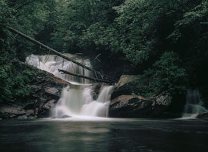
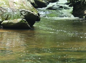
The Hike to Dennis Cove Falls includes three water crossings and passes several small waterfalls. Sturdy cables spanning the width of the water crossings provide a fun way of traversing the creek without wading. It is completely possible to wade through the creek while holding onto the cables for...
Read more
-
-
Unicoi, Tennessee
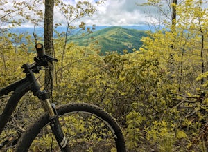
Pinnacle Mountain is a long, grinding climb to the top. The singletrack winds up 1,500 feet of elevation for nearly 5 miles with few downhill sections. Once at the top, take a rest and climb the fire tower that overlooks the Downtown Johnson City area, Elizabethton, Erwin, and the rest of the Buf...
Read more
-
Unicoi, Tennessee
5.0
3.47 mi
/ 663 ft gain
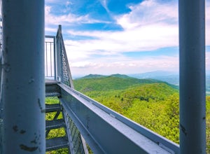
Pinnacle Mountain hosts one of the nicest fire towers on the East Coast of the United States. The fire tower is relatively new, sturdy, and has a large 360 degree viewing area at the top. The tower overlooks the Downtown Johnson City area, Elizabethton, Erwin, and the rest of the Buffalo Mountain...
Read more
-
Johnson City, Tennessee
Lone Oak to Tip Top Trail is an out-and-back trail where you may see beautiful wildflowers located near Johnson City, Tennessee.
Read more
-
Johnson City, Tennessee
5.0
4.94 mi
/ 1457 ft gain
White Rock Loop is a loop trail where you may see beautiful wildflowers located near Johnson City, Tennessee.
Read more
-
Johnson City, Tennessee
4.0
5.4 mi
/ 1388 ft gain
Tip Top rests on one of the highest points of Buffalo Mountain. The overlook features tree coverage perfect for hammocking and benches while providing views of Downtown Johnson City as well as the other side of the mountain range. The hike from the trailhead to Tip Top is moderately steep. The tr...
Read more
-
Johnson City, Tennessee
5.0
3.12 mi
/ 1220 ft gain
The Fork Knob and White Rock Loop in Johnson City, Tennessee, is a moderately challenging hiking trail that spans approximately 3.12 miles. The trail is marked by a variety of natural features, including a prominent rock formation known as White Rock, which offers panoramic views of the surroundi...
Read more
-
Johnson City, Tennessee
5.0
2.85 mi
/ 876 ft gain
The White Rock trailhead is less than a 10 minute drive from downtown Johnson City. When pulling up Highbridge Road, take a left at the fork. You will shortly encounter a vehicle gate where you will park to the side of the road (do not block the yellow vehicle gate).
You have the option to walk ...
Read more
-
Johnson City, Tennessee
5.0
0.65 mi
/ 223 ft gain
Sunset Point is an overlook located in Buffalo Mountain State Park. The trail is a short hike up along the White Rock loop trail then a short walk off the trail to get to the overlook. There is a clearing with a few benches that has wide open views to the west. The short hike up to the point shou...
Read more
-
Elizabethton, Tennessee
Great spot for kayaking! There is a small waterfall across the lake. The water is very still. Great for kayaking. The spot is somewhat hidden so not many people know about it. There are never many people there. It is a beautiful lake with amazing views. There is also a small picnic area in front ...
Read more
-
Johnson City, Tennessee
The course gravel trail begins just east of downtown Johnson City. The trail maintains a flat grade throughout the 10 miles towards the city of Elizabethton. There are restrooms 3 miles in from the Johnson City trailhead. You can also park at Lions Field in Elizabethton and head west towards John...
Read more
-
Asheville, North Carolina
The Haw Creek Valley Overlook is only 8 miles from downtown Asheville. If you're in the downtown area, it's a rather easy place to zip on over to if you're in need of some time away from urban life.
This overlook is a hot spot for sunset watching and picture taking. If you plan on seeing what th...
Read more
-
Black Mountain, North Carolina
Eagle Rock is located in Chimney Rock State Park and is a hot spot for climbers and hikers!
The hike to the overlook at Eagle Rock is 0.4 miles, and it's one of the most bang-for-your-buck trails in the area. We love to picnic out on the rock as it's in the sun most of the day. If you decide to...
Read more
-
Connelly Springs, North Carolina
5.0
6.18 mi
/ 1299 ft gain
This 6.2-mile total trip will take you through the highlights of South Mountains State Park with an overnight stay in one of the drier campsites.
OPTIONAL: You can get a warm-up in by starting with a 2.5-mile loop to High Shoal Falls that you can do without packs before picking up with a 3-mile...
Read more
-

