Sapphire, North Carolina
Top Spots in and near Sapphire
-
Gatlinburg, Tennessee
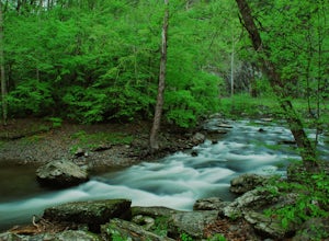
Quilliam Cave via Courthouse Rock Trail
2.85 mi / 1404 ft gainQuilliam Cave via Courthouse Rock Trail is an out-and-back trail that takes you by a river located near Gatlinburg, Tennessee.Read more -
Del Rio, Tennessee
Max Patch Mountain
5.01.51 mi / 315 ft gainMax Patch Mountain was once cleared for pasture land, leaving an expansive flat summit that now serves as the ideal location for a picnic hike, flying a kite, or laying in the sun surrounded by the Great Smoky Mountains. With little elevation gain and a short distance it is also very family (and ...Read more -
Gatlinburg, Tennessee
Mount LeConte-Cliff Tops via Rainbow Falls Trail
4.513.37 mi / 3993 ft gainBegin at the Rainbow Falls trail parking lot. This is very popular area especially in the summer. If the parking area at the trail head is full there is additional parking located just past the main lot. From here the Rainbow Falls trail is just under 14 miles to the summit of Mount Leconte. Elev...Read more -
35.675929,-83.485764
Roaring Fork Motor Nature Trail
5.05.83 miThis 6 mile drive is a great way to spend a scenic day in the Smokies. The road is open to cars only (no trucks or RVs) and runs one-way. There are no visitors centers after you head out, so be sure to bring everything you need along. The drive begins at the historic Ogle farmstead, which is als...Read more -
Lake Lure, North Carolina
Explore Chimney Rock
4.00.5 miChimney rock is a beautiful slab of weather granite that is visible from miles around. To get to this hike you'll want to head to Lake Lure in North Carolina, a beautiful lake located in the mountains of western North Carolina. Follow the signs for Chimney Rock and take the switchback road up t...Read more -
Lake Lure, North Carolina
Exclamation Point and Skyline Trail to Hickory Nut Falls
5.02.98 mi / 1204 ft gainExclamation Point and Skyline Trail to Hickory Nut Falls is an out-and-back trail that takes you by a waterfall located near Chimney Rock, North Carolina.Read more -
Lake Lure, North Carolina
Hike to Hickory Nut Falls
5.02 mi / 200 ft gainThis waterfall is located inside of the Chimney Rock State Park. There is a fee of 15 dollars to go to the State Park but it is very worth it because of the beautiful scenery and beautiful views. The hike to the waterfall is partially uphill on the way. When you get to the waterfall there are a f...Read more -
Cosby, Tennessee
Maddron Bald - Albright Grove Loop
6.72 mi / 1500 ft gainHidden in the eastern reaches of Great Smoky Mountains National Park, the Cosby region receives a fraction of the visitation of Gatlinburg or Cherokee. This section of the park preserves some of the best deciduous old-growth forest in the eastern United States. Individual tulip trees and eastern ...Read more -
Young Harris, Georgia
Hike the Miller Trek
5.06.3 mi / 1325 ft gainThis is an awesome trek with views of both Young Harris and Hiawassee, GA! The trail starts from the parking area where there is the Miller Trek A-Frame (see photo for reference)! There are several different trails within the trail system on the mountain, but if you take 5 minutes to read the map...Read more -
Blairsville, Georgia
Hike to the Brasstown Bald Peak
4.31.42 mi / 430 ft gainOnce you make it to the parking area (parking fee required) to Brasstown Bald you will be at about 4284 feet elevation. From there you will have a short (0.6 mile) but steep hike to the tower that sits atop Brasstown Bald. Along the path you will see Rhododendron and various other blooms dependi...Read more -
Helen, Georgia
Hike the Unicoi Lake Trail
1.9 miUnicoi State Park is a pleasant, refreshing park just outside of Helen, GA. There is a hiking trail, kayaking/canoeing launch, paddle boat rentals, camping area, and even a 3 segment zipline course (all three were fantastic)! Fishing is allowed, and when we went last there were a few kayakers fis...Read more -
Blairsville, Georgia
Hike to Horsetrough Falls
5.00.4 mi / 10 ft gainTo get to the trail head you will follow Wilks road five miles to Upper Chattahoochee River Campground. The five miles down the gravel road should be doable for a majority of cars as the gravel road is in good condition. Pretty much if you feel comfortable driving your car on a regular gravel roa...Read more -
Hartford, Tennessee
Whitewater Rafting the Pigeon River
5.0The Pigeon River is a dam controlled river that winds its way through North Carolina and Eastern Tennessee just outside Great Smoky Mountains National Park. The river provides beautiful views as one paddles along via raft or kayak. Cutting through portions of the Pisgah and Cherokee National For...Read more -
Del Rio, Tennessee
Max Patch to Hot Springs, N.C. via Appalachian Trail
3.014.06 mi / 2966 ft gainMake a weekend trip from Max Patch to Hot Springs N.C., and be sure to soak in the natural hot springs at the old inn after your hike! This is an incredible, relatively easy hike with the reward at the end being hot springs on the French Broad River. You can break this up however you like, this i...Read more -
Black Mountain, North Carolina
Eagle Rock
0.7 mi / 151 ft gainEagle Rock is located in Chimney Rock State Park and is a hot spot for climbers and hikers! The hike to the overlook at Eagle Rock is 0.4 miles, and it's one of the most bang-for-your-buck trails in the area. We love to picnic out on the rock as it's in the sun most of the day. If you decide to...Read more -
Gatlinburg, Tennessee
Hike the Cucumber Gap and Little River Loop
4.05.5 mi / 800 ft gainThis loop offers a scenic 2.5 mile hike next to the river before looping back around via the Cucumber Gap Trail. At the tail end, you'll connect with the Jakes Creek Trail for about 0.7 miles to return you back to the parking lot. Many people hike this trial clockwise, but if it's a hot day, it...Read more

