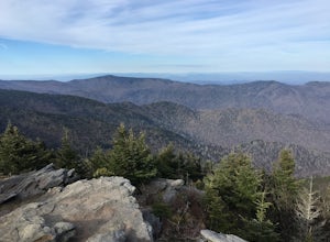
Maggie Valley, North Carolina
Looking for the best photography in Maggie Valley? We've got you covered with the top trails, trips, hiking, backpacking, camping and more around Maggie Valley. The detailed guides, photos, and reviews are all submitted by the Outbound community.
Top Photography Spots in and near Maggie Valley
-
Clayton, Georgia
Hike the James E. Edmond trail to Lookoff Mountain Overlook
4.07.5 mi / 2378 ft gainBlack Rock Mountain State Park is Georgia's highest elevation State Park. It is adorned with several waterfalls, sweeping overlooks, blooming Rhododendron's, and plenty of miles of trail. The James E. Edmond trail is the longest and by far most challenging hike in the park. Its medium-long dis...Read more -
Montreat, North Carolina
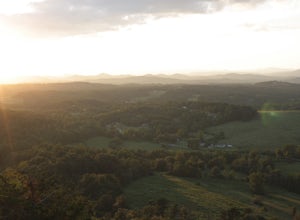
Hike Lookout Mountain, Montreat
5.01.1 mi / 623 ft gainNestled in the Blue Ridge Mountains is Montreat, North Carolina. Just down the road from Asheville, it neighbors Black Mountain and doesn't disappoint for views. Montreat itself houses a plethora of hiking trails, but the cream of the crop HAS to be Lookout Mountain. After a weekend of checking o...Read more -
Hendersonville, North Carolina
Hike along The World's Edge
0.7 mi / 40 ft gainPark at the end of The World's Edge Road, but be aware that parking is very limited. There is a private residence up to the right so do not block their driveway/gate. Begin your hike by going through the leftmost gate, and continue straight until you reach the first view less than half a mile in....Read more -
Clayton, Georgia
Camp at Tallulah River Campground
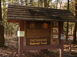
Tallulah River Campground is located in the Chattahoochee-Oconee national forest. It is just outside of Clayton, Georgia. The campground has about 15 spots that are big enough for a small to medium sized RV. Each camping spot also has a nice tent pad for a big tent. Most spots are also on the riv...Read more -
Tallassee, Tennessee
Hike to Look Rock Tower
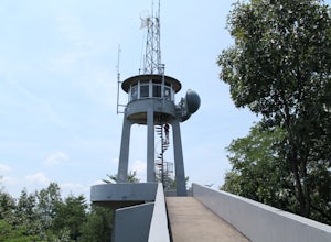
5.01 mi / 300 ft gainLook Rock tower has spectacular views and is a great hike to enjoy year round. The tower is an old fire tower used for spotting smoke in the valley. Because of this the tower is placed on the highest ridge around making for some amazing views. The only way to get to the tower is along the Foothil...Read more -
Robbinsville, North Carolina
Hike Joyce Kilmer Memorial Forest Loop
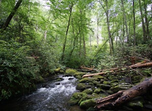
5.02 miThe beauty of this trail starts at the parking lot. Before you start the trail, you will find a picnic table near the parking lot and go down to the edge of the rolling stream. Its a great spot to hear the stream and take some pictures. If you are feeling adventurous you can try to hop from rock ...Read more -
Lake Lure, North Carolina
Explore Chimney Rock
4.00.5 miChimney rock is a beautiful slab of weather granite that is visible from miles around. To get to this hike you'll want to head to Lake Lure in North Carolina, a beautiful lake located in the mountains of western North Carolina. Follow the signs for Chimney Rock and take the switchback road up t...Read more -
Lake Lure, North Carolina
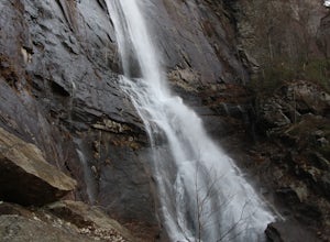
Hike to Hickory Nut Falls
5.02 mi / 200 ft gainThis waterfall is located inside of the Chimney Rock State Park. There is a fee of 15 dollars to go to the State Park but it is very worth it because of the beautiful scenery and beautiful views. The hike to the waterfall is partially uphill on the way. When you get to the waterfall there are a f...Read more -
Pickens, South Carolina
Hike Glassy Mountain
5.01.3 mi / 200 ft gainThis view never gets old and it is super easy to access. It's also only like half a mile down and then half a mile back up, so if you do watch the sunset, the walk back is easy. The trail is out by Glassy Mountain Church in Pickens, SC and it's accessible year round. The hike is very simple, and ...Read more -
Walhalla, South Carolina
Hike to Issaqueena Falls and Stumphouse Tunnel
4.01.5 mi / 250 ft gainFrom Walhalla South Carolina, follow SC 28 westward 7 miles until you see Stumphouse Tunnel Park on the right-hand side of the road. Take this road halfway down, and park in the parking area on the right. From here, you can travel a short walk to the falls overlook, or, for the more adventurous ...Read more -
Old Fort, North Carolina
Catawba Falls
4.82.19 mi / 394 ft gainPlease note, Catawba Falls is temporarily closed. You can learn more about updates at www.fs.usda.gov. This quick and relatively easy hike is located close to Asheville, NC. If you're looking to have the trail to yourself, it can be a little tough. It's best to get there as early as possible or ...Read more -
Robbinsville, North Carolina
Hike the Big Fat Gap Trail
12 mi / 3000 ft gainThere are many trailheads leading into the wilderness on either the Tennessee or North Carolina side. My favorite is the Big Fat Gap trail on the North Carolina side at an elevation of 3,060'. To see the best of what this area has to offer take the Hangover Lead South Trail to the 5,180' Hangover...Read more -
Burnsville, North Carolina
Deep Gap Trail at Mt. Mitchell State Park
5.08.24 mi / 2310 ft gainI personally find this trail to be more difficult and have more rewarding views than the Mt. Mitchell summit trail. The Deep Gap Trail starts near the Mount Mitchell summit and heads into a forest of spruce and balsam fir trees. The trail then climbs along the ridgeline to neighboring summits. E...Read more


