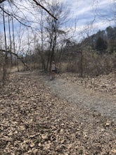
Jefferson, North Carolina
Jefferson, North Carolina is a great destination for outdoor adventurers. With its scenic trails, breathtaking views, and must-visit attractions, it’s no wonder that it is a popular destination for those who adore the great outdoors. There are plenty of activities to choose from, such as hiking, biking, camping, kayaking, and fishing. The nearby New River State Park is a great spot for those looking for a peaceful stroll or a challenging trek. There are also plenty of opportunities to explore the area’s rich history, with historical sites and monuments scattered throughout the area. The nearby Blue Ridge Parkway is a must-visit for those seeking an awe-inspiring and picturesque journey. With its winding roads, stunning views, and plenty of wildlife, it’s a great way to spend a day. No matter what type of outdoor activities you’re looking for, Jefferson, North Carolina is a thrilling treasure trove sure to provide you with plenty of options.
Top Spots in and near Jefferson
-
Linville, North Carolina
Rough Ridge via the Tanawha Trail from Beacon Heights
5.07.49 mi / 1280 ft gainIf you're feeling frisky, set your alarm for the early am and park at the Beacon Heights Parking area about 30 minutes before dawn. Put on your head lamp and hike the short trip to Beacon Heights, bask in the glory of the warm morning sun, then head back down and connect with the Tanawha Trail. A...Read more -
Elk Park, North Carolina
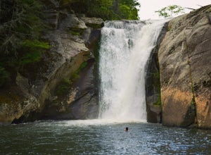
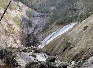
Elk River Falls
4.60.35 mi / 62 ft gainThe coordinates for the parking area are 36.198288, -81.970137. You'll see a parking area that's dirt/gravel on the right side of the road. At the far end of the parking lot is a sign that says Elk River Falls with an arrow pointing up the hill. From this point its about a .2 mile long walk to th...Read more -
Marion, Virginia
Hike Molly's Knob
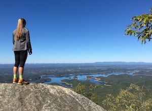
5.03.4 mi / 1100 ft gainThe parking lot is located on the east side of the lake, just before the group lodge on Lake Drive. The Molly’s Knob trail begins just uphill on the right and is marked by white blazes. You can also take an alternate route and follow the Lake Loop Trail (located to the left of the parking area)...Read more -
Marion, Virginia
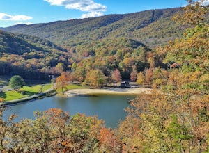
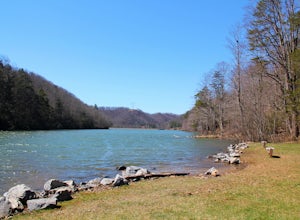
Hike the Lake Trail Loop at Hungry Mother SP
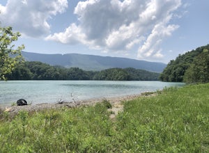
6 mi / 800 ft gainHungry Mother State Park is located in the picturesque Blue Ridge Mountains in Southern Virginia. Located inside the state park is the Lake Trail Loop that winds itself around the man-made reservoir and the park. Hikers can access the trail in numerous locations throughout the park but the easies...Read more -
Bristol, Tennessee
Little Oak Campground
4.0Little Oak is a campground in Sullivan County, TN in the Cherokee National Forrest. There are 69 campsites located in three separate sections of the campground. Each section has a vault toilet and there is a shower house for the whole campground. There is a host in each section to help ensure you...Read more -
Elizabethton, Tennessee
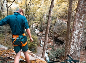
Climb at Blue Hole Falls
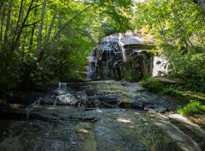
3.70.1 mi / 0 ft gainFrom TN 91, turn onto Panhandle Road. Follow Panhandle for 1 mile and park in the parking lot to the left. Waterfall Follow the path to your right downwards until you encounter wooden stairs. The main waterfall will be to your right less than .1 mile from the parking lot. There are two other wat...Read more -
Linville, North Carolina
Hike the Flat Rock Trail (NC)
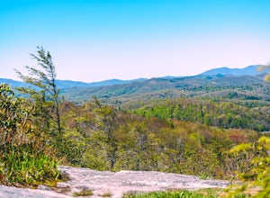
5.00.6 miFlat Rock Trail is located off the Blue Ridge Parkway at milepost 308. There is a pull-off from the Parkway with a sign designating the location. There are several picnic tables around the pull-off, but I would recommend taking your lunch up to Flat Rock. The wide, clear trail is practically flat...Read more -
Elizabethton, Tennessee
Flint Mill Trail
5.02.44 mi / 1302 ft gainFlint Mill Trail is an approximately 2.4 mile out-and-back trail in the Cherokee National Forrest. The trailhead is located on Flatwoods Road in Elizabethton, TN. The trail has a rather steep incline and is considered challenging. There is a 1,264 foot altitude change from the base to the top . T...Read more -
Appalachian Trail, Tennessee
Jones Falls via Appalachian Trail
5.010.65 mi / 2484 ft gainStarting at the Appalachian Trail (AT) trailhead at US 19E, follow the AT north for 3.1 miles until you reach the intersection of the trail with Buck Mountain Rd. This section of the AT has an elevation gain of almost 1000 ft, and large sections of trail with significant meadows offering magnific...Read more -
Bristol, Tennessee
Spillway Trail
5.03.54 mi / 869 ft gainSpillway Trail is an out-and-back trail that takes you by a lake located near Bristol, Tennessee.Read more -
Bristol, Tennessee
Explore the South Holston Dam
5.0Coming from US-421 turn off on Emmett Rd and keep left to get on Holston View Dam Rd and continue straight on this road by the river. There are parking spaces by the river below the dam and short easy trails to walk on next to the river. You’ll see fly fishers in the river below the dam on early ...Read more -
Collettsville, North Carolina
South Harper Creek Falls
5.03.46 mi / 564 ft gainSouth Harper Creek Falls is an out-and-back trail that takes you by a waterfall located near Collettsville, North Carolina.Read more -
Bristol, Tennessee
Osceola Island Loop
5.01.52 mi / 95 ft gainThe Osceola Island Loop is a 1.50 mile gravel loop on an island in the South Holston River. There are multiple benches along the loop to stop and observe the wildlife. Fishing is a common activity along the edge of the trail. There is a large parking area and bathrooms at the start of the trail.Read more -
Bristol, Tennessee
Bouton Loop Trail
5.01.45 mi / 157 ft gainThe Bouton Trail Loop is an approximately 1.5 mile round trip on TVA land. There is a gravel parking lot with an information sign and trail map. Sections of the trail are gravel and sections are dirt. There are multiple places along the trail that cut off and lead down to the river for prime fish...Read more -
Bristol, Tennessee
Tailwater Trail
5.00.95 mi / 30 ft gainThe TVA Tailwater Trail is a 0.5 mile trail along the east side of South Fork Holston River. The trail is dirt and ends in an incline. Along the edge of the river, there are views of the distant Holston Mountain. This trail provides access to the river for fishing. It is located near the Emmett T...Read more -
Bristol, Tennessee
Emmett Trail
5.02.16 mi / 194 ft gainThe Emmett Trail is one of the TVA South Holston Tailwater Trails. This trail began as a footpath created by anglers. The trail now has gravel, which makes for easier access for families and pets. The trailhead begins on Piney Hill Road where it the traverses down to the waters edge and leads to ...Read more

