Hot Springs, North Carolina
Top Spots in and near Hot Springs
-
Montreat, North Carolina
Nestled in the Blue Ridge Mountains is Montreat, North Carolina. Just down the road from Asheville, it neighbors Black Mountain and doesn't disappoint for views. Montreat itself houses a plethora of hiking trails, but the cream of the crop HAS to be Lookout Mountain. After a weekend of checking o...
Read more
-
Cherokee, North Carolina
4.2
0.22 mi
/ 148 ft gain
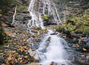
Although it is not much of a hike at just 0.3 miles, it is accessible to people of all fitness levels. A climb up a series of stairs leads you to a trail overlooking Mingo creek. You will then find a 20 foot wide bridge which serves as the viewing platform of the falls.
If you care to advent...
Read more
-
Old Fort, North Carolina
4.8
0.76 mi
/ 292 ft gain
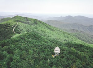
Green Knob Lookout Tower is an abandoned fire tower near Mt. Mitchell and located directly off the Blue Ridge Parkway. The tower boasts a full 360-degree, unobstructed view of Mt. Mitchell, Craggy Mountains, Table Rock, Grandfather Mountain, and the Parkway. Unlike most fire towers, this tower is...
Read more
-
Canton, North Carolina
4.3
8.69 mi
/ 2569 ft gain
There are several ways to access the Shining Rock Wilderness Area, but go for the main trail head off of Hwy 276. The trail is split by the Pigeon River, providing a seemingly infinite combinations of trails and routes, keeping in mind that this area intersects often with the well known Art Lobe ...
Read more
-
Canton, North Carolina
We began this trip by camping overnight in Graveyard Fields. Those camp sites are .5 miles from the car, so we kept our food there over night. Bear activity has increased, so it's strongly advised to bring a bear canister and be wise about food storage.
We woke up early the next morning made bre...
Read more
-
Johnson City, Tennessee
Lone Oak to Tip Top Trail is an out-and-back trail where you may see beautiful wildflowers located near Johnson City, Tennessee.
Read more
-
Bryson City, North Carolina
5.0
3.92 mi
/ 850 ft gain
Kephart Prong is a pretty easy hike in close proximity to the Visitor Center on the North Carolina Side of GSMNP. 2 miles up the trail, you'll arrive at Kephart Shelter, where you can rest and enjoy vies of the Kephart Prong. Once you've had your fill, head back down the way you came.
During th...
Read more
-
Unicoi, Tennessee
3.5
0.68 mi
/ 190 ft gain
Red Fork Falls Trail is an out-and-back trail that takes you by a waterfall located near Unicoi, Tennessee.
Read more
-
Bryson City, North Carolina
Charlies Bunion via Kephart Loop is a loop trail located near Cherokee, North Carolina. This is a longer version of the Charlies Bunion hike starting from the Newfound Gap parking lot. The added benefit of this longer loop is the opportunity to see more of the Great Smokey Mountains! You'll pass ...
Read more
-
Burnsville, North Carolina
Park at the work center but don't block the gate. Hike around the gate and head up the grassy and gravel road. Once you get to the creek a narrow path leads upstream to the base of the falls.
gps: n35 46.101/ w82 11.713
Read more
-
Cherokee, North Carolina
The pinpoint for this particular entrance starts just outside of Cherokee, North Carolina, following the Parkway North.
They say the Blue Ridge Parkway is more than just a road, it's a beautiful journey. Start this journey and you will quickly find this to be true. This 469 mile gateway connects...
Read more
-
Johnson City, Tennessee
5.0
0.65 mi
/ 223 ft gain
Sunset Point is an overlook located in Buffalo Mountain State Park. The trail is a short hike up along the White Rock loop trail then a short walk off the trail to get to the overlook. There is a clearing with a few benches that has wide open views to the west. The short hike up to the point shou...
Read more
-
Johnson City, Tennessee
5.0
3.12 mi
/ 1220 ft gain
The Fork Knob and White Rock Loop in Johnson City, Tennessee, is a moderately challenging hiking trail that spans approximately 3.12 miles. The trail is marked by a variety of natural features, including a prominent rock formation known as White Rock, which offers panoramic views of the surroundi...
Read more
-
Johnson City, Tennessee
4.0
5.4 mi
/ 1388 ft gain
Tip Top rests on one of the highest points of Buffalo Mountain. The overlook features tree coverage perfect for hammocking and benches while providing views of Downtown Johnson City as well as the other side of the mountain range. The hike from the trailhead to Tip Top is moderately steep. The tr...
Read more
-
Johnson City, Tennessee
5.0
4.94 mi
/ 1457 ft gain
White Rock Loop is a loop trail where you may see beautiful wildflowers located near Johnson City, Tennessee.
Read more
-
Johnson City, Tennessee
5.0
2.85 mi
/ 876 ft gain
The White Rock trailhead is less than a 10 minute drive from downtown Johnson City. When pulling up Highbridge Road, take a left at the fork. You will shortly encounter a vehicle gate where you will park to the side of the road (do not block the yellow vehicle gate).
You have the option to walk ...
Read more


