Hot Springs, North Carolina
Looking for the best photography in Hot Springs? We've got you covered with the top trails, trips, hiking, backpacking, camping and more around Hot Springs. The detailed guides, photos, and reviews are all submitted by the Outbound community.
Top Photography Spots in and near Hot Springs
-
35.610235,-83.426410
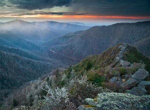
Myrtle Point via Alum Cave
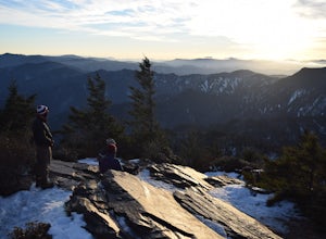
5.015.43 mi / 3100 ft gainThis hike can be started at the Alum Cave trailhead or the Boulevard Trailhead. For this particular adventure, the starting point is Alum Cave. If you're lucky enough to stay the night at the backcountry shelter on top of Mt. LeConte, (add 0.2 miles if coming from the Lodge), head east on the Bou...Read more -
Micaville, North Carolina
Crabtree Falls
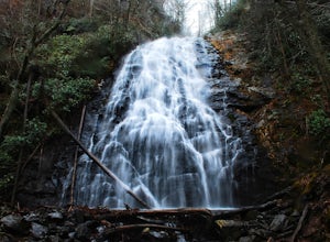
4.92.83 mi / 525 ft gainStarting from the old store parking area at MP 339.5 on the Blue Ridge Parkway, follow the trail through a meadow past the campground amphitheater. After crossing the paved road to the campground, the trail will come to a T-intersection. Take the trail to the right for the shortest way to the fal...Read more -
Canton, North Carolina
Sam Knob and Flat Laurel Creek Loop
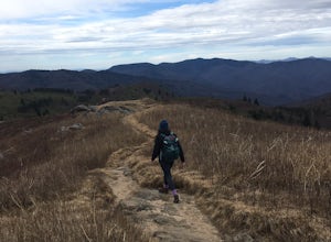
4.93.84 mi / 807 ft gainThis is one of my favorite quick "getaway" loops in the Pisgah Ranger District. Turn onto Black Balsam Knob Road (Mile Marker 420 on the Blue Ridge Parkway) go until you reach a dead end and park at the parking lot. You'll see the Sam Knob trail to the right of the public bathrooms. From there, i...Read more -
Canton, North Carolina
Tennent Mountain
5.03 mi / 285 ft gainPark at the Lot at the end of Black Balsam road, and start your morning in the dark, down the old dirt road at the end of the lot. Take this road until you get to Ivestor Gap and make a right onto the Art Loeb, try and time it so the sun is just about to rise here. Hike or trail run The Art Loeb ...Read more -
35.629385,-83.450994
Camp out at Mt. LeConte Lodge via Alum Cave
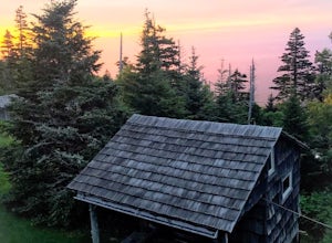
5.09.96 miAt the summit of Mt. LeConte in the Great Smoky Mountains National Park, the lodge sits at a elevation of 6400 feet. It is the only "accommodations" inside the park boundaries. It is the highest lodge in the eastern United States. Accessible only by hiking one of the five trails to the summit,...Read more -
Gatlinburg, Tennessee
Mt. LeConte via Alum Cave Bluff
5.010.68 mi / 3982 ft gainThe Alum Cave trailhead is on Newfound Gap Road, 8 miles from the Sugarlands Visitor Center. Mt. LeConte is the third highest peak in the Smokies, and this is an extremely popular hike, so arrive early to get a parking spot and beat the crowds. Starting from the parking lot the trail gently wind...Read more -
Canton, North Carolina
Skinny Dip Falls
4.81.03 mi / 148 ft gainPark at the Looking Glass Rock Overlook. After enjoying the view of Looking Glass Rock, gear up and head to the right side of the parking area (right side if your back is to the overlook). On the opposite side of the road you'll see a mile marker and a little trail to the left of the marker. Foll...Read more -
Fairview, North Carolina
Hike the Trombatore Trail to Blue Ridge Pastures
5.05 mi / 1350 ft gainPark along the road at Bearwallow Gap - this is also the parking area for Bearwallow Mountain. Starting at a little over 3600ft, the Trombatore Trail has been well marked by the Carolina Mountain Land Conservancy with red blazes. Parts of the trail border private land, so pay attention to the sig...Read more -
Hendersonville, North Carolina
Hike to the Top of Bearwallow Mountain
5.02 mi / 583 ft gainOnce you have parked along the roadside near the trailhead, pass through the big gate on the right side of the road and take the trail off to the right. The trail winds up the mountain for a mile before it empties out onto the bald atop Bearwallow. Once on the bald, you can follow the gravel road...Read more -
Canton, North Carolina
Explore Lower Falls at Graveyard Fields
4.3Graveyard Fields got it's name years ago from wind-thrown tree trunks that gave the appearance of a graveyard, until 1925 when an intense fire swept through the area, destroying the stumps. The forest has been recovering ever since.The parking area for Graveyard Fields is located at milepost 418....Read more -
Haywood County, North Carolina
Black Balsam Knob via Art Loeb Trail
5.01.56 mi / 305 ft gainThe parking area for Black Balsam Knob is at mile marker 420.2 on the Blue Ridge Parkway. It's free to hike here. Take the Art Loeb Trail a half mile until you reach the knob. Along the way you will be walking almost entirely on the bald which is a very pleasant experience. You feel like you're ...Read more -
Gatlinburg, Tennessee
Mount LeConte-Cliff Tops via Rainbow Falls Trail
4.513.37 mi / 3993 ft gainBegin at the Rainbow Falls trail parking lot. This is very popular area especially in the summer. If the parking area at the trail head is full there is additional parking located just past the main lot. From here the Rainbow Falls trail is just under 14 miles to the summit of Mount Leconte. Elev...Read more -
35.675929,-83.485764
Roaring Fork Motor Nature Trail
5.05.83 miThis 6 mile drive is a great way to spend a scenic day in the Smokies. The road is open to cars only (no trucks or RVs) and runs one-way. There are no visitors centers after you head out, so be sure to bring everything you need along. The drive begins at the historic Ogle farmstead, which is als...Read more -
Gatlinburg, Tennessee
Hike the Chimney Tops
4.94.03 mi / 1487 ft gainThe Chimney Tops Trail is one of the most visited trails in the Smokies, which is why I recommend going up just before sunset to beat the crowd! During the summer and fall months, it's common to see a hundred people taking in the views on the same trail, but if you scramble on out after hours, y...Read more -
Johnson City, Tennessee
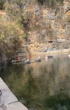
Gray Quarry
5.0Gray Quarry is a perfect destination for scuba diving in TN! The quarry is about 70 feet deep with ~3 acres of clear water. They have sunk a plane, bus, truck, firetruck, boat, seedoos, and more to the bottom. There is also a large variety of aquatic animals in the quarry. This is an awesome, loc...Read more -
Brevard, North Carolina
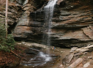
Moore Cove Falls
4.31.28 mi / 223 ft gainThe hike relatively quick and has minimal elevation gain, making it a great hike for the family or a quick stop off if you're planning to do another hike in the same day. This part of the Pisgah National Forest is filled with scenic hikes. Once you've parked your car, cross over the stream via a...Read more

