Hiddenite, North Carolina
Looking for the best photography in Hiddenite? We've got you covered with the top trails, trips, hiking, backpacking, camping and more around Hiddenite. The detailed guides, photos, and reviews are all submitted by the Outbound community.
Top Photography Spots in and near Hiddenite
-
Catawba, North Carolina
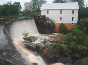
Visit Murray's Mill
4.5The Murray's Mill Historic District features Murray's Mill (constructed in 1913) with its 28 ft. waterwheel, a general store constructed in the 1890's, Wheathouse Exhibit gallery, and the John Murray House. Free and open to the public to visit, this is a great place to stop and stretch your legs...Read more -
Hays, North Carolina
Hike along Basin Creek in Doughton Park
5.011 mi / 1800 ft gainA treasure in North Carolina that doesn't get as much attention as it should, Doughton Park has some of the best trails around. It is the largest park operated by the Blue Ridge Parkway and has over 30 miles of trails available. The parking area for the Basin Creek Trail is small, but rarely cro...Read more -
Traphill, North Carolina
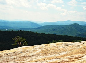
Hike the Stone Mountain Loop
4.5This is a strenuous 4.5 mile hike beginning from the Lower Parking Lot in Stone Mountain State Park (for a 5.2 mile hike, begin at the Upper Parking Lot). From the lot, take the trail by the bathroom. Keep right at the first trail intersection, then left at the second trail intersection to stay ...Read more -
Traphill, North Carolina
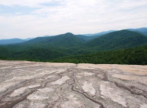
Hike to Wolf Rock and Cedar Rock
5.0This easy 3.0 mile hike begins at the Lower Trailhead Parking Lot at Stone Mountain State Park and includes a 400' ascent to two granite outcrops with nice views. This hike can be combined with the Stone Mountain Loop hike for a 6.5 mile strenuous hike.From the parking lot, walk towards the strea...Read more -
Connelly Springs, North Carolina
Chestnut Knob via River Trail
4.05.9 mi / 1115 ft gainThe journey begins at the Cicero Branch Parking Area along South Mountain Road, following Jacob Fork River Trail. The trail runs along the Fork before ascending Chestnut Knob. After completing the trail, you will find yourself on the highest peak of the South Mountain chain, where there are breat...Read more -
Sparta, North Carolina
Hike the Bluff Mountain Trail
1.8 mi / 270 ft gainBefore you head out, check the status of the Blue Ridge Parkway (it periodically closes during the winter). The entire Bluff Mountain Trail is a 7.1 mile trail that traverses the Doughton Park Area along the Blue Ridge Parkway. To do this particular hike, park at the bathrooms in the Doughton P...Read more -
Blowing Rock, North Carolina
Camp and Paddle at Price Lake
This campground is all kinds of amazing, and if you get one of the sites in the A loop, you will have lakefront property (just be warned, if I see you there, I'll have to crash with you ;-). Price Lake is a gorgeous lake right off the Blue Ridge Parkway in North Carolina and perfect for canoeing...Read more -
Banner Elk, North Carolina
Explore Boone Fork Creek
0.25 mi / 75 ft gainBoone Fork Bridge and creek is situated at the base of Grandfather Mountain, on the Blue Ridge Parkway, milepost 299.9. Elevation 3905'.The trailhead is at the left side of Boone Fork Creek parking area and the trail is a gentle meander through Rhododendrons and a hardwood forest.As you head tow...Read more -
Linville, North Carolina
Rough Ridge Lookout
4.30.5 mi / 92 ft gainThe trailhead for Rough Ridge will be on your righthand side when driving the Blue Ridge Parkway from Boone, NC. This trail gets busy in the warmer months, but parking usually is not too much of an issue. This trail is not open in the winter. Rough Ridge will take you around 30-45 minutes to rea...Read more -
Morganton, North Carolina
Hike to Hawksbill Mountain
5.02.1 mi / 660 ft gainStarting at the Hawksbill Mountain Trailhead, which is clearly marked start hiking up! The trail starts out with some easy uphill switchbacks and leads you to the first lookout point. Enjoy sometime at the lookout point, but you'll want to keep going for a more incredible view. Keep hiking uphill...Read more -
Newland, North Carolina
Beacon Heights Overlook
5.00.71 mi / 105 ft gainBeacon Heights is the perfect hike when you're on the Blue Ridge Parkway near Linville and Grandfather Mountain, Milepost 305.2. The trail is a steady climb uphill for less than a half mile. The last section being fairly steep and rocky. Once at the top, there are several rock outcroppings, but...Read more -
Linville, North Carolina
Rough Ridge via the Tanawha Trail from Beacon Heights
5.07.49 mi / 1280 ft gainIf you're feeling frisky, set your alarm for the early am and park at the Beacon Heights Parking area about 30 minutes before dawn. Put on your head lamp and hike the short trip to Beacon Heights, bask in the glory of the warm morning sun, then head back down and connect with the Tanawha Trail. A...Read more -
Linville, North Carolina
Profile Trail to Calloway Peak
5.06.2 mi / 2300 ft gainIf you're looking for a challenge and hoping to escape the crowds at Grandfather Mountain, this is the hike for you. Climbing up the back side of the mountain (opposite the famed mile-high swinging bridge) this trail is fee-free and easy-to-access with its own parking lot. The trail, marked w...Read more -
Linville, North Carolina
Hike the Flat Rock Trail (NC)
5.00.6 miFlat Rock Trail is located off the Blue Ridge Parkway at milepost 308. There is a pull-off from the Parkway with a sign designating the location. There are several picnic tables around the pull-off, but I would recommend taking your lunch up to Flat Rock. The wide, clear trail is practically flat...Read more -
Morganton, North Carolina
Hawksbill Mountain Trail
4.91.87 mi / 633 ft gainHidden far above the beautiful Linville Gorge stands Hawksbill Mountain, among many other fantastic hikes. The roughly 1.7 mile hike from the dusty gravel parking lot is steep but worth every step. It took me about an hour to conquer with a few water bottle-guzzling stops. At the top, you are al...Read more -
Morganton, North Carolina
Photograph Hawksbill Mountain at Sunrise or Sunset
5.01.5 mi / 860 ft gainThe trail to the summit of Hawksbill begins on an unpaved road for the Pigsah National Forest. In about a half a mile the trail turns left just before reaching the Jonas Ridge Trail. This turn is an clearly marked turn with a sign for "Hawksbill Summit". The trail then becomes steeper and rocki...Read more

