Hendersonville, North Carolina
Looking for the best hiking in Hendersonville? We've got you covered with the top trails, trips, hiking, backpacking, camping and more around Hendersonville. The detailed guides, photos, and reviews are all submitted by the Outbound community.
Top Hiking Spots in and near Hendersonville
-
Del Rio, Tennessee
Max Patch to Hot Springs, N.C. via Appalachian Trail
3.014.06 mi / 2966 ft gainMake a weekend trip from Max Patch to Hot Springs N.C., and be sure to soak in the natural hot springs at the old inn after your hike! This is an incredible, relatively easy hike with the reward at the end being hot springs on the French Broad River. You can break this up however you like, this i...Read more -
Nebo, North Carolina
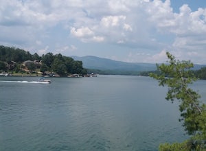
Explore Lake James State Park
The park has about 15 miles of trails with different levels of difficulties . Hiked the Lake Channel Trail along the lake with good views of the lake and the Blue Ridge Mountains. Hiked the Mill's creek trail which is nicely shaded and offers good views of the lake and the Linville Gorge area. ...Read more -
Mountain Rest, South Carolina
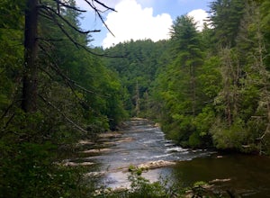
Hike to Big Bend Falls
5.06.5 miThe hike to Big Bend Falls begins on the Chattooga River Trail at the Burrell's Ford Campground. To get here you take Burrell's Ford Road off of SC 107. There will be a good sized gravel parking area off to the left about 3 miles down Burrell's Ford Road. When you park the car you can walk down t...Read more -
138 Silver Mine Road, North Carolina
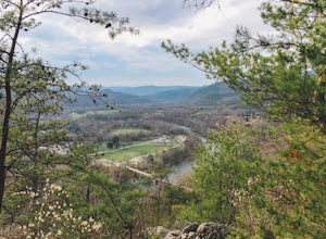
Hike the Lovers Leap Loop Trail
5.01.8 mi / 472 ft gainLovers Leap Loop trail is a 1.8 mile loop in Hot Springs, NC. The address of the trailhead is 138 Silver Mine Rd, Hot Springs, NC 28743. Once you arrive at the parking lot, you will see a trail leading up into the mountain with a post next to it. This is where you want to begin. It is part of the...Read more -
Bureau of Indian Affairs Highway 506, North Carolina
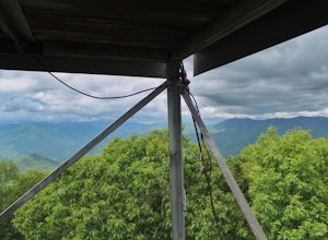
Barrett Knob Fire Tower
5.01.21 mi / 400 ft gainYour hike will start at the base of the Blue Ridge Parkway just a few miles from the start in Cherokee. The trail starts right off of the parkway in a very small easy to miss dirt road. There is a small area to park that then you start your hike up the dirt road right after the gate. The hike to ...Read more -
Tamassee, South Carolina
Hike to Lee Falls
4.01.6 miThe Hike: Head out through the middle of the first of three fields, crossing creeks two times as you come to them. At the end of the last field, the trail enters the woods. Hike through the woods for 0.3 mile and take the left fork, crossing a creek , and head toward the larger branch of Tamassee...Read more -
Morganton, North Carolina
Camp on Shortoff Mountain in the Linville Gorge
5.0The Linville Gorge Wilderness Area, also known as the Grand Canyon of the East, is one of the wildest, most rugged gorges in the eastern United States. It's also an outdoor paradise for hikers and backpackers. Camping here is always a treat and you are sure to enjoy your time spent in the gorge.D...Read more -
Newport, North Carolina
Hike to Mt. Sterling's Fire Tower
4.012 mi / 4200 ft gainOn your way in, stop at the ranger station parking lot to use the outhouses and grab a map for $1. Once at the Baxter Creek trailhead you have two options: 1. The Out and Back (12.2 miles) 2. The Loop (17 miles)Out and Back: Start on the Baxter Creek Trail and continue up for 6.1 miles until you...Read more -
Newport, North Carolina
Hike to Mouse Creek Falls
5.04.2 mi / 605 ft gainFollow Big Creek Trail on a moderate climb to this 45-foot waterfall. Around 1.3 miles in, you will begin to hike alongside Big Creek, and shortly afterwards you will pass Midnight Hole, a particularly deep pool. There are a number of other small falls en route. In spring you should see a number ...Read more -
Highlands, North Carolina
Explore Dry Falls, North Carolina
4.60.42 mi / 95 ft gainDry Falls is located off of Hwy. 64, which has been designated as the Mountain Waters Scenic Byway, and the road does not disappoint. Hwy. 64 is a two lane road which hugs the northern side of Cullasaja Gorge, which has been carved by the Cullasaja River. Besides Dry Falls, Hwy. 64 leads you past...Read more -
Linville, North Carolina
Shortoff Mountain Summit
4.84.64 mi / 1178 ft gainStart your hike from the Shortoff Mountain Trail off of Wolf Pit Road at the base of Lake James. From the summit there is a small grassy area off a side trail that provided awesome cliff side views of the Gorge and Linville River! You can setup after making the hour and a half trek (maybe just in...Read more -
Highlands, North Carolina
Explore Cullasaja Falls
5.00.3 mi / 200 ft gainThis is an awesome waterfall that offers views from several different spots along the road as well as a quick hike down to the base! The small pull-off area is located towards the top of the falls. There isn't much space (3 maybe 4 cars at a time), but there are additional pull-off areas further ...Read more -
Marion, North Carolina
Hike the Rock Jock Trail
6 mi / 700 ft gainOne of the first things I noticed when researching this hike was the conflicting information regarding finding the trail head, length of the hike, and the hike's correct route. Hopefully, as of September 2017, this report will contain the most up-to-date information currently available. To find t...Read more -
Cherokee, North Carolina
Mingo Falls
4.20.22 mi / 148 ft gainAlthough it is not much of a hike at just 0.3 miles, it is accessible to people of all fitness levels. A climb up a series of stairs leads you to a trail overlooking Mingo creek. You will then find a 20 foot wide bridge which serves as the viewing platform of the falls. If you care to advent...Read more -
Sylva, North Carolina
Hike to Cowee Bald Fire Tower
4.4 mi / 400 ft gainThe Cowee Bald Fire Tower is located in the Nantahala National Forest near Bryson City North Carolina. To get there you can either drive almost all the way to the top about .2 miles from the top but to get there you will need to have a 4WD or a higher clearance vehicle to cross a small stream. Ho...Read more -
Pelzer, South Carolina
Interpretive Jo Peeler Nature Trail
3.70.74 mi / 151 ft gainThere are three loop trail options at this 65-acre park, all beginning at the kiosk. The interpretive Jo Peeler Nature Trail is an easy 0.6 mile tour of the park, while the white trail is rated as a medium length hike, and the blue trail as long. Leashed dogs are permitted at the park.Read more

