Hays, North Carolina
Top Spots in and near Hays
-
Linville, North Carolina
Profile Trail to Calloway Peak
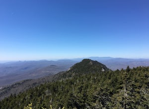
5.06.2 mi / 2300 ft gainIf you're looking for a challenge and hoping to escape the crowds at Grandfather Mountain, this is the hike for you. Climbing up the back side of the mountain (opposite the famed mile-high swinging bridge) this trail is fee-free and easy-to-access with its own parking lot. The trail, marked w...Read more -
Seven Devils, North Carolina
Calloway Peak via Profile Trail
7.11 mi / 2493 ft gainCalloway Peak via Profile Trail is an out-and-back trail with waterfall views located near Banner Elk, North Carolina in Grandfather Mountain State Park.Read more -
Newland, North Carolina
Beacon Heights Overlook
5.00.71 mi / 105 ft gainBeacon Heights is the perfect hike when you're on the Blue Ridge Parkway near Linville and Grandfather Mountain, Milepost 305.2. The trail is a steady climb uphill for less than a half mile. The last section being fairly steep and rocky. Once at the top, there are several rock outcroppings, but...Read more -
Linville, North Carolina
Rough Ridge via the Tanawha Trail from Beacon Heights
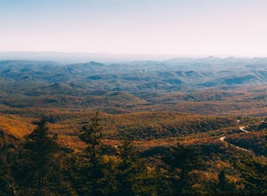
5.07.49 mi / 1280 ft gainIf you're feeling frisky, set your alarm for the early am and park at the Beacon Heights Parking area about 30 minutes before dawn. Put on your head lamp and hike the short trip to Beacon Heights, bask in the glory of the warm morning sun, then head back down and connect with the Tanawha Trail. A...Read more -
Statesville, North Carolina
Hike the Lake Shore Trail at Lake Norman
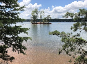
4.45 mi / 75 ft gainFrom the Cove Picnic area in Lake Norman State Park, you immediately begin hiking along the lakeshore. If you don't want to take the full lake loop, use Short Turn Trail for a 2.5 mile hike. This trail makes for a moderate hike or solid trail run route.Read more -
Collettsville, North Carolina
South Harper Creek Falls
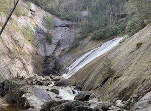
5.03.46 mi / 564 ft gainSouth Harper Creek Falls is an out-and-back trail that takes you by a waterfall located near Collettsville, North Carolina.Read more -
Linville, North Carolina
Hike the Flat Rock Trail (NC)
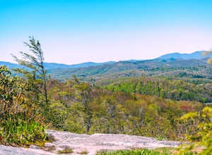
5.00.6 miFlat Rock Trail is located off the Blue Ridge Parkway at milepost 308. There is a pull-off from the Parkway with a sign designating the location. There are several picnic tables around the pull-off, but I would recommend taking your lunch up to Flat Rock. The wide, clear trail is practically flat...Read more -
Wytheville, Virginia
Hike the High Rock Trail
3.02.7 mi / 636 ft gainThe hike to High Rocks begins at a gravel parking lot up a long winding road, seems like forever but really is only mile or two past the quarry when your turn onto the road. The out-and-back hike begins by passing through the two large boulders near the back of the parking lot. The trail leads d...Read more -
Shady Valley, Tennessee
Explore Backbone Rock and Falls
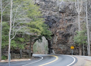
4.7First, from the parking lot, there is a trail which climbs up to walk on top of the rock. The top of the rock is narrow, but has hand rails to hold on to. Once finished walking on top of the rock, cross the road (be extremely careful) and walk away from the tunnel. Here is a good angle to take a...Read more -
Damascus, Virginia
Bike the Virginia Creeper Trail
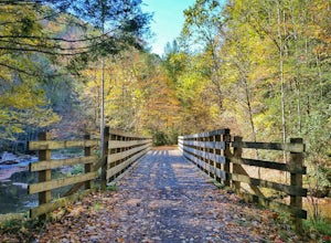
5.017 miThis multi-use (hiking, biking, horseback riding) rail-trail stretches 34 miles from Abingdon, Virginia to Whitetop, Virginia, passing through forests in the Blue Ridge Mountains, small farming communities in the countryside, and small historic towns.While you can pick up the trail at any point, ...Read more -
Walnut Cove, North Carolina
Hike the Sauratown Trail
22 mi / 800 ft gainYou can through-hike or section hike. I did it from Tory's Den to the Corridor Trail Parking Lot in about 10 hours. Check the Sauratown Trail Association's website before traveling. It is a bridle and hiking trail so the hiking is fairly easy. A lot of it travels beside streams. In other places...Read more -
Walnut Cove, North Carolina
Hike and Rock Climb Moore's Knob
4.3Looking for a shorter hike with stunning views, or a place to rappel with a backdrop like no other on the East Coast? Look no further than Moore's Knob, located within Hanging Rock State Park. Just North of Winston-Salem, Moore's Knob is one of the many wonders of the Sauratown Mountains. At 2579...Read more -
Elk Park, North Carolina
Elk River Falls
4.60.35 mi / 62 ft gainThe coordinates for the parking area are 36.198288, -81.970137. You'll see a parking area that's dirt/gravel on the right side of the road. At the far end of the parking lot is a sign that says Elk River Falls with an arrow pointing up the hill. From this point its about a .2 mile long walk to th...Read more -
Danbury, North Carolina
Hanging Rock
4.42.45 mi / 515 ft gainPark in the main parking lot for Hanging Rock State Park, and the trailhead can easily be found in the upper parking lot (furthest away from the main building), and is clearly marked. The trail starts off by descending, but don't be fooled, it quickly turns into a steady climb that will have you ...Read more -
Danbury, North Carolina
Hanging Rock and Cole Gap Mountain Loop
4.53.95 mi / 623 ft gainBeautiful hike through the forest up to an elevation of 2000+ feet for Hanging Rock. The Hanging Rock Trail is 1.3 miles one way. It includes a moderate incline up a well-kept dirt and gravel trail then, turns into steps made of timber, rock, and boulders (330 steps to be more exact!). Well worth...Read more -
Morganton, North Carolina
Hawksbill Mountain Trail
4.91.87 mi / 633 ft gainHidden far above the beautiful Linville Gorge stands Hawksbill Mountain, among many other fantastic hikes. The roughly 1.7 mile hike from the dusty gravel parking lot is steep but worth every step. It took me about an hour to conquer with a few water bottle-guzzling stops. At the top, you are al...Read more

