Frank, North Carolina
Top Spots in and near Frank
-
Shady Valley, Tennessee
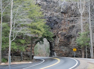
Explore Backbone Rock and Falls
4.7First, from the parking lot, there is a trail which climbs up to walk on top of the rock. The top of the rock is narrow, but has hand rails to hold on to. Once finished walking on top of the rock, cross the road (be extremely careful) and walk away from the tunnel. Here is a good angle to take a...Read more -
Connelly Springs, North Carolina
Sawtooth Campground via Chestnut Knob Trail
5.06.18 mi / 1299 ft gainThis 6.2-mile total trip will take you through the highlights of South Mountains State Park with an overnight stay in one of the drier campsites. OPTIONAL: You can get a warm-up in by starting with a 2.5-mile loop to High Shoal Falls that you can do without packs before picking up with a 3-mile...Read more -
Connelly Springs, North Carolina
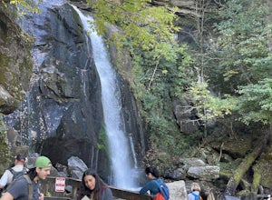
High Shoals Falls
4.62.47 mi / 617 ft gainFrom the Jacob Fork parking area in South Mountains State Park, it is a short 1 mile walk over the Jacob River to the High Shoals Waterfall (80'). If you choose to continue past the observation deck, High Shoals Falls Trail (blue circle) climbs up above the waterfall, crossing the river. Keep rig...Read more -
Connelly Springs, North Carolina
High Shoals Waterfall and H.Q. Loop Trail
4.83 mi / 1043 ft gainHigh Shoals Waterfall and H.Q. Loop Trail is a loop trail that takes you by a waterfall located near Connelly Springs, North Carolina.Read more -
Connelly Springs, North Carolina
Chestnut Knob via River Trail
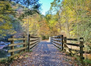
4.05.9 mi / 1115 ft gainThe journey begins at the Cicero Branch Parking Area along South Mountain Road, following Jacob Fork River Trail. The trail runs along the Fork before ascending Chestnut Knob. After completing the trail, you will find yourself on the highest peak of the South Mountain chain, where there are breat...Read more -
Marshall, Tennessee
Appalachian Trail: Jones Meadow to Jerry Cabin Shelter
7.58 mi / 909 ft gainAppalachian Trail: Jones Meadow to Jerry Cabin Shelter is an out-and-back trail that provides a good opportunity to view wildlife located near Greeneville, Tennessee.Read more -
Colonial Heights, Tennessee
Kayak Patrick Henry Reservoir
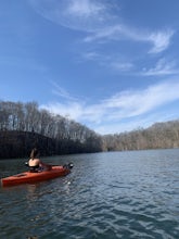
5.0Patrick Henry Reservoir in Warriors Path State Park is a great location for kayaking, canoeing and stand up paddling. The reservoir is not always very clean, but it can still be very beautiful when you're on the water. In the Summer and Fall, the trees are beautiful to view. There is also a small...Read more -
Greeneville, Tennessee
Hike to Margarette Falls
5.02.7 mi / 715 ft gainTo reach the trail head, take exit number 39 to Erwin/Jonesborough and turn onto State Route 81/107 west and stay on this for 6.5 miles. Then you will turn left to stay on Route 107 and continue on for 16 more miles. Then you will take a left on Route 351 and drive 4.5 miles. Then you will take a...Read more -
Damascus, Virginia
Bike the Virginia Creeper Trail
5.017 miThis multi-use (hiking, biking, horseback riding) rail-trail stretches 34 miles from Abingdon, Virginia to Whitetop, Virginia, passing through forests in the Blue Ridge Mountains, small farming communities in the countryside, and small historic towns.While you can pick up the trail at any point, ...Read more -
Hickory, North Carolina
Geitner Rotary Park Loop
5.02.65 mi / 354 ft gainGeitner Rotary Park Loop is a loop trail that takes you by a lake located near Hickory, North Carolina.Read more -
Asheville, North Carolina
Photograph Haw Creek Valley Overlook
The Haw Creek Valley Overlook is only 8 miles from downtown Asheville. If you're in the downtown area, it's a rather easy place to zip on over to if you're in need of some time away from urban life. This overlook is a hot spot for sunset watching and picture taking. If you plan on seeing what th...Read more -
Kingsport, Tennessee
Kingsport Greenbelt
5.09.1 mi / 308 ft gainKingsport Greenbelt is a point-to-point trail that takes you by a river located near Kingsport, Tennessee.Read more -
Black Mountain, North Carolina
Eagle Rock
0.7 mi / 151 ft gainEagle Rock is located in Chimney Rock State Park and is a hot spot for climbers and hikers! The hike to the overlook at Eagle Rock is 0.4 miles, and it's one of the most bang-for-your-buck trails in the area. We love to picnic out on the rock as it's in the sun most of the day. If you decide to...Read more -
Lake Lure, North Carolina
Hike to Party Rock
4.52.4 mi / 1549 ft gainThis hike is a strenuous 2.4 miles that takes about 1.5 hours to complete. The trail is not maintained--it is an old logging road--so there are lots of loose rocks and you frequently have to hop over the washout/creek. However, the difficulty on the way up is extremely rewarding at the top!The tr...Read more -
Asheville, North Carolina
Relax at Martin Luther King Jr Park
The Martin Luther King Jr Park includes a large multi-purpose field as well as a playground that's great for kids. It's the perfect place to go solo to clear your head and chill with a book or with family and friends for an outdoor game. Right at the entrance to the Park stands a statue of Mart...Read more -
Lake Lure, North Carolina
Boulder at Rumbling Bald
4.51.5 miLocated off of Boys Camp Rd. in Lake Lure, North Carolina, Rumbling Bald is a huge boulder yard that has been in use since the 1970's and has begun to flourish. Conveniently at the trail head is a gravel parking lot with three Port A Johns to use. Make sure you get to the parking lot early thou...Read more

