Frank, North Carolina
Top Spots in and near Frank
-
Bluff City, Tennessee
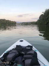
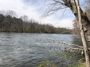
Kayak or SUP the South Fork
5.0There is a mud parking area on Lakeview Drive underneath the 11E bridges with a cleared mud parking area with access to the the South Fork of the Holston River. There is a gradual drop to the water where kayaks, canoes, or SUPs can be placed in the water. To the east, the river is more narrow at ...Read more -
Bristol, Tennessee
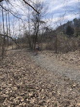
Emmett Trail
5.02.16 mi / 194 ft gainThe Emmett Trail is one of the TVA South Holston Tailwater Trails. This trail began as a footpath created by anglers. The trail now has gravel, which makes for easier access for families and pets. The trailhead begins on Piney Hill Road where it the traverses down to the waters edge and leads to ...Read more -
Johnson City, Tennessee
Kayak or SUP at Picken’s Bridge
5.0Picken's Bridge has a parking area and boat drop that is accessible to place kayaks or paddle boards. From the boat drop there is a large open area of the lake to paddle around and explore. Northwest from the boat drop there are some cliffs that can easily be climbed up to cliff jump. Please rem...Read more -
Bristol, Tennessee
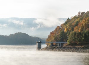
Explore the South Holston Dam
5.0Coming from US-421 turn off on Emmett Rd and keep left to get on Holston View Dam Rd and continue straight on this road by the river. There are parking spaces by the river below the dam and short easy trails to walk on next to the river. You’ll see fly fishers in the river below the dam on early ...Read more -
Bristol, Tennessee
Osceola Island Loop
5.01.52 mi / 95 ft gainThe Osceola Island Loop is a 1.50 mile gravel loop on an island in the South Holston River. There are multiple benches along the loop to stop and observe the wildlife. Fishing is a common activity along the edge of the trail. There is a large parking area and bathrooms at the start of the trail.Read more -
Bristol, Tennessee
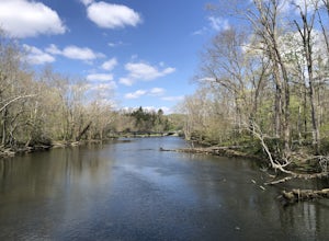
Tailwater Trail
5.00.95 mi / 30 ft gainThe TVA Tailwater Trail is a 0.5 mile trail along the east side of South Fork Holston River. The trail is dirt and ends in an incline. Along the edge of the river, there are views of the distant Holston Mountain. This trail provides access to the river for fishing. It is located near the Emmett T...Read more -
Black Mountain, North Carolina
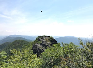
Craggy Pinnacle Trail
4.81.03 mi / 285 ft gainI usually spend the day visiting restaurants and breweries around Asheville. Before it gets late, so you can enjoy the views, head to the Blue Ridge Parkway located right outside the city. After about 30 minutes on the parkway, you will park at the Craggy Pinnacle parking lot Milepost 364.1. Fro...Read more -
Purlear, North Carolina
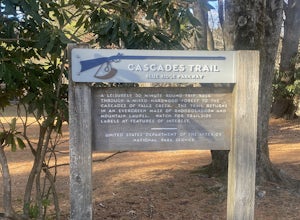
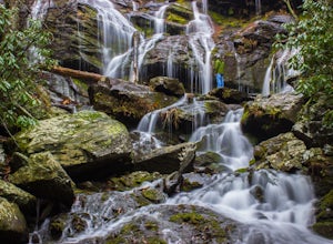
Cascades Trail
5.00.86 mi / 220 ft gainCascades Trail is an out-and-back trail that takes you by a waterfall located near Deep Gap, North Carolina.Read more -
Creston, North Carolina
Three Top Mountain
4.2 mi / 1260 ft gainThree Top Mountain sits within the same vicinity of Elk Knob. The mountain gets its name from its three prominent rock projections at its peak. The highest point, unofficially named “Big Rock”, is at an elevation of 5020 feet. Prior to the originally named rock peak, you will arrive at Huckleb...Read more -
Montreat, North Carolina
Hike Lookout Mountain, Montreat
5.01.1 mi / 623 ft gainNestled in the Blue Ridge Mountains is Montreat, North Carolina. Just down the road from Asheville, it neighbors Black Mountain and doesn't disappoint for views. Montreat itself houses a plethora of hiking trails, but the cream of the crop HAS to be Lookout Mountain. After a weekend of checking o...Read more -
Old Fort, North Carolina
Catawba Falls
4.82.19 mi / 394 ft gainPlease note, Catawba Falls is temporarily closed. You can learn more about updates at www.fs.usda.gov. This quick and relatively easy hike is located close to Asheville, NC. If you're looking to have the trail to yourself, it can be a little tough. It's best to get there as early as possible or ...Read more -
Johnson City, Tennessee
Gray Quarry
5.0Gray Quarry is a perfect destination for scuba diving in TN! The quarry is about 70 feet deep with ~3 acres of clear water. They have sunk a plane, bus, truck, firetruck, boat, seedoos, and more to the bottom. There is also a large variety of aquatic animals in the quarry. This is an awesome, loc...Read more -
Bristol, Tennessee
Lake Ridge Trail and Lakeside Trail
5.04.56 mi / 669 ft gainLake Ridge Trail and Lakeside Trail is a loop trail that takes you through a nice forest located near Bristol, Tennessee.Read more -
Bristol, Tennessee
Lake Ridge Trail to Cross Ridge Trail Loop
5.04.68 mi / 1368 ft gainLake Ridge Trail to Cross Ridge Trail Loop is a loop trail that takes you through a nice forest located near Bristol, Tennessee.Read more -
Bristol, Tennessee
Powerline Trail and Lakeside Trail Loop
4.03.77 mi / 797 ft gainPowerline Trail and Lakeside Trail Loop is a loop trail that takes you through a nice forest located near Bristol, Tennessee.Read more -
Purlear, North Carolina
The Lump Trail
4.00.27 mi / 82 ft gainThe Lump Trail is an out-and-back trail where you may see beautiful wildflowers located near Purlear, North Carolina.Read more

