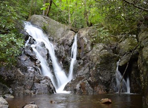
Frank, North Carolina
Looking for the best hiking in Frank? We've got you covered with the top trails, trips, hiking, backpacking, camping and more around Frank. The detailed guides, photos, and reviews are all submitted by the Outbound community.
Top Hiking Spots in and near Frank
-
Kingsport, Tennessee
Bay's Mountain Firetower
4.83.67 mi / 768 ft gainBay's Mountain Firetower overlooks the city of Kingsport, the South Fork Holston River, and the surrounding Tennessee mountains. Part of Bay's Mountain State Park, this is the most popular hike of the 25 miles of trails. The hike to the fire tower passes the Kingsport Reservoir which is essential...Read more -
Kingsport, Tennessee
Bays Mountain Reservoir Trail
5.02.8 mi / 469 ft gainBays Mountain Reservoir Trail is a loop trail that takes you by a lake located near Kingsport, Tennessee.Read more -
Kingsport, Tennessee
Bays Mountain Fire Tower Loop
5.04.79 mi / 879 ft gainBays Mountain Fire Tower Loop is a loop trail that takes you by a lake located near Kingsport, Tennessee.Read more -
Lake Lure, North Carolina
Hike to Hickory Nut Falls
5.02 mi / 200 ft gainThis waterfall is located inside of the Chimney Rock State Park. There is a fee of 15 dollars to go to the State Park but it is very worth it because of the beautiful scenery and beautiful views. The hike to the waterfall is partially uphill on the way. When you get to the waterfall there are a f...Read more -
Lake Lure, North Carolina
Exclamation Point and Skyline Trail to Hickory Nut Falls
5.02.98 mi / 1204 ft gainExclamation Point and Skyline Trail to Hickory Nut Falls is an out-and-back trail that takes you by a waterfall located near Chimney Rock, North Carolina.Read more -
Lake Lure, North Carolina
Explore Chimney Rock
4.00.5 miChimney rock is a beautiful slab of weather granite that is visible from miles around. To get to this hike you'll want to head to Lake Lure in North Carolina, a beautiful lake located in the mountains of western North Carolina. Follow the signs for Chimney Rock and take the switchback road up t...Read more -
Troutdale, Virginia
Hike the Appalachian Trail from Elk Garden to Buzzard Rock
5.06.6 mi / 1000 ft gainStarting at the Elk Garden Parking Area hike the Appalachian Trail south (do not cross the road, follow the trail from the parking area). Hike along the trail following the white blazes and at 2.4 miles you'll reach a campsite on your left. This is a great place to camp overnight if you decide to...Read more -
Fairview, North Carolina
Hike the Trombatore Trail to Blue Ridge Pastures
5.05 mi / 1350 ft gainPark along the road at Bearwallow Gap - this is also the parking area for Bearwallow Mountain. Starting at a little over 3600ft, the Trombatore Trail has been well marked by the Carolina Mountain Land Conservancy with red blazes. Parts of the trail border private land, so pay attention to the sig...Read more -
Hendersonville, North Carolina
Hike to the Top of Bearwallow Mountain
5.02 mi / 583 ft gainOnce you have parked along the roadside near the trailhead, pass through the big gate on the right side of the road and take the trail off to the right. The trail winds up the mountain for a mile before it empties out onto the bald atop Bearwallow. Once on the bald, you can follow the gravel road...Read more -
138 Silver Mine Road, North Carolina
Hike the Lovers Leap Loop Trail
5.01.8 mi / 472 ft gainLovers Leap Loop trail is a 1.8 mile loop in Hot Springs, NC. The address of the trailhead is 138 Silver Mine Rd, Hot Springs, NC 28743. Once you arrive at the parking lot, you will see a trail leading up into the mountain with a post next to it. This is where you want to begin. It is part of the...Read more -
Mouth of Wilson, Virginia
Twin Pinnacles Loop
5.01.35 mi / 157 ft gainPark at the Visitor Center; don't stress when you get to the parking lot and can't see it, it's up the hill. From the parking lot hike across the road and find the staircase. Follow this up to the Visitor Center. If you're standing in front of the Visitor Center, the trailhead will be to the left...Read more -
Mouth of Wilson, Virginia
Twin Pinnacles via Big Pinnacles Trail
5.02 mi / 525 ft gainTo reach the Big Pinnacle Trail Head, park at the Massie Gap Day Parking area, and then follow the road west (away from Massie Gap) until you reach the trail head located on the left side of the road. Follow the Big Pinnacles Trail for 0.4 miles until it intersects with the Twin Pinnacles Trail....Read more -
Mouth of Wilson, Virginia
Wilburn Ridge and Massie Gap Loop
5.02.32 mi / 318 ft gainTo reach the trail head, park in the Massie Gap Parking Lot. This is the parking lot for most of the trails in the park, so it can fill up very quickly, but you are able to park along the side of the road. Massie Gap as two parking areas: one intended for overnight hikers and one for day hikers...Read more -
Mouth of Wilson, Virginia
Rhododendron Trail to Rock Croppings
5.01.77 mi / 289 ft gainIn order to go when the Rhododendron are blooming you'll need to aim for the first three weeks of June. Starting from the Massies Gap parking area in the Grayson Highlands State Park, follow the trail through the field and towards the base of a large hill. You will see a fence that runs along t...Read more -
Mouth of Wilson, Virginia
Hike and Fish Cabin Creek Trail
5.01.8 mi / 400 ft gainStarting at the Massie Gap Parking Area follow the paved road down towards the woods. You will see a gravel dirt path off the side of the road to your right that heads back towards the woods. A couple steps down the trail you will see a metal pole with "Cabin Creek Trail" written on it. Follow th...Read more -
Mouth of Wilson, Virginia
Photograph Wild Horses at Grayson Highlands State Park
4.61.8 mi / 306 ft gainThe wild horses gather on top of the bald at the end of Horse Trail North located in Grayson Highlands State Park. Because they are wild, it is important to remember not to touch or feed the horses. The horses are accustomed to hikers and will allow you in their near proximity, but bring a zoom l...Read more


