Cullowhee, North Carolina
Top Spots in and near Cullowhee
-
Clyde, North Carolina
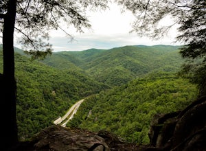
This is an awesome place to check out if you are driving Interstate 40 or if you are visiting the area for awhile. The access point for Buzzards Roost is located on the same exit as the well known Max Patch Mountain, just in the other direction.
Once off the exit, you will travel down a gravel Fo...
Read more
-
Clayton, Georgia
4.0
7.5 mi
/ 2378 ft gain
Black Rock Mountain State Park is Georgia's highest elevation State Park. It is adorned with several waterfalls, sweeping overlooks, blooming Rhododendron's, and plenty of miles of trail. The James E. Edmond trail is the longest and by far most challenging hike in the park. Its medium-long dis...
Read more
-
Cosby, Tennessee
Hidden in the eastern reaches of Great Smoky Mountains National Park, the Cosby region receives a fraction of the visitation of Gatlinburg or Cherokee. This section of the park preserves some of the best deciduous old-growth forest in the eastern United States. Individual tulip trees and eastern ...
Read more
-
Hendersonville, North Carolina
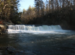
Hooker Falls is located in Dupont State Forest in southern North Carolina. The hike is a great hike for kids to go on and to have a picnic. The waterfall is a beautiful waterfall that offers a great place to swim. Along the hike there are also other places you can see the river and you can swim a...
Read more
-
Little River, North Carolina
4.5
2.38 mi
/ 502 ft gain
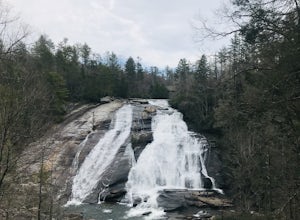
Both falls provide ample open, flat rock right up next to the massive falls where you can picnic, take photos, or just lounge in the sun and mist. There are signs saying so, but be sure to be careful near the waters edge below the falls - swimming is not allowed as the current can be very strong....
Read more
-
Gatlinburg, Tennessee
This loop offers a scenic 2.5 mile hike next to the river before looping back around via the Cucumber Gap Trail. At the tail end, you'll connect with the Jakes Creek Trail for about 0.7 miles to return you back to the parking lot.
Many people hike this trial clockwise, but if it's a hot day, it...
Read more
-
Sevier County, Tennessee
5.0
12.34 mi
/ 412 ft gain
The trailhead parking area is large but if no spaces are available additional parking can be had at the Jake's Creek trailhead at the top of the hill and to the right of the Little River trail parking lot. After parking, the trailhead itself will be to the left of the parking area. Parking Lot Co...
Read more
-
Clyde, North Carolina
The trailhead to this hike is easy to find but the gps is hard to match so it might try to take you through the middle of the trees but its easy to follow the road. The best way to get here is to go off of I-40 at the Harmon Den exit and then go up the road towards Max Patch. To get to the trailh...
Read more
-
Gatlinburg, Tennessee
You will find the trailhead to this gravel path just to the left of the Sugarlands Visitor Center. The easy walk along Fighting Creek is scenic and tends not to be crowded, either.
At the end of the hike you will find a beautiful 25-foot waterfall. Please refrain from climbing on or around the f...
Read more
-
-
Gatlinburg, Tennessee
4.0
4.54 mi
/ 879 ft gain
Twin Creeks Trail is an out-and-back trail that takes you by a river located near Gatlinburg, Tennessee.
Read more
-
Asheville, North Carolina
Lake Powhatan is located just minutes away from Asheville, NC and offers a number of fun activities for you, your friends, and your family. In the warm summer months, the Lake is a popular spot for swimming. The small stretch of beach along the lake is a nice place to lay out and soak in the sun....
Read more
-
Pickens, South Carolina
4.5
7.2 mi
/ 2433 ft gain
While the Piedmont Foothills may sound deceptive, this is no easy trail. The first two miles of the Table Rock Trail take you soaring through the trees at a rapid pace. The trail is extremely well kept, but harsh and tough. A little before the two mile marker is a wooden shelter which is a great ...
Read more
-
Pickens, South Carolina
5.0
76.2 mi
/ 11036 ft gain
Starting at Table Rock State Park (South Carolina) and working your 76.2 miles way towards Oconee State Park (South Carolina) is the most popular route, with a few spur trails that lead to places like Raven Cliff Falls in Cesar's Head State Park. The trail gains ~11,036 feet in elevation with ano...
Read more
-
Pickens, South Carolina
5.0
17.2 mi
/ 5041 ft gain
Pinnacle Trail begins by the Nature Center in Table Rock State Park. Keep left at the first three splits in the trail. You will make some creek crossings, gain elevation through the forest, and pass by Mills Creek Falls (25 ft).
At Bald Rock Overlook, you can catch some nice views of Table Rock M...
Read more
-
Cleveland, South Carolina
For Caesar's Head State Park access, head North from Pickens on HWY 178 until it intersects with HWY 11. Turn right onto HWY 11 North and continue for 10 miles until the 276 intersection where you veer off to the left. Follow 276 to the top of the mountain. 1 miles past the Caesars Head Visitors ...
Read more

