Bryson City, North Carolina
Looking for the best photography in Bryson City? We've got you covered with the top trails, trips, hiking, backpacking, camping and more around Bryson City. The detailed guides, photos, and reviews are all submitted by the Outbound community.
Top Photography Spots in and near Bryson City
-
Glenville, North Carolina
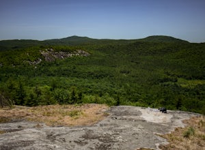
Hike to Blackrock Overlook
3 mi / 700 ft gainThis is probably one of my favorite hikes I've done in Panthertown Valley. Its also one of the easier views to access. You start from the Salt Rock Gap Parking lot, taking the Blackrock Trail (447) up Blackrock Mountain. This trail is located about 100 yards to the left if you are standing lookin...Read more -
Robbinsville, North Carolina
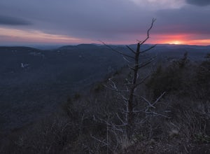
Hike the Big Fat Gap Trail
12 mi / 3000 ft gainThere are many trailheads leading into the wilderness on either the Tennessee or North Carolina side. My favorite is the Big Fat Gap trail on the North Carolina side at an elevation of 3,060'. To see the best of what this area has to offer take the Hangover Lead South Trail to the 5,180' Hangover...Read more -
Highlands, North Carolina
Hike the Whiteside Mountain Loop
5.02 mi / 595 ft gainWhiteside Mountain is simply breathtaking, there is no way around it. Views of the mountain from the South expose its sheer granite face, which runs almost its entire length East-to-West. However, the views of the mountain are just the beginning, as this hike climbs to higher heights than just ...Read more -
Joyce Kilmer-Slickrock Wilderness, North Carolina
Backpack Slickrock Creek Trail #42
30 mi / 3700 ft gain8:30 a.m. and we’re winding our way down Highway 129 near Robbinsville, NC. The fog is still thick over the Little Tennessee River as we slow down crossing the bridge into Graham County. “I think we missed it,” I say as we continue onward. Within minutes the Tapoco Lodge comes into view. My pre-h...Read more -
Tuckasegee, North Carolina
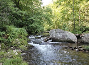
Hike to Dill Falls
0.4 mi / 400 ft gainThe drive to this waterfall can be a little muddy when there is a lot of rain and can need an AWD or 4WD in the rain. The road has some new gravel laid in parts so it could be improved in a few months. In the summer there is also a chance of seeing large dump trucks and logging trucks, but the ro...Read more -
Cashiers, North Carolina
Hike to Chimney Top
3.31.7 mi / 1000 ft gainUpon entering High Hampton Inn, follow the entrance road past the registration building, cart shed and parking lot. Take a right down a gravel road that follows alongside Hampton Lake. This gravel road continues for half a mile, even winding through part of the golf course and crossing over the c...Read more -
Tallassee, Tennessee
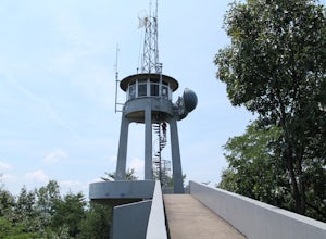
Hike to Look Rock Tower
5.01 mi / 300 ft gainLook Rock tower has spectacular views and is a great hike to enjoy year round. The tower is an old fire tower used for spotting smoke in the valley. Because of this the tower is placed on the highest ridge around making for some amazing views. The only way to get to the tower is along the Foothil...Read more -
Highlands, North Carolina
Explore Cashiers Sliding Rock
0.2 mi / 70 ft gainThis waterfall is located just outside of Cashiers, NC. The trailhead to the waterfall is right off of the road and has a good amount of parking. The trial itself is very nice and has new steps at the beginning of the trail. The trail is very wide and is mostly flat the entire way there. Once you...Read more -
Canton, North Carolina
Photograph Sunburst Falls
This waterfall is right off the side of the road on NC 215. NC 215 is straight off of the blue ridge parkway and is just north of Brevard. The waterfall has to main parts one that is above the road and one that is below. The part below the road is the most scenic and the easiest to walk too. The ...Read more -
Lake Santeetlah, North Carolina
Huckleberry Knob
4.81.77 mi / 295 ft gainHuckleberry Knob is the highest point in the Cheoah Ranger District at 5,560 feet, and it offers expansive views of the surrounding Cherokee and Natahala National Forest. The hike is 2.4 miles roundtrip and begins at the parking lot between mile 8 and 9 up an old dirt road. You will go up the di...Read more -
Clyde, North Carolina
Photograph the Smokies from Buzzards Roost
This is an awesome place to check out if you are driving Interstate 40 or if you are visiting the area for awhile. The access point for Buzzards Roost is located on the same exit as the well known Max Patch Mountain, just in the other direction. Once off the exit, you will travel down a gravel Fo...Read more -
Hartford, Tennessee
Whitewater Rafting the Pigeon River
5.0The Pigeon River is a dam controlled river that winds its way through North Carolina and Eastern Tennessee just outside Great Smoky Mountains National Park. The river provides beautiful views as one paddles along via raft or kayak. Cutting through portions of the Pisgah and Cherokee National For...Read more -
Highlands, North Carolina
Bouldering Granite City
5.00.3 mi / 96 ft gainAt the foot of Blackrock Mountain just outside of Highlands, North Carolina, lies one of the most unique and secluded natural playgrounds around. Granite City is composed of several massive granite boulders, ranging between 10-40 feet tall. This spot is most popular for bouldering (mostly V0-V2...Read more -
Balsam Grove, North Carolina
Devil's Courthouse
4.70.85 mi / 246 ft gainThe Devil's Courthouse Overlook and Trail can be one of the best places to see the entire Blue Ridge countryside. Even though it is a short hike, there is a fairly steep incline halfway through, so be prepared to huff and puff a little. It takes anywhere from 15 to 20 minutes depending upon your ...Read more -
Robbinsville, North Carolina
Hike Hooper Bald
1 mi / 250 ft gainHooper bald is one of the highest points in Graham County so the views from the top can be spectacular year round. The trail-head starts at mile marker 8 on the Cherohala Skyway. From the trail-head you start your accent on a semi-paved trail and walk about a half-mile before reaching the edge o...Read more -
Canton, North Carolina
Sam Knob and Flat Laurel Creek Loop
4.93.84 mi / 807 ft gainThis is one of my favorite quick "getaway" loops in the Pisgah Ranger District. Turn onto Black Balsam Knob Road (Mile Marker 420 on the Blue Ridge Parkway) go until you reach a dead end and park at the parking lot. You'll see the Sam Knob trail to the right of the public bathrooms. From there, i...Read more

