Warrensburg, New York
Top Spots in and near Warrensburg
-
Keene Valley, New York
Hike to Mount Colvin and Blake Peak
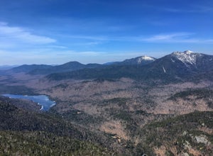
4.014.6 mi / 4000 ft gainMount Colvin and Blake Peak are located along the Colvin Range in the High Peaks Wilderness. Mount Colvin is number 39 on the 46er list, at 4,057 feet. Blake Peak is is number 43 on the list, at 3,960 feet, although new surveying methods discovered this summit just short of 4,000 feet, tradition ...Read more -
Salisbury, Vermont
Camp at Lake Dunmore
The campground office for Branbury state park is on the opposite side of Route 53 from the pin on the map here, but the best campsites are where the pin is. Start by going and talking to the rangers at the office, they are super friendly and very helpful for recommendations of hikes or things to...Read more -
Long Lake, New York
Buttermilk Falls
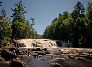
0.17 mi / 36 ft gainButtermilk Falls is an out-and-back trail that takes you by a waterfall located near Long Lake, New York.Read more -
Long Lake, New York
Camp along Section 2 of the Northern Forest Canoe Trail
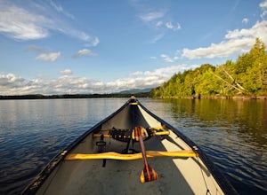
The Northern Forest Canoe Trail is a 740-mile paddling trail with the western terminus located in Old Forge, New York and the eastern terminus in Fort Kent, Main. Section Two is a 42.4 mile journey in the Adirondacks of New York from Long Lake to Saranac Lake. There are primitive campsites and ...Read more -
Long Lake, New York
Canoe from Long Lake to Tupper Lake in the Adirondacks
This is a 3-4 day adventure that begins with part of the Northern Forest Canoe Trail. Rent a canoe at a local outfitter and make arrangements for your vehicle shuttle. They will drive your car to the end point of the adventure. A couple of options include St. Regis Canoe Outfitters and Raquette...Read more -
Long Lake, New York
Hike to Owls Head Mountain Fire Tower in Sargent Ponds Wild Forest
5.06.2 mi / 1500 ft gainOwls Head Mountain is an Adirondack Fire Tower Mountain with an elevation of 2,812 feet. It is located in Long Lake in the Sargent Ponds Wild Forest and is a 6.2 mile out and back round trip hike. The trail head is located on Endion Ln, 2 miles north of the hamlet of Long Lake heading towards Tup...Read more -
Keene Valley, New York
Hike Rooster Comb Mountain
5.2 mi / 1795 ft gainTake in two unique views of the Adirondacks on one hike. Rooster Comb offers a great 5.2 mile round trip hike that gives you some unique vantage points. Starting from the parking lot you cross over a nice wooden bridge to the trail registry. Remember to sign in. Next you'll come up on a pond in w...Read more -
Keene Valley, New York
Climb Haystack, Basin & Saddleback
18 miThis hike starts in the Garden Parking Lot in Keene Valley, NY. The Garden parking lot (operated by the town of Keene) costs $7 per day from late April through the end of October (2014 rate). An attendant is on duty 1 p.m.-7 p.m. Fridays and 7 a.m.-7 p.m. Saturdays, Sundays, and holidays. Town e...Read more -
Lake Placid, New York
Hike Mount Marcy
4.713.94 mi / 3383 ft gainThe hike does offer several different terrains and an elevation gain of 3170 feet, which can make you feel like it's going to be a long day. There are four routes for summiting Mount Marcy. This is the most popular route and leaves from the Adirondack Loj. Once you hit the trail, you will head up...Read more -
Lake Placid, New York
Hike to Avalanche Pass
5.010.4 miStarting at the end of Adirondack Loj Road in the far right parking lot you will locate the trail register. After signing in you will follow the Van Hovenberg trail. At 1.0 mile you will reach a junction and turn left continuing an additional 1.3 miles to Marcy Dam. From here there are views o...Read more -
Lake Placid, New York
Hike Mt. Colden via the Trap Dike
4.014.5 mi / 2700 ft gainIn the summer, consider this hike for sunset, because what better way to hike one of the most beautiful trails in the Adirondack Mountains than by summiting at sunset and hiking back to your car under the stars? If you've rock climbed before or are simply comfortable with heights and high exposur...Read more -
Lake Placid, New York
Hike Wright, Algonquin, and Iroquois Mountains
5.0Although a bit strenuous this loop climb up the MacIntyre Range is one of the most beautiful climbs in all the High Peaks. I suggest that you travel past Marcy Dam to Avalanche Lake and ascend the range in that direction as the trail from Lake Colden up to the ridge is very steep and best climbed...Read more -
Lake Placid, New York
Hike Phelps and Tabletop Peaks
12.6 mi / 3300 ft gainThe Adirondack Loj is a BEAUTIFUL place to go to, even if you do not plan on hiking. Located just ten minutes outside of the famous Lake Placid, you do not want to miss visiting this alluring Loj in the woods.Starting from Lot number 1 from the Adk Loj, begin hiking the 2.1 miles to Marcy Dam. Th...Read more -
Lake Placid, New York
Hike Algonquin Peak
4.8Algonquin Peak, the second highest peak in New York, is one of the best hikes up in the Adirondack's. If you are looking for a challenging hike with views of the Adirondack park then this is a perfect hike.Starting at the Adirondack Loj, locate the trail head at the end of the parking lot. After ...Read more -
Lake Placid, New York
Hike to Mount Colden via Avalanche Pass
5.013.5 mi / 3300 ft gainMount Colden is number 11 on the list of 46ers, standing at 4,714 feet. There are a couple routes to Colden from the Loj. This route climbs through Avalanche Pass to Lake Colden and up the steep Lake Colden trail to the summit, and then descends through Lake Arnold, making this a nice 13.5 mile l...Read more -
Lake Placid, New York
Hike to the Summit of Phelps Mountains
3.08 mi / 2100 ft gainThe hike starts at Adirondack Loj in the High Peaks Information Center parking lot. From there, follow the signs for Phelps Mountain/Mt. Marcy. The trail to Phelps Mountain follows the Marcy trail for the first three miles.The first two miles to Marcy Dam are relatively flat, with the elevation g...Read more

