Queens, New York
Looking for the best photography in Queens? We've got you covered with the top trails, trips, hiking, backpacking, camping and more around Queens. The detailed guides, photos, and reviews are all submitted by the Outbound community.
Top Photography Spots in and near Queens
-
Cedar Grove, New Jersey
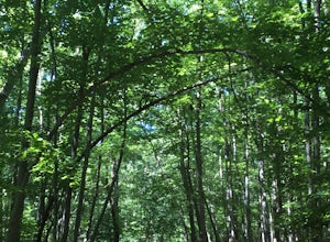
Hike at Mills Reservation
4.72 mi / 200 ft gainMills Reservation is over 150 acres of wooded area located off of Normal Ave. near the Cedar Grove reservoir. Parking space is limited due to the small size but there is another hidden lot towards the back if you make a right out of the parking lot and then the first right turn onto Highland Ave....Read more -
Paterson, New Jersey
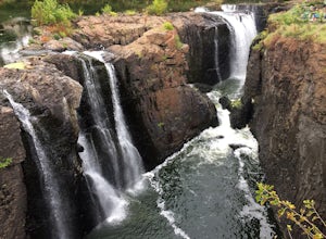
Explore the Great Falls of the Passaic River
3.2Getting to the Great Falls of the Passaic River is a relatively straight shot. It is located off exit 57B on Route 80 which is also accessible from highway 287. Parking is located on McBride Avenue across the street from the park's welcome center.Typically during autumn park rangers offer 45 to 1...Read more -
Stamford, Connecticut
Hike Cove Island Park Loop Trail
5.01.1 mi / 3 ft gainThis trail is accessible year round and features water views of the Long Island Sound with beach access. The trail is a popular spot for walking, biking, fishing, and even bird watching. But if you’re not quite in the mood to get your steps in, you can use the small beach to sit and chat with a f...Read more -
Gillette, New Jersey
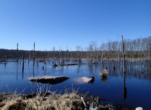
Great Swamp National Wildlife Refuge Loop
5.00.94 mi / 43 ft gainNestled within the more urban and suburban communities in Northern New Jersey, you can escape back to nature at Great Swamp National Wildlife Refuge. The name says it all - this place is the perfect opportunity to get up close to a variety of different wildlife that call this protected land home....Read more -
Kings Park, New York
Kayaking the Nissequogue River
5.0Starting on the banks of Nissequogue River State Park, this 6 mile journey makes you feel like you’re cruising down river in the south, when you’re really on Long Island. I really suggest going as high tide is rolling in as there can be some shallow sections along this trip. Head out into the ope...Read more -
Ringwood, New Jersey
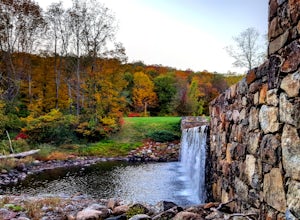
Explore Ringwood Manor State Park
5.01.3 miOn my way to the drive-in, I saw a sign for Ringwood Manor estate and wanted to adventure around. The parking is easy and the property was beautiful!As we walked through the estate, we found:a quaint tree foresta small cemetery with headstones hundreds of years olda river with a small waterfall ...Read more -
Rockaway, New Jersey
Hike the Timberbrook Pond - Riley's Rise Loop
5 mi / 500 ft gainThe trailhead parking is at the end of Timberbrook Road, before the road enters Camp Winnebago (Boy Scouts). I hiked this in a clockwise directions starting on the Timberbrook Trail (yellow markers). After about 1 mile the trail ends at a junction with the Four Birds Trail (white markers). Turn...Read more -
Jefferson, New Jersey
Thru Hike the Four Birds Trail
19 mi / 1200 ft gainThe Four Birds Trail is about 19 miles long and is a great thru hike or can be done in sections as out and back hikes or part of loop hikes with other trails. Starting from the north, the trail ascends gradually over easy terrain until you reach a cliff ridge. There are several good view points...Read more -
Pound Ridge, New York
Leatherman's Loop
1.25 mi / 1183 ft gainThis loop trail is moderately rated and reaches a total elevation gain of approximately 1,183 feet. It’s located in the Ward Pound Ridge Reservation, which spans roughly 4,315 acres. It is Westchester County’s largest park and includes roughly 35 plus miles of hiking trails to explore. The Ward...Read more -
89 Van Orden Road, New Jersey
Hike the Hank's Pond Loop
7 mi / 500 ft gainHank's Pond loop can be accessed from the south at the corner of Clinton road and Van Orden road or from the north, parking at the lot on Stephens road. I hiked from the south on this trip. Follow the wide trail known as Hank's East trail marked with white blazes. Soon you will reach a trail c...Read more -
West Milford, New Jersey
Hike the Terrace Pond North - South Loop
10.7 mi / 1200 ft gainFrom Warwick Road, parking at the northernmost road side parking area, cross the road, and the Terrace Pond North trail (marked with blue blazes) begins as a steady climb until you gain a ridge that offers some great views for several miles. Eventually, you'll reach a power line where you turn ri...Read more -
Point Pleasant, New Jersey
Kayak to Herring Island
Starting at the small beach at the end of Bay Blvd, paddle heading south. You will need to pass through the boat canal so keep an eye out for speeding boats. You're able to see the island from the starting point so you really don’t have to worry about getting lost. You will reach the island after...Read more -
Cortlandt, New York
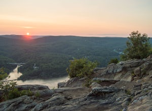
Hike the Camp Smith Trail
4.55.92 mi / 1759 ft gainThis approximately 3-hour hike borders the Hudson River, and is one of the best in Westchester County. Start off at the parking area at the Bear Mountain Tollhouse, or at a small parking area farther up Bear Mountain Road, if you want a slightly shorter hike. The trail is fairly steep in places, ...Read more -
Patchogue, New York
Fire Island's Watch Hill
4.02 miIf departing from NYC, catch the early LIRR train from Penn Station (or Atlantic Terminal) towards Patchogue. You may have to transfer at both Jamaica & Babylon, but it's an easy hop across the platform. Trip will take approximately an hour and a half and cost around $15, Off Peak, each way. ...Read more -
Bear Mountain, New York
Hike Bald Mountain, Bear Mountain State Park
4.76.8 mi / 1080 ft gainFrom your starting point at the Bear Mountain Inn, go left along the Cornell Mine Trail. (This part can be a bit confusing, but go past the carousel to a shaded picnic area; that is where the trail starts.) You will go under a bridge and follow the trail until it takes a sharp left and descends t...Read more -
Philipstown, New York
Anthony's Nose via Appalachian Trail
4.61.95 mi / 682 ft gainParking for the trail runs along both sides of 9D right up until the Bear Mountain Bridge. It can be busy on the weekends so just make sure you're as far off the road as you can and be especially careful unloading kids and dogs. The trailhead is located at approximately 41.322571, -73.975949 and ...Read more

