Pottersville, New York
Looking for the best hiking in Pottersville? We've got you covered with the top trails, trips, hiking, backpacking, camping and more around Pottersville. The detailed guides, photos, and reviews are all submitted by the Outbound community.
Top Hiking Spots in and near Pottersville
-
Lake Pleasant, New York
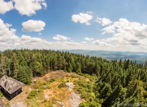
Hike Pillsbury Mountain Fire Tower
5.0Pillsbury Mountain is a fairly short but satisfying hike, ending with beautiful views of surrounding mountain ranges and lakes, and home to a defunct ranger station and fire tower. To get to the parking area within the Perkins Clearing wilderness area, head north on Route 30 out of Speculator and...Read more -
Lake Pleasant, New York
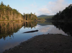
Backpack to Cedar Lakes Lean-to #2 in the West Canada Lakes Wilderness
5.3 mi / 705 ft gainKnow before you go! It’s a bumpy road in and a bumpy road out so be sure your vehicle is ready to handle a long, winding dirt and rocky road back to the trail head. The road is approximately 7 miles to the trailhead starting on Jessup River Road off of State Route 30 in Speculator, NY. Follow Jes...Read more -
Long Lake, New York
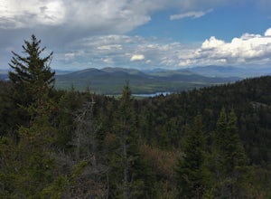
Hike to Owls Head Mountain Fire Tower in Sargent Ponds Wild Forest
5.06.2 mi / 1500 ft gainOwls Head Mountain is an Adirondack Fire Tower Mountain with an elevation of 2,812 feet. It is located in Long Lake in the Sargent Ponds Wild Forest and is a 6.2 mile out and back round trip hike. The trail head is located on Endion Ln, 2 miles north of the hamlet of Long Lake heading towards Tup...Read more -
Long Lake, New York
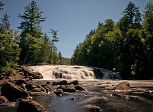
Buttermilk Falls
0.17 mi / 36 ft gainButtermilk Falls is an out-and-back trail that takes you by a waterfall located near Long Lake, New York.Read more -
Poultney, Vermont
Camp on Mount St. Catherine
5.0Looking for the best view in all of Poultney, Vermont? Look no further than Lake St. Catherine Mountain. Located within Deane's Nature Preserve, this fast and easy hike tops as one of the best views and camping spots for the little time and energy needed to reach the summit. Only 30-45 minutes fr...Read more -
Salisbury, Vermont
Camp at Lake Dunmore
The campground office for Branbury state park is on the opposite side of Route 53 from the pin on the map here, but the best campsites are where the pin is. Start by going and talking to the rangers at the office, they are super friendly and very helpful for recommendations of hikes or things to...Read more -
Lake Placid, New York
Hike Up Cobble Hill
5.0Looking for a great family hike up in the Adirondacks? Take a look into Cobble Hill right off of Mirror Lake in Lake Placid. This is a perfect hike for those with younger kids and want to expose them to hiking.Cobble Hill has a little bit of everything all packed into the short distance. The tr...Read more -
Lake Placid, New York
Hike to McKenzie and Haystack Mountains
12.4 mi / 4100 ft gainMcKenzie Mountain stands at 3,861 feet and is one of the highest 100 in the Adirondacks. Haystack Mountain stands at 2,874 feet. Both are part of the Saranac 6ers Challenge.The trailhead for this route to McKenzie and Haystack is located on route 86 in Ray Brook, there is a nice parking area off ...Read more -
Lake Clear, New York
Hike to the Summit of Ampersand Mountain
4.55.2 mi / 1775 ft gainAmpersand Mountain is part of the Saranac Lake 6er Hiking Challenge. It is one of six mountains surrounding Saranac Lake. The trail starts just across the street from the parking area. Though there is ample parking it can full up on a good day as it is a popular hike. The trail begins over most...Read more -
Lake Clear, New York
Relax at Ampersand Beach
1.1 mi / 20 ft gainLocated across from the Ampersand Mountain trailhead on NY Route 3, a trail will take you a short walk (about a half mile) to this beautiful, quiet beach on the shores of Middle Saranac Lake. Starting at the trailhead, you will continue along an unmarked but clear footpath that trails through the...Read more -
Saranac Lake, New York
Hike to Mount Baker in Saranac Lake
1.8 mi / 900 ft gainMount Baker (also referred to as Baker Mountain) stands at 2,457 feet and sits in the village of Saranac Lake and is part of the Saranac Lake 6ers Challenge. This is a moderate out and back 1.8 mile hike with an elevation gain of around 900 feet. It is the easiest of the 6ers and makes for a grea...Read more -
Inlet, New York
Hike to Shallow Lake in the Pigeon Lake Wilderness
2.8 miShallow Lake is a 268 acre remote lake located in the Pigeon Lake Wilderness in Central Adirondacks. This trail starts from Brown Tract Pond Campground, near campsite number 68 via the Shallow Lake Trail. This is a nice and easy hike for all fitness levels, with little elevation gain.There is a w...Read more -
Dorset, Vermont
Hike 'The Merck'
4.02.5 miOf the 10 trails at The Merck, The Wildlife Trail is a great hike through the forest that offers you the best way to see wildlife, streams and tracks. You can do the whole hike as a loop in about 2-2 1/2 hours or shorten it up with some shortcuts if you just want a quick hike. Great for family ...Read more -
Wilmington, New York
Whiteface Mountain Summit Trail
9.45 mi / 3606 ft gainWhiteface Mountain Summit Trail is an out-and-back trail that takes you through a nice forest located near Wilmington, New York.Read more -
Mendon, Vermont
Hike to Killington Peak
5.03.4 miThe trail head (Bucklin Trail) is found a couple of miles up Wheelerville Road on the left. Wheerlerville is a dirt road that will be muddy in the spring and summer. The drive is long enough that you will think you did something wrong, but you haven't! the trail head will eventually pop up.The tr...Read more -
Wilmington, New York
Hike Cobble Lookout in the Wilmington Wild Forest
4.72.6 mi / 240 ft gainPark at the trailhead located on County Route 18A just after the split from Whiteface Veteran's Memorial Highway in Wilmington, NY. There is a small parking lot for 4-5 cars and a pull off just ahead for another 3-4 cars. The trail begins at the back of the parking area. Following the contour of ...Read more

