Pine Bush, New York
Looking for the best photography in Pine Bush? We've got you covered with the top trails, trips, hiking, backpacking, camping and more around Pine Bush. The detailed guides, photos, and reviews are all submitted by the Outbound community.
Top Photography Spots in and near Pine Bush
-
Jefferson, New Jersey
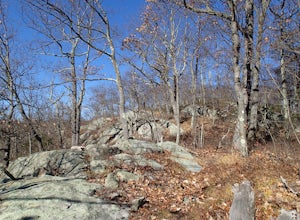
Thru Hike the Four Birds Trail
19 mi / 1200 ft gainThe Four Birds Trail is about 19 miles long and is a great thru hike or can be done in sections as out and back hikes or part of loop hikes with other trails. Starting from the north, the trail ascends gradually over easy terrain until you reach a cliff ridge. There are several good view points...Read more -
Stanfordville, New York
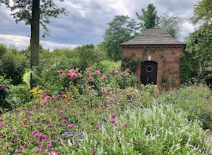
Explore Wethersfield Estate & Gardens
The Wethersfield Estate is a beautiful estate and property located less than 2 hours north of New York City. The gardens are expansive and extremely beautiful, open to the public each day from noon to 5pm (COVID-19 hours). Additionally, there are trails for horseback rides, carriage rides, dog-wa...Read more -
Dingmans Ferry, Pennsylvania
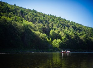
Canoe and Camp in the Delaware Water Gap
4.7This is one of those easy, simple and truly relaxing adventures you can embark on this summer. Thanks to outfitters such as Kittatinny Canoes you'll have everything ready for you when you arrive, minus of course your camping gear. They will pick you up at the destination of your choice along the ...Read more -
Dingmans Ferry, Pennsylvania
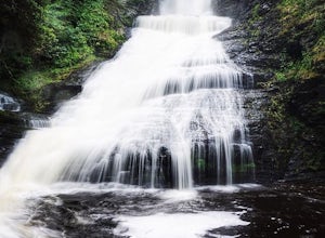
Explore Dingmans Falls
3.80.4 miThe waterfall is about 0.2 miles into the hike. I would recommend going to the very top of the biggest waterfall towards the end of the hike, there are steps leading up to it! There's also a hidden water hole at the very top of the waterfall about 0.2 miles up stream, I saw people in it during th...Read more -
Dingmans Ferry, Pennsylvania
Explore George W Child's Park
4.01.4 mi / 144 ft gainOnce parked, enter the trailhead and follow the trail down Dingmans Creek to the first set of falls. Try taking pictures from off the trail to the right of these falls. Continue on to the second waterfall and again step off the trail to take pictures from the right side of the waterfall, if you d...Read more -
Haines Falls, New York
Fawns Leap
2.3Please be respectful if visiting this local swimming hole. Pack out what you pack in, carry out others' trash, and familiarize yourself with Leave No Trace principles. Hidden in the Catskill Mountains is one of the coolest cliff jumping locations I have ever been to. The first time I went was a...Read more -
Haines Falls, New York
Kaaterskill Falls
4.52.57 mi / 719 ft gainAlthough this is a super short hike, it is definitely a tough one! The quick, steep climb is totally worth it once you reach the 260 foot cascade and pool at the end. Hike along the trail, hugging Spruce Creek all the way to the falls. If you hike in the spring, the creek and the falls will be ra...Read more -
Dingmans Ferry, Pennsylvania
Hike to Indian Ladder Falls Along Hornbecks Creek
3.52 mi / 400 ft gainFor some time, the trail was eroded above the first falls on Hornbecks Creek, not allowing hikers to access the creek's upper falls if they were coming upstream from Route 209. I am writing this in June 2017 and that is no longer the case! You can hike from Rt. 209 all the way up the creek to Eme...Read more -
Haines Falls, New York
Summit North Mountain
4.56 mi / 855 ft gainHave you ever wanted to feel as if you were hiking two different locations at once? If so, then North Mountain is definitely somewhere to check out. Take the birch tree forests around Aspen, CO and pair it with the spruces/pines of the Adirondacks and you'll have this route in the Catskills.Parki...Read more -
Rockaway, New Jersey
Hike the Timberbrook Pond - Riley's Rise Loop
5 mi / 500 ft gainThe trailhead parking is at the end of Timberbrook Road, before the road enters Camp Winnebago (Boy Scouts). I hiked this in a clockwise directions starting on the Timberbrook Trail (yellow markers). After about 1 mile the trail ends at a junction with the Four Birds Trail (white markers). Turn...Read more -
New Fairfield, Connecticut
Hike Squantz Pond Trail
2.2 mi / 321 ft gainThe hike is rated as moderate and is accessible all year round. While it’s accessible during all seasons, the sights of the leaves changing colors in the autumn makes it an exceptionally beautiful time to do this hike. You’ll definitely want to snap some photos along the way of the foliage reflec...Read more -
Pound Ridge, New York
Leatherman's Loop
1.25 mi / 1183 ft gainThis loop trail is moderately rated and reaches a total elevation gain of approximately 1,183 feet. It’s located in the Ward Pound Ridge Reservation, which spans roughly 4,315 acres. It is Westchester County’s largest park and includes roughly 35 plus miles of hiking trails to explore. The Ward...Read more -
Lehman township, Pennsylvania
Hike to Hornbeck's Creek Waterfall
4.31.2 miGPS Coordinates: 41.187148,-74.885454Driving Directions: From 209, enter into the Delaware Water Gap and in between the 10 and 11 mile markers you will see a sign for Hornbecks Creek with a gravel road adjacent to it. Follow the road back until you reach the parking lot and the trail will be to t...Read more -
Kent, Connecticut
Explore Kent Falls
5.00.75 mi / 250 ft gainEvery now and then you need a day to rest those sore muscle from all your recent adventures. The only issue is, you don't want to sit around inside, you want to be outside. Insert a trip to Kent Fall State Park. The perfect rest adventure day.Located 1 hour and 45 minutes north of New York City i...Read more -
Closter, New Jersey
Hike Alpine White Trail (Stateline Lookout)
5.05 mi / -520 ft gainStarting at about 520 feet, the White path takes you along the Stateline Lookout which is a small stone building overlooking the Hudson River. The initial descent is your average hike through the woods and across a couple of wooden bridges until you reach the Giant Steps. The Giant Steps take you...Read more -
Paterson, New Jersey
Explore the Great Falls of the Passaic River
3.2Getting to the Great Falls of the Passaic River is a relatively straight shot. It is located off exit 57B on Route 80 which is also accessible from highway 287. Parking is located on McBride Avenue across the street from the park's welcome center.Typically during autumn park rangers offer 45 to 1...Read more

