Boiceville, New York
Looking for the best hiking in Boiceville? We've got you covered with the top trails, trips, hiking, backpacking, camping and more around Boiceville. The detailed guides, photos, and reviews are all submitted by the Outbound community.
Top Hiking Spots in and near Boiceville
-
Salisbury, Connecticut
Bear Mountain Loop
4.56.05 mi / 1516 ft gainAt 2,316 feet, Bear Mountain is the highest peak in Connecticut. The peak is about a half-mile south of the Massachusetts state line on the Appalachian Trail. The views are great. On a clear day you can see some of the peaks in southern New Hampshire. The remnants of a stone tower are on the summ...Read more -
New Windsor, New York
Hike Jessup/West Ridge Loop via the Sweet Clover Trail
10 mi / 1700 ft gainSchunnemunk Mountain State Park is one of my favorite parks. It offers many trails and possibilities for different loops. The attraction of Schunnemunk Mountain is the long double ridges running parallel to each other and amazing views in all directions.This hike starts at the Taylor Road parki...Read more -
Cornwall, New York
Hike the North Point Loop
6.5 mi / 1400 ft gainThere is three different trailheads to access the North Point Loop. I chose the trailhead that would give me the longest hike. That would be the Butter Hill parking area on Route 9W north. From the parking lot, start on the connector trail designated with white markers. Follow this for about ...Read more -
Kent, Connecticut
Hike the Ridge Loop Trail, Macedonia Brook SP
3.0For a quick weekend trip from Newport, RI, Macedonia Brook State Park had a lot to offer for its size. In three or four hours, with lunch, you can hike the 6.4 mile ridge trail and get some fresh air without having to hike on too busy of trails. The elevation gain is only around 700 ft, however, ...Read more -
Cornwall, New York
Storm King Mountain Loop
4.52.44 mi / 400 ft gainThis is an easy, yet very rewarding hike with a lot of viewpoints on the way up. Technically you scale up two mountains, Butter Hill and Storm King, but most people just describe it as Storm King Mountain. This is a great hike for families with younger kids, those who don't have much time but wan...Read more -
Cold Spring, New York
Hike the Washburn/Nelsonville/Undercliff Loop
7.2 mi / 2000 ft gainThis is a difficult loop hike that has several different starting points. I chose to start at the Washburn Trail Head, which is the lowest starting point you can select. Nearly on the Hudson River, the trail ascends immediately along a well maintained road designated by white disc markers. Aft...Read more -
Cold Spring, New York
Hike the Cornish/Brook/Notch/Washburn/Undercliff Loop
8 mi / 1500 ft gainThis loop is a great option to avoid crowds on the west side of the Washburn trail. Start at the same trailhead for the Washburn Trail. The Cornish Trail is on the left and there is an obvious sign at the trail split a few feet from the parking area. The Cornish Trail is an old road from about...Read more -
Cold Spring, New York
Mt. Taurus (Bull Hill)
4.53.52 mi / 1375 ft gainMt. Taurus (or Bull Hill) is a short, family and dog friendly, hike just outside the town of Cold Spring, easily accessible by car or taking the train into town. It snakes along the edge of an old quarry that is just now being retaken by nature and provides lookouts towards the Hudson, other near...Read more -
Sheffield, Massachusetts
Hike to Race Brook Falls
4.03.4 mi / 1174 ft gainHiking along the Appalachian trail I made a detour in Mt Everett State reservation. About a 2.5 mile detour lead me down to a beautiful 100ft waterfall called Race Brook falls. The waterfall felt made me feel like i was in the tropical jungle in Hawaii. Adding to the beauty of the waterfall were ...Read more -
Cold Spring, New York
Hike the Perkins/Fahnestock/Charcoal Burners Trail Loop
7.5 mi / 800 ft gainThis is one of my favorite hikes in the Clarence Fahnestock State Park. A real mixed bag but mostly very enjoyable. The trail starts at the Charcoal Burners Trailhead Route 301. There is only road side parking on a soft shoulder, both sides of the road. After a short walk into the forest, you re...Read more -
Hopewell Junction, New York
Beaver Pond via Appalachian Trail
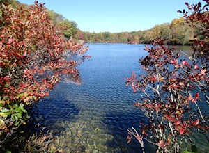
5.03 mi / 400 ft gainBeaver Pond is a small body of water created by a dam that was constructed during the days of iron ore mining in the area. The pond is crystal clear and has a wonderful tree line right on the water. The best time to visit here is early morning in the fall. With the leaves changing color they m...Read more -
Hopewell Junction, New York
Lake Canopus Viewpoint
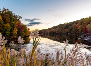
4.02.07 mi / 148 ft gainIts a great place to explore as it has a beautiful calm lake especially in the fall, the reflection of the water and the awesome colors are unbelievable. Its a short hike but you certainly could go further up. Parking is free by the road, hike towards the lake about a mile or so. The sound of bi...Read more -
Cold Spring, New York
Photograph Indian Brook Falls
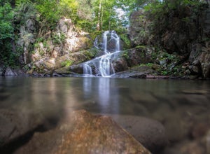
2.8This is about as short a walk and as little effort as you can put in for a beautiful waterfall. You can barely call it a hike, but I'll list it as such since you do walk through the woods for 5 minutes. The trail is extremely well built, and is pretty easily accessible through the winter.The trai...Read more -
Monroe, New York
Hike the Jessup/Highlands/Long Path Trails
7.8 mi / 500 ft gainThis trails starts at a small park in Woodbury called Gonzaga Park. Closed from mid-November to April, you are still able to park just outside the gate if that is the time of year you are hiking. Three different trail names share this path. The Jessup trail starts/end at Gonzaga Park and trave...Read more -
Voorheesville, New York
Hike the Indian Ladder Trail
4.53.5 mi / 200 ft gainThere are many parking areas within the park. Park at the overlook parking. From here you head west following the wood fence. This is the Cliff Top trail. Approximately after walking 0.5 miles you will reach the stairs that will lead you to the base of the cliffs. This marks the start of the...Read more -
Canaan, Connecticut
Explore Great Falls
3.00.5 miStumbled upon Great Falls in the Falls Village section of Canaan, CT. The stunning 50ft waterfall doesn't disappoint. very easy hike from parking lot, you must cross the river in order to get close for bottom view. Hop on top of turtle rock and relax as the waterfall tumbles in the distance.Read more

