White Sands NM, New Mexico
Looking for the best hiking in White Sands NM? We've got you covered with the top trails, trips, hiking, backpacking, camping and more around White Sands NM. The detailed guides, photos, and reviews are all submitted by the Outbound community.
Top Hiking Spots in and near White Sands NM
-
White Sands NM, New Mexico
Dune Life Nature Trail
1.8 miStarted the hike at the Dune Life Nature trail parking area. Two rangers took us all on the trail . We walked up and down the dunes and some flat areas. We started out at sunset and the views of the sunset were beautiful. 30 minutes later we walked in the dark with light of the moon. The sand was...Read more -
Tularosa, New Mexico
Camp at White Sands National Monument
5.01.5 mi / 40 ft gainSpend a night under the stars in one of the more beautiful places to take it all in. White Sands National Monument offers camping to “backpackers” who have the ability to hike out into the dunes to set up camp for an overnight adventure. The closest site will be .75 miles away while the farthest ...Read more -
Tularosa, New Mexico
Hike the Alkali Flat Loop
4.04.9 mi / 52 ft gainFrom the US 70 pull into the White Sands Visitor Center. Then continue along Dunes Drive. Eventually, Dunes Drive turns into Loop Drive. At the end of this road, you will find the Alkali Flat trailhead. One of the most beautiful and potentially disorienting 5-mile round-trip treks through the de...Read more -
Alamogordo, New Mexico
Explore White Sands National Monument
4.7The White Sands National Monument is one of the most surreal locations in the southwest. Located just north of Las Cruces, NM, White Sands is about a 45 minute drive from the city of Las Cruces. To access the park from any location, you'll take Route 70, and from Las Cruces it's one straight shot...Read more -
Alamogordo, New Mexico
Hike Oliver Lee State Park Dog Canyon
0.7 mi / 101 ft gainThis State Park is close to the city of Alamagordo , NM. It has a nice creek with water flowing during the rainy season. The Dog Canyon hike is hard but offers great views of the canyon and the canyon walls. Superb views of the Sacramento Mountains. The historic Ranch House can be visited during...Read more -
Alamogordo, New Mexico
Hike Alamo Canyon Loop Trail
-6.6 mi / 1205 ft gainAlamo Canyon Loop trail is a 6.6 miles loop in the Lincoln National Forest. It is best to start the trail from the junction of TR 107 Roundup Ground trail and hike counter clock wise. There are spectacular views of the canyon and the Sacramento Mountains. There is great variety of desert flora a...Read more -
Las Cruces, New Mexico
Pine Tree Trail Loop
4.54.29 mi / 1276 ft gainPark in the Parking area at the end of Aguirre Springs Loop. The trailhead is across the road. The trail will take you in a loop. Enjoy the diversity of plant life and the varied landscape. There are numerous interesting geological and ecological features in these foothills.Read more -
Aguirre Springs Road, New Mexico
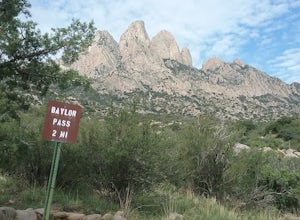
Hike the Baylor Pass Trail
5.06.9 mi / 1568 ft gainModerate hike in the Organ Mountains Desert Peak National Monument in New Mexico. Very good views of the Organ Mountains , the Tularosa Basin and wildflowers in the summer and fall. Excellent place to see the Organ Mountains evening primroseRead more -
Las Cruces, New Mexico
Hike the Baylor Pass West Trail
6.3 mi / 1548 ft gainStart your hike from the parking lot of Baylor Pass Road. The trail starts to climb gently first and then gradually the climb gets steeper, but nothing too difficult. There is nice desert vegetation along the trail and very good views of the Organ Mountains and valley below.Read more -
Las Cruces, New Mexico
Baylor Peak via Baylor Canyon Pass
8.36 mi / 2772 ft gainBaylor Peak via Baylor Canyon Pass is an out-and-back trail where you may see beautiful wildflowers located near Las Cruces, New Mexico.Read more -
Salado Canyon Trail, New Mexico
Hike the Salado Canyon Trail
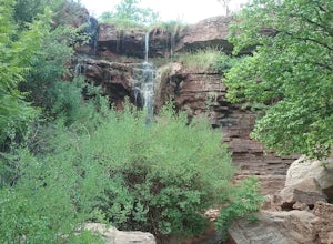
3.4 mi / 307 ft gainFairly easy trail on an old railroad bed. The trail is not steep and has nice scenery. The waterfall is sall but scenic, it is nice to see soe running water in the desert.Read more -
15595 Baylor Peak Road, New Mexico
Hike the Rabbit Ear Plateau.
5.06 mi / 3000 ft gainPark at the small parking area of Baylor Peak rd. Start climbig up the mountain on a old jeep road. The trail becomes steeper the further up you go. Very good views of the Organ Mountains and the Mesilla Valley. Lots of wildflowers along the way in the summer and also cacti in bloom. Did not make...Read more -
Las Cruces, New Mexico
Hike the Picacho Mountain
3 mi / 1200 ft gainThis is a somewhat strenuous hike up Picacho Mountain. The trail is 3 miles round trip and has an elevation gain of 1200 ft. Great views from the top and also many cacti species can be seen along the trail.Read more -
Las Cruces, New Mexico
Organ Needle from Baylor Canyon Road
5.07.67 mi / 3658 ft gainOrgan Needle from Baylor Canyon Road is an out-and-back trail that provides a good opportunity for scenic views located near Las Cruces, New Mexico. Keep in mind on the trail, there isn't much in terms of shade or coverage, so please pack accordingly and with sufficient water for the trail. There...Read more -
Las Cruces, New Mexico
Organ Peak Trail
5.09.92 mi / 3458 ft gainOrgan Peak Trail is an out-and-back trail where you may see beautiful wildflowers located near Las Cruces, New Mexico. This is one of the longer and more challenging hikes in the Organ Mountains. An early start is recommended to keep heat down during the warmer months as well trekking poles and p...Read more -
Las Cruces, New Mexico
Organ Needles Trail
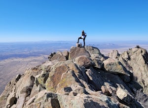
5.88 mi / 3333 ft gainThe Organ Needles Trail in Las Cruces, New Mexico is a challenging hike that rewards with stunning views. This 5.88-mile round trip trail is rated as difficult, with a steep incline and rocky terrain. The trail begins at the Baylor Canyon Road trailhead and ascends to the Organ Needle Peak, the h...Read more


