Cochiti Lake, New Mexico
Top Spots in and near Cochiti Lake
-
Lamy, New Mexico
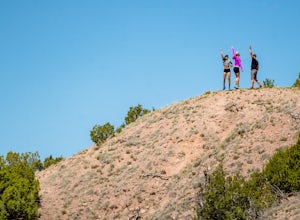
Hike to the Happy Valley Overlook in the Galisteo Basin Preserve
1 mi / 150 ft gainThe Galisteo Basin Preserve south of Santa Fe, New Mexico is community conservation area of some 10,000 acres with 28 miles of publicly accessible trails for hikers, mountain bikers, and equestrians.The Happy Valley Overlook is a great, quick way to get an epic view of a large portion of Galisteo...Read more -
Jemez Springs, New Mexico
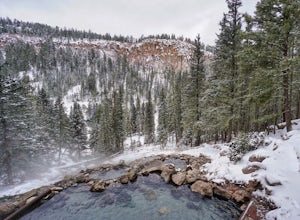
San Antonio Hot Springs
4.61.46 mi / 312 ft gainThese hot springs are a short hike from the parking area along the top of Forest Service Road 376. I've added additional details below in the event that the road is closed due to seasonality or you prefer to stretch your legs for a significantly longer, yet scenic hike. The GPX track is displayin...Read more -
Santa Fe, New Mexico
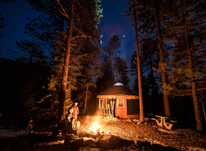
Stay in the Hyde State Park Yurts
Hyde Memorial State Park yurts are nestled high in the Sangre de Cristo mountains amongst the ponderosa pines, and sleep six and provide a modern setting with roots in ancient tradition. Their location in the State Park provide easy access to park's vast trail system.Each bed has an encapsulated...Read more -
Albuquerque, New Mexico
Hike the Piedra Lisa Trail
5.04.2 mi / 1000 ft gainUp near the iconic La Luz Trailhead is a smaller and somewhat hidden trail a little farther up the road, Piedra Lisa Trail. This short two mile climb to the ridge that divides the view of Albuquerque and Placitas tops out at a rocky outcrop that provides simply stellar views of the city and to t...Read more -
Albuquerque, New Mexico
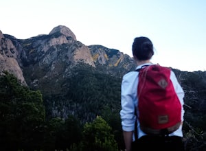
Summit Point 8300
6.5 mi / 1300 ft gainPoint 8300, also nicknamed Mayan Temple by the locals, is the highest point in the Rincon Ridge. In order to reach the summit you start by following the South Piedra Lisa Trail for about 2.25 miles to the ridge. Once you reach the ridge the Piedra Lisa goes off to the right, but there is an unmar...Read more -
Albuquerque, New Mexico
Hike La Luz Trail
5.07.2 mi / 3378 ft gainLeaving from the foothills above Albuquerque this trail leads you from the desert up to the peaks of the Sandia Mountains. You'll climb from the city at 7000 ft above sea level all the way up to 10,378 ft in altitude along a trail the changes from high desert to deep pine forest. The views alon...Read more -
Sandia Park, New Mexico
Hike the 10K Loop
5.2 mi / 700 ft gain10K trailhead springs from it a whole handful of beautiful trails. With access to a rocky path that leads off into raw wilderness, a clean and smooth walking, hiking, and mountain biking trail covered by tall pine canopy, or a wide cut service road ideal for easy strolls, you have plenty of opti...Read more -
Santa Fe, New Mexico
Hike Santa Fe Baldy
5.0Starting at an elevation of 10,000 feet at the Santa Fe Ski Basin, a right turn at the Winsor trail starts a steep climb for .5 miles until the wilderness boundary gate. From there, the trail descends slightly, taking a path along the ridge through mossy pines and emerald stones. A mile later, yo...Read more -
Santa Fe, New Mexico
Hike or Bike Aspen Vista
3.512.1 mi / 2100 ft gainAspen Vista Road (Forest Road 150) starts at an elevation of 10,000 feet and climbs up through a large stand of beautiful aspen and pine trees to the summit of Tesuque Peak at an elevation of 12,045 feet (note the Aspen grove is one large living being as all the roots are interconnected). These ...Read more -
Cedar Crest, New Mexico
Tree Spring Trail
5.04.11 mi / 984 ft gainTree Spring Trail is an out-and-back trail where you may see beautiful wildflowers located near Sandia Park, New Mexico.Read more -
Santa Fe County, New Mexico
Santa Fe Baldy Via Windsor Trail
13.55 mi / 3140 ft gainSanta Fe Baldy Via Windsor Trail is an out-and-back trail that provides a good opportunity to view wildlife located near Santa Fe, New Mexico.Read more -
Santa Fe, New Mexico
Backpack to Lake Katherine in the Pecos Wilderness
5.016 mi / 1450 ft gainAccessible June through October, snow lingers on the trail late into the summer. This is a very popular, well-marked route so if it's solitude you're seeking, you'll probably be disappointed. At least on the weekend.The trailhead is at the parking lot for Ski Santa Fe. You'll climb from 10,250 to...Read more -
Santa Fe, New Mexico
Hike to Nambé Lake
4.06.2 mi / 1800 ft gainStarting at the ski basin above Santa Fe, where parking is ample and the drive to reach it is staggeringly beautiful, you head north from the bottom of the parking lot from a well marked trailhead. The climb starts right out of the gate, and at a starting altitude of 10,000 ft above sea level yo...Read more -
Albuquerque, New Mexico
Sandia Peak
4.5/ 10378 ft gainStart at the Sandia Mountain base terminal where you can purchase your tickets to ride the tram (Tip: If you make reservations at the peaks restaurant, High Finance, you can get a discount on your ticket). Enjoy the 15 minute ride to the peak while taking in beautiful city views of Albuquerque as...Read more -
Cedar Crest, New Mexico
Sulphur Canyon #281 and Cienega Horse Bypass #266 Loop
4.02.25 mi / 469 ft gainSulphur Canyon #281 and Cienega Horse Bypass #266 Loop is a loop trail that provides a good opportunity to view wildlife located near Cedar Crest, New Mexico.Read more -
Glorieta, New Mexico
Hike the Glorieta Battlefield Trail
2.25 mi / 500 ft gainThis trail is a little tricky to get to, so be sure to stop at the Pecos NHP Visitor Center first for directions. You will also need to retrieve a gate code from the ranger. I would recommend picking up a guide inside the Visitor Center so you know what you're looking at on the trail (important)....Read more

