Cedar Crest, New Mexico
Looking for the best running in Cedar Crest? We've got you covered with the top trails, trips, hiking, backpacking, camping and more around Cedar Crest. The detailed guides, photos, and reviews are all submitted by the Outbound community.
Top Running Spots in and near Cedar Crest
-
Cedar Crest, New Mexico
Sulphur Canyon #281 and Cienega Horse Bypass #266 Loop
4.02.25 mi / 469 ft gainSulphur Canyon #281 and Cienega Horse Bypass #266 Loop is a loop trail that provides a good opportunity to view wildlife located near Cedar Crest, New Mexico.Read more -
Albuquerque, New Mexico
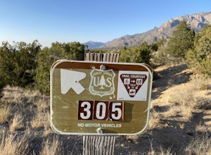
Michael M. Emery and Trail 305 Loop
5.03.17 mi / 335 ft gainThe Michael M. Emery and Trail 305 Loop in Albuquerque, New Mexico, is a moderately challenging hiking trail. It spans approximately 3.17 miles and is primarily used for hiking, walking, and nature trips. The trail is well-marked and offers a variety of terrain, including dirt paths, rocky sectio...Read more -
Sandia Park, New Mexico
Hike the 10K Loop
5.2 mi / 700 ft gain10K trailhead springs from it a whole handful of beautiful trails. With access to a rocky path that leads off into raw wilderness, a clean and smooth walking, hiking, and mountain biking trail covered by tall pine canopy, or a wide cut service road ideal for easy strolls, you have plenty of opti...Read more -
Sandia Park, New Mexico
Golden Open Space Mesa Trail Loop
5.02.07 mi / 131 ft gainGolden Open Space Mesa Trail Loop is a dog and family-friendly loop trail located near Sandia Park, New Mexico. The trail is open year-round and offers expansive views of the valleys and mountains alongside Juniper and Pinyon trees. These trails are used by mountain bikers as well, so please keep...Read more -
Lamy, New Mexico
Hike to the Happy Valley Overlook in the Galisteo Basin Preserve
1 mi / 150 ft gainThe Galisteo Basin Preserve south of Santa Fe, New Mexico is community conservation area of some 10,000 acres with 28 miles of publicly accessible trails for hikers, mountain bikers, and equestrians.The Happy Valley Overlook is a great, quick way to get an epic view of a large portion of Galisteo...Read more -
Glorieta, New Mexico
Hike the Glorieta Battlefield Trail
2.25 mi / 500 ft gainThis trail is a little tricky to get to, so be sure to stop at the Pecos NHP Visitor Center first for directions. You will also need to retrieve a gate code from the ranger. I would recommend picking up a guide inside the Visitor Center so you know what you're looking at on the trail (important)....Read more -
Santa Fe, New Mexico
Trail Run the Dale Ball Trails
22 mi / 500 ft gainThe Dale Ball Trail system, covers a wide swath of terrain between Santa Fe County, the City of Santa Fe, the National Forest, and The Nature Conservancy with a 22 mile network of trails in the foothills of the Sangre de Cristo Mountains. Located a short distance from downtown Santa Fe, it is the...Read more -
Pecos, New Mexico
Hike the South Pasture Loop Trail
3.8 mi / 196 ft gainThe South Pasture Loop trail, while part of the Pecos NHP, isn't in the main park. Currently, this trail is only open on the weekends and the road gate closes at 1pm. The trail itself closes at 3pm, and takes about 2-3 hours unless you plan on hiking for speed. No pets allowed. 0.7 miles down th...Read more -
Pecos, New Mexico
Hike the Grand Slam in Pecos New Mexico
7.5 mi / 600 ft gainPecos National Historical Park offers up the "grand slam" for hiking, which is a bit of a misnomer because they only have 3 trails and a grand slam indicates you would have completed 4 of something. In order to achieve the "grand slam" you need to hike all 3 trails in one day, completing approxi...Read more

