Ringwood, New Jersey
Looking for the best photography in Ringwood? We've got you covered with the top trails, trips, hiking, backpacking, camping and more around Ringwood. The detailed guides, photos, and reviews are all submitted by the Outbound community.
Top Photography Spots in and near Ringwood
-
New York, New York
Explore the Met Cloisters
5.0The Met Cloisters is an art museum owned by the Met that boasts religious (mostly Catholic) art from a range of time periods as the building used to function as a cloister for monks. The inside of the Cloisters museum is a castle-like building that can be visited for a small ticket fee (suggested...Read more -
Cornwall, New York
Hike the North Point Loop
6.5 mi / 1400 ft gainThere is three different trailheads to access the North Point Loop. I chose the trailhead that would give me the longest hike. That would be the Butter Hill parking area on Route 9W north. From the parking lot, start on the connector trail designated with white markers. Follow this for about ...Read more -
Cornwall, New York
Storm King Mountain Loop
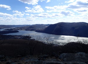
4.52.44 mi / 400 ft gainThis is an easy, yet very rewarding hike with a lot of viewpoints on the way up. Technically you scale up two mountains, Butter Hill and Storm King, but most people just describe it as Storm King Mountain. This is a great hike for families with younger kids, those who don't have much time but wan...Read more -
Cornwall-on-Hudson, New York
Hike the Stillman - Bluebird Loop
5.4 mi / 1200 ft gainThis loop hike starts at the northern trailhead of the park where the Stillman Trail begins. The parking area has enough space for only 6 or 7 cars. Start off on a wide maintained carriage road. After about a half mile, the Stillman Trail (yellow markers) breaks of to the left. However, stay ...Read more -
Frankford, New Jersey
Picnic at the Sunrise Mountain Pavilion
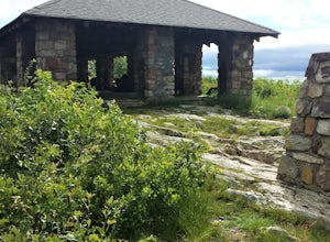
This pavilion is one of the key features along the New Jersey section of the Appalachian Trail. There is a parking lot a very short hike part way down the mountain, but I recommend backpacking in from a different area to take in more of the beauty of the trail, mountains, and views in this area. ...Read more -
Cold Spring, New York
Photograph Indian Brook Falls
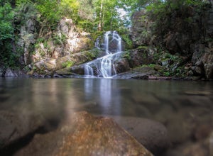
2.8This is about as short a walk and as little effort as you can put in for a beautiful waterfall. You can barely call it a hike, but I'll list it as such since you do walk through the woods for 5 minutes. The trail is extremely well built, and is pretty easily accessible through the winter.The trai...Read more -
Cold Spring, New York
Hike the Cornish/Brook/Notch/Washburn/Undercliff Loop
8 mi / 1500 ft gainThis loop is a great option to avoid crowds on the west side of the Washburn trail. Start at the same trailhead for the Washburn Trail. The Cornish Trail is on the left and there is an obvious sign at the trail split a few feet from the parking area. The Cornish Trail is an old road from about...Read more -
Cold Spring, New York
Hike the Washburn/Nelsonville/Undercliff Loop
7.2 mi / 2000 ft gainThis is a difficult loop hike that has several different starting points. I chose to start at the Washburn Trail Head, which is the lowest starting point you can select. Nearly on the Hudson River, the trail ascends immediately along a well maintained road designated by white disc markers. Aft...Read more -
Weehawken, New Jersey
Photograph the NYC Skyline from JFK Boulevard East
The Big Apple. NYC has arguably the best skyline in the world. So, if you are one of the millions of people visiting wouldn't you want to get some photos of the entire skyline to post on social media and show friend & family? Skip the boat and helicopter tour lines (although a cool experience...Read more -
Cold Spring, New York
Sugarloaf Mountain and Breakneck Ridge Loop
4.74.33 mi / 1562 ft gainThe Breakneck Ridge to Sugar Loaf Loop gives rise to various bypasses that offer hikers moderate to advanced terrain and multiple rock scrambles. The loop entails a total elevation gain of 1,670 feet and a total distance of 5.5 miles. The start of the trail begins at the (white blazes) at the no...Read more -
Beacon, New York
Sunset Point - South Beacon Mountain Loop
4.08.92 mi / 2470 ft gainThis loop hike form the Notch Trail northern trailhead on Route 9D. There is enough parking at this trailhead for about 5-6 cars. The Notch Trail is identified with blue trail markers. It is well maintained and plenty of markers to guide your way. This is important because there are m...Read more -
Beacon, New York
Sugarloaf Mountain via Wilkinson Memorial Trail
5.02.15 mi / 820 ft gainTrail is currently closed. Get updates at parks.ny.gov. Sugarloaf Mountain is part of the Hudson Highlands State Park, along with Breakneck Ridge, Bull Hill, and Mt Beacon. Though the views are just as impressive as its sister trails, it is never as crowded and it's one of my favorite spots in ...Read more -
New York, New York
Watch the Sunset from Top of the Rock
4.0There aren't any mountain peaks to summit in New York City, but the view from the top of the Rockefeller Building is the next best thing. You'll have to pay a few bucks ($29 to be exact) and deal with some tourists but you won't regret your decision once you're looking out over one of the most ic...Read more -
Sandyston, New Jersey
Hike the AT to Culvers Lookout Tower
3.2 miStart your journey in Stokes State Forest at the Culver Gap Parking Lot, located at 41.180239, -74.787954. From the parking lot, jump on over to the Appalachian Trail and hike Northbound. You know you're headed the right way if you are going away from the small town and cross over Sunrise Mountai...Read more -
New York, New York
High Line
4.61.47 mi / 26 ft gainBuilt on a historic freight rail line and perched above the streets of Manhattan’s West Side, the High Line is a public park that features a green-lined walkway. Park hours depend on the season, although it never opens before 7am, so best to go for sunset. Although you may have some company on wa...Read more -
New York, New York
Walk the George Washington Bridge at Sunset
3.00.9 miJoin the thousands of people who cross the GWB each day, but do it by foot! This is an easy walk with beautiful views of the New York City skyline. You will begin seeing signs for the bridge bike path at Ft. Washington St. & E. 177th St., which you follow for a few blocks until you begin asce...Read more

