Orford, New Hampshire
Looking for the best hiking in Orford? We've got you covered with the top trails, trips, hiking, backpacking, camping and more around Orford. The detailed guides, photos, and reviews are all submitted by the Outbound community.
Top Hiking Spots in and near Orford
-
Lincoln, New Hampshire
Osceola Mountain via Greeley Pond
4.06.8 mi / 2677 ft gainStart out at the Greeley Pond trailhead off of the Kancamagus Highway. After 1.3 miles the trail splits--bear right to get onto the Mt. Osceola Trail. Continue 1.5 miles to the summit. This summit hike offers a different kind of reward. Views are limited from the peak of Mt. Osceoloa, which allow...Read more -
Appalachian Trail, Vermont
Hike to Thundering Brook Falls
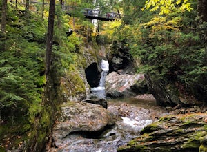
4.50.4 mi / 29 ft gainThe hike to Thundering Brook Falls is kid friendly and fun for the whole family. At only .4 miles roundtrip, this is an excellent quick workout. Dogs are allowed on this trail but must be kept on leash. This trail is hiked year-round but is best used in the spring, summer, or during fall colors.Read more -
368 Weathersfield Trail, Vermont
Hike Mount Ascutney
3.05.2 mi / 2326 ft gainThis route to the top of Mount Ascutney is completed via the Weathersfield Trail. This trail goes past gorgeous Cascade Falls - often frozen in the winter months. There is a great spot to eat lunch at the top of Mount Ascutney to the side of the hang glider landing. While the summit itself does n...Read more -
Waterville Valley, New Hampshire
Sabbaday Falls
4.70.7 mi / 171 ft gainThis awesome waterfall is located right off of the Kancamagus Highway (rt 112) that runs from Lincoln to North Conway, NH. The highway itself is a very scenic drive through the White Mountains that has pull off spots every couple of miles. From I93 take exit 32 for Lincoln. Drive straight throug...Read more -
Hancock, Vermont
Hike at Texas Falls Recreation Area
5.01 mi / 209 ft gainDirectly across from the main parking area are the viewing access points of Texas Falls. A footbridge crosses high above the flume and gorge, offering the best views. Crossing the bridge, there are plenty of other great view points with wooden railings keeping you away from the steep drops. ...Read more -
Warren, Vermont
Explore Warren Falls
5.00.25 miWarren Falls is a popular local swimming hole just outside of Warren, VT on Route 100. You can access the falls by driving south on Route 100 from Warren (it's 3.5 miles south on the right hand side) or north from Granville on Route 100. The parking lot is clearly marked with a sign and ample par...Read more -
Bartlett, New Hampshire
Hike Mt. Carrigain
5.010 mi / 3250 ft gainPark on Sawyer River Road at the Signal Ridge Trailhead. Trail starts out as a mild climb and meanders with the Whiteface Brook. When you arrive at the Carrigain Notch Trail junction, turn left. Enjoy three miles of steep uphill along the mountain's edge. When you reach the the apex of Mt. Carrig...Read more -
Jefferson, New Hampshire
Hike the Sugarloaf Trail
3.3 mi / 1099 ft gainThe Sugarloaf Trail begins at the Sugarloaf trailhead on Zealand Road off of US 302. There are two trails that begin at this trailhead--be sure to cross the bridge over the Ammonoosuc and look for the "Sugarloaf Trail" sign. The trail begins following the Ammonoosuc River for a short while before...Read more -
Newbury, New Hampshire
Hike to Lake Solitude, NH
4.04.8 mi / 2510 ft gainThe two most popular routes to Lake Solitude are the Newbury Trail and Andrew Brook Trail. The round-trip distance of the hikes are 4.8 miles and 3.8 miles. Both could be described as moderate in terms of difficulty. The Newbury trail is accessed from Lakeview Ave and Andrew Brook Trail can be a...Read more -
Hart's Location, New Hampshire
Rappelling at Ripley Falls
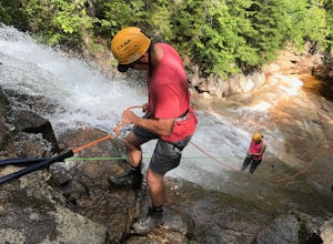
1.5 mi / 0 ft gainThis is a once-in-a-lifetime adventure to rappel down a 100+ waterfall surrounded by beautiful scenes in the midst of the White Mountains. This adventure is organized and facilitated by Northeast Mountaineering who provide gear, guidance, and safety instruction. You will begin your day at the Bu...Read more -
Hart's Location, New Hampshire
Hike Mt. Crawford
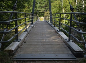
5.05 miDon't let the relatively short 2.5 mile hike up Mt. Crawford fool you, you certainly work for the amazing views from the summit. Located in Crawford Notch, park in the Davis Path lot almost directly across from the Notchland Inn on Rt. 302. The trail starts by going over a footbridge crossing the...Read more -
Hart's Location, New Hampshire
Hike to Frankenstein Cliffs
4.35 mi / 1400 ft gainThe Frankenstein Cliff trailhead is located in Crawford Notch State Park directly off of Route 302. If you're traveling from the south (Bartlett/North Conway) the parking lot for the trailhead is on your left hand side about 12 miles from Bartlett. There are signs for Arethusa Falls/Frankenstein ...Read more -
Arethusa Falls Road, New Hampshire
Snowshoe to Arethusa Falls via Bemis Brook Trail
2.8 mi / 853 ft gainArethusa Falls is a popular hike in the White Mountains, and come winter it is a popular spot for ice climbing. The falls are located in Crawford Notch State Park and is the tallest waterfall in New Hampshire (between 140-200 feet). Following the Bemis Brook Trail to Arethusa Falls will add a few...Read more -
Mendon, Vermont
Hike to Killington Peak
5.03.4 miThe trail head (Bucklin Trail) is found a couple of miles up Wheelerville Road on the left. Wheerlerville is a dirt road that will be muddy in the spring and summer. The drive is long enough that you will think you did something wrong, but you haven't! the trail head will eventually pop up.The tr...Read more -
Carroll, New Hampshire
Mount Willard
5.03.07 mi / 958 ft gainThis hike begins at the trailhead behind Crawford Depot. The first 1/4 mile of the trail is relatively level. You will cross two small streams before the trail begins to steepen. For much of the trek up to the top of the mountain you will be following an abandoned carriage road. Along the sid...Read more -
Crawford Notch Road, New Hampshire
Hike to the Summits of Mt. Jackson and Mt. Pierce
8 mi / 5000 ft gainFrom I93 take exit 35 onto rt 3. Follow that until you get to a four way intersection. Take a right onto rt 302 and follow that until you see an AMC information building on the right. Drive past the parking lot about 500 feet and park on the left right after the lake.From there take the Webster ...Read more

