Orange, New Hampshire
Top Spots in and near Orange
-
Franconia, New Hampshire
Backpack the Franconia Ridge Loop
4.514.5 mi / 3000 ft gainThis is a multi-day backpacking loop in Franconia Notch State Park, New Hampshire (located in the the White Mountains).Leave the car at the Lafayette Place Campground, (about 1700' elevation), then head up 1.4mi to Lonesome Lake. If you start hiking in the evening, as the sun is setting, you can ...Read more -
Franconia, New Hampshire
Camp at Lafayette Campground, White Mountains
5.08.3 miThe White Mountains offer some of the most prime foliage sightseeing (aka 'leaf peeping') in New England. Tourists flock to the Franconia Notch State Park area and surrounding parts of the White Mountains every October, but camping is generally less common. October can be a cold month in New Hamp...Read more -
Franconia, New Hampshire
Winter Hike North Kinsman
8 mi / 2500 ft gainPark at Lafayette Place right off of I-93. It is one of the most accessible trail heads to hit a “4,000 footer” in the White Mountains and has plenty parking. Signage is visible and easy to follow as you begin at 1,800 feet and walk through a wooded campground onto the Lonesome Lake Trail. The t...Read more -
Franconia Notch State Park, New Hampshire
Backpack the Pemi Loop
5.032 mi / 9000 ft gainThis round trip loop is the combination of many trails within the Pemigewasset Wilderness. We chose to this hike up into a 3 day backpacking trip although we came across some particularly adventurous folks who were doing it in 2 and even 1 day. We also came across hikers less pressed for time who...Read more -
Waterville Valley, New Hampshire
Sabbaday Falls
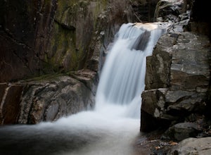
4.70.7 mi / 171 ft gainThis awesome waterfall is located right off of the Kancamagus Highway (rt 112) that runs from Lincoln to North Conway, NH. The highway itself is a very scenic drive through the White Mountains that has pull off spots every couple of miles. From I93 take exit 32 for Lincoln. Drive straight throug...Read more -
Franconia, New Hampshire
Hike to the Summit of Cannon Mountain via Kinsman Ridge trail
5.04 mi / 3000 ft gainDriving north on I-93 in New Hampshire, Cannon Mountain can be seen on the left just a few miles after exit 32. It is a massive cliff that towers over the highway, thousands-of-feet tall. Parking for the trail head is left off of exit 34B. If you look left as you're driving into the paved parking...Read more -
Franconia, New Hampshire
Hike Artists Bluff
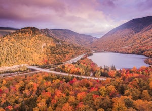
4.31.5 miStarting from the Bald Mountain trailhead, the Artists Bluff trail takes you up a short but steep 1.5 mile path to a beautiful rocky overlook of Franconia Notch State Park. This is the perfect hike to find incredible views of the park and some amazing foliage in autumn. We parked across the stree...Read more -
Sugar Hill, New Hampshire
Photograph Lupines in Sugar Hill
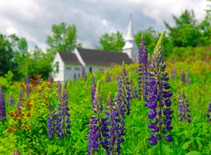
Every year, more or less around the second week of June, the village of Sugar Hill boasts a magnificent show of lupines. There are several concentrations of lupines in fields along the road, but the highlight of a visit to Sugar Hill is the small hillside near St. Matthew's Church. The vistas tow...Read more -
Appalachian Trail, Vermont
Hike to Thundering Brook Falls
4.50.4 mi / 29 ft gainThe hike to Thundering Brook Falls is kid friendly and fun for the whole family. At only .4 miles roundtrip, this is an excellent quick workout. Dogs are allowed on this trail but must be kept on leash. This trail is hiked year-round but is best used in the spring, summer, or during fall colors.Read more -
Albany, New Hampshire
Champney Falls - Bolles Chocura Loop
5.09.18 mi / 2904 ft gainChampney Falls - Bolles Chocura Loop is a loop trail that takes you by a waterfall located near Lincoln, New Hampshire.Read more -
Bartlett, New Hampshire
Hike Mt. Carrigain
5.010 mi / 3250 ft gainPark on Sawyer River Road at the Signal Ridge Trailhead. Trail starts out as a mild climb and meanders with the Whiteface Brook. When you arrive at the Carrigain Notch Trail junction, turn left. Enjoy three miles of steep uphill along the mountain's edge. When you reach the the apex of Mt. Carrig...Read more -
Albany, New Hampshire
Rocky Gorge Scenic Area Loop
2 mi / 266 ft gainA beautiful area of the Kancamagus Highway, the Rocky Gorge section is home to rushing rapids and scenic lakes. When visiting in the fall the colors are amazing however be ready for traffic and more crowds. This location has a parking lot and walking trails along the river to multiple viewpoints.Read more -
Hart's Location, New Hampshire
Hike Mt. Crawford
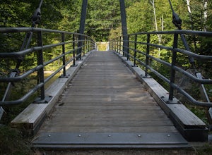
5.05 miDon't let the relatively short 2.5 mile hike up Mt. Crawford fool you, you certainly work for the amazing views from the summit. Located in Crawford Notch, park in the Davis Path lot almost directly across from the Notchland Inn on Rt. 302. The trail starts by going over a footbridge crossing the...Read more -
Hart's Location, New Hampshire
Rappelling at Ripley Falls
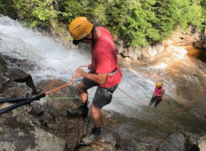
1.5 mi / 0 ft gainThis is a once-in-a-lifetime adventure to rappel down a 100+ waterfall surrounded by beautiful scenes in the midst of the White Mountains. This adventure is organized and facilitated by Northeast Mountaineering who provide gear, guidance, and safety instruction. You will begin your day at the Bu...Read more -
Hart's Location, New Hampshire
Hike to Frankenstein Cliffs
4.35 mi / 1400 ft gainThe Frankenstein Cliff trailhead is located in Crawford Notch State Park directly off of Route 302. If you're traveling from the south (Bartlett/North Conway) the parking lot for the trailhead is on your left hand side about 12 miles from Bartlett. There are signs for Arethusa Falls/Frankenstein ...Read more -
Arethusa Falls Road, New Hampshire
Snowshoe to Arethusa Falls via Bemis Brook Trail
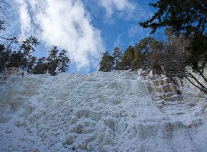
2.8 mi / 853 ft gainArethusa Falls is a popular hike in the White Mountains, and come winter it is a popular spot for ice climbing. The falls are located in Crawford Notch State Park and is the tallest waterfall in New Hampshire (between 140-200 feet). Following the Bemis Brook Trail to Arethusa Falls will add a few...Read more

