Milford, New Hampshire
Top Spots in and near Milford
-
Bolton, Massachusetts
Take a Stroll at Fyfeshire Conservation Area
1.0Fyfeshire is located in Bolton Massachusetts off "Wattaquadock Hill Road", near the "Fotini's Restaurant and Bar". The trailhead begins at a small parking area with a stone gate that says Fyfeshire Conservation area on a wood plank. Once you are in the conservation area you will see an opening in...Read more -
Clinton, Massachusetts
Watch a Sunset at Wachusett Reservoir
4.5Wachusett Reservoir is located in central Massachusetts, northeast of Worcester. Easy location and parking, you can go anytime of the day and you won't be disappointed. The Reservoir is the second largest body of water in the State of Massachusetts, taking place in 5 cities around the area, West ...Read more -
Concord, New Hampshire
Hike to the Oak Hill Fire Tower
4.03 mi / 500 ft gainClimbing to the Fire Tower on Oak Hill is a great urban adventure, short enough for a lunch break trail run or a morning hike with the family. The trail is primarily wooded, with a panoramic view from the Fire Tower for those brave enough to ascend it's wooden steps.Park at the well signed dirt l...Read more -
Concord, Massachusetts
Hike around Walden Pond
4.51.69 mi / 45 ft gainPark in the lot ($8 for MA residents) by Walden Pond to access the trail, and head out either direction on the loop around the pond. Trail is accessible from April-October.Read more -
Marlborough, Massachusetts
Hemingway Street Trail
1.73 mi / 197 ft gainHemingway Street Trail is an out-and-back trail that provides a good opportunity to view wildlife located near Marlborough, Massachusetts.Read more -
Newbury, New Hampshire
Hike to Lake Solitude, NH
4.04.8 mi / 2510 ft gainThe two most popular routes to Lake Solitude are the Newbury Trail and Andrew Brook Trail. The round-trip distance of the hikes are 4.8 miles and 3.8 miles. Both could be described as moderate in terms of difficulty. The Newbury trail is accessed from Lakeview Ave and Andrew Brook Trail can be a...Read more -
Medford, Massachusetts
Hike Southern Middlesex Fells Loop
4.73.5 mi / 756 ft gainPark in the parking area near Bellevue Pond. There are multiple entrances to the reservation (some closer to the reservoir itself than others). I have spent days in there hiking around and never seeing the water and there are days when I just hiked right in to the water and sat and enjoyed it. Th...Read more -
Wellesley, Massachusetts
Walk along Lake Waban
3 miNote: The campus is currently closed due to COVID-19 restrictions. This is a lake on Wellesley College Campus. It is easy to get to from just about any direction. Just park and walk toward the lake, and there are paths that will take you there. The easiest place to park (pinned on the map) is ju...Read more -
Ashland, Massachusetts
Hike the Ashland Reservoir Trail
5.03.2 mi / 68 ft gainPark in the lot on State Park Road (see map) to access the trail. It's a popular trail that is dog-friendly. Pay attention to the trail as at parts it is not well marked.Read more -
Newbury, Massachusetts
Explore the Parker River National Wildlife Refuge
4.66.5 miLocated just north of Boston, Parker River National Wildlife Refuge was established in 1941 to provide feeding, resting, and nesting habitat for migratory birds. The refuge lands are both scenic and diverse, with approximately 4700 acres of habitats including sandy beach and dune, cranberry bog, ...Read more -
Erving, Massachusetts
Rattlesnake Loop to Red Trail
1.97 mi / 676 ft gainRattlesnake Loop to Red Trail is a loop trail that provides a good opportunity to view wildlife located near Erving, Massachusetts.Read more -
Cambridge, Massachusetts
Bike or Run on the Charles River Path
5.010 miThe Charles River Path becomes a center of activity in Boston, especially during the summer, and you can run (or bike) it! It is a paved pathway that travels along both sides of the Charles River from the North End of the city to Allston and beyond. There are several bridges along the way with pe...Read more -
Newbury, Massachusetts
Hellcat Dunes Loop
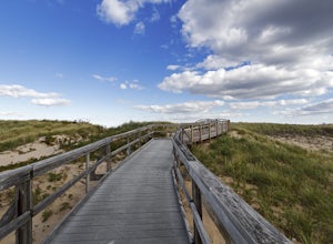
4.50.98 mi / 20 ft gainPark in the parking area off of Refuge Rd. Take the Dunes Trail, a boardwalk path for the ~1-mile loop. Enjoy the views from an observation deck on three-story-high dunes. This trail is accessible from April-October.Read more -
Boston, Massachusetts
Run the Jamaica Pond and Victorian Jamaica Plain Loop
5.01.5 mi / 95 ft gainPark in the Jamaica Pond parking area. You can go either direction on this loop trail, which is highly trafficked and dog-friendly. Keep a lookout for (and a respectful distance from) the wildlife that live here. The loop around Jamaica Pond itself is 1.5 miles. The best part about running in thi...Read more -
Boston, Massachusetts
Freedom Trail
4.72.9 mi / 121 ft gainPark along the trail and then hop on. The Freedom Trail allows you to not only see the most beautiful parts of Boston (which is an absolutely gorgeous city) but you can learn some history too! Head off the trail a bit to explore the Charles River, the waterfront near the aquarium and picturesque ...Read more -
Ipswich, Massachusetts
Photograph Castle Hill
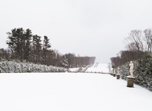
4.0Castle Hill refers to either a 165-acre drumlin surrounded by sea and salt marsh or to the mansion that sits on the hill. Both are part of the 2,100-acre Crane Estate located on Argilla Road in Ipswich, Massachusetts.Take a walk through the public garden or down to the beach. Plenty of beautiful ...Read more

