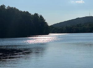
Merrimack, New Hampshire
Looking for the best hiking in Merrimack? We've got you covered with the top trails, trips, hiking, backpacking, camping and more around Merrimack. The detailed guides, photos, and reviews are all submitted by the Outbound community.
Top Hiking Spots in and near Merrimack
-
Jaffrey, New Hampshire
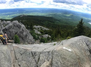
Hike MT Monadnock via White Arrow Trail
4.3 mi / 1485 ft gainArriving at the Old Toll Road/Halfway House Trail head you will have $5 entrance fee. Starting on the Old Toll road you'll find yourself walking on a gradual incline into the beautiful New Hampshire wilderness. Everything you see and smell is fresh and vibrant. Following the road for 1.1 miles yo...Read more -
Westminster, Massachusetts
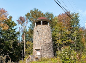
Summit Mt. Wachusett via the West Side Trail
5.01.2 mi / 750 ft gainSet your GPS to Wachusett Mountain ski area. Coming from Rt. 2 turn onto Mile Hill Rd and look for your first right to take Bolton Rd. Take this road all the way until it intersects with West Princeton Rd. Turn left. and drive down W Princeton Rd for 1.2 miles and there should be a small parkin...Read more -
Newbury, Massachusetts
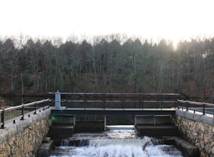
Explore the Parker River National Wildlife Refuge
4.66.5 miLocated just north of Boston, Parker River National Wildlife Refuge was established in 1941 to provide feeding, resting, and nesting habitat for migratory birds. The refuge lands are both scenic and diverse, with approximately 4700 acres of habitats including sandy beach and dune, cranberry bog, ...Read more -
Marlborough, Massachusetts
Hemingway Street Trail
1.73 mi / 197 ft gainHemingway Street Trail is an out-and-back trail that provides a good opportunity to view wildlife located near Marlborough, Massachusetts.Read more -
Medford, Massachusetts
Hike Southern Middlesex Fells Loop
4.73.5 mi / 756 ft gainPark in the parking area near Bellevue Pond. There are multiple entrances to the reservation (some closer to the reservoir itself than others). I have spent days in there hiking around and never seeing the water and there are days when I just hiked right in to the water and sat and enjoyed it. Th...Read more -
Newbury, Massachusetts
Hellcat Dunes Loop
4.50.98 mi / 20 ft gainPark in the parking area off of Refuge Rd. Take the Dunes Trail, a boardwalk path for the ~1-mile loop. Enjoy the views from an observation deck on three-story-high dunes. This trail is accessible from April-October.Read more -
Wellesley, Massachusetts
Walk along Lake Waban
3 miNote: The campus is currently closed due to COVID-19 restrictions. This is a lake on Wellesley College Campus. It is easy to get to from just about any direction. Just park and walk toward the lake, and there are paths that will take you there. The easiest place to park (pinned on the map) is ju...Read more -
Boston, Massachusetts
Freedom Trail
4.72.9 mi / 121 ft gainPark along the trail and then hop on. The Freedom Trail allows you to not only see the most beautiful parts of Boston (which is an absolutely gorgeous city) but you can learn some history too! Head off the trail a bit to explore the Charles River, the waterfront near the aquarium and picturesque ...Read more -
Newbury, New Hampshire
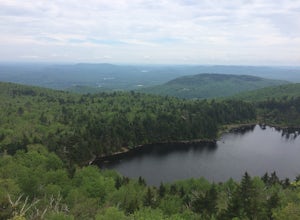
Hike to Lake Solitude, NH
4.04.8 mi / 2510 ft gainThe two most popular routes to Lake Solitude are the Newbury Trail and Andrew Brook Trail. The round-trip distance of the hikes are 4.8 miles and 3.8 miles. Both could be described as moderate in terms of difficulty. The Newbury trail is accessed from Lakeview Ave and Andrew Brook Trail can be a...Read more -
Rollinsford, New Hampshire
Scoutland Road Trail
4.03.88 mi / 108 ft gainScoutland Road Trail is an out-and-back trail where you may see beautiful wildflowers located near Rollinsford, New Hampshire.Read more -
Ashland, Massachusetts
Hike the Ashland Reservoir Trail
5.03.2 mi / 68 ft gainPark in the lot on State Park Road (see map) to access the trail. It's a popular trail that is dog-friendly. Pay attention to the trail as at parts it is not well marked.Read more -
Boston, Massachusetts
Run the Arnold Arboretum Trail
5.02.6 mi / 150 ft gainPark in the lot off of Arborway to access the trail. This place is gorgeous year round. The winter offers a quiet solitude, fall boasts bright colors, spring is the most beautiful as the flowers start to burst and cherry blossoms take over, and summer is overwhelmingly green. There are dozens of ...Read more -
Quincy, Massachusetts
Hike The Skyline Trail at Blue Hills
4.012.7 mi / 2542 ft gainPark in the lot across from Batterymarch Rd off of Willard St. Access the Skyline trail from here, it is marked blue. Follow the signs. The trails in Blue Hills are perfect for training for backpacking because they are so steep and rocky. I would fill up a big pack and take the skyline trail up t...Read more -
Milton, Massachusetts
Houghton's Pond Recreation Area
1.2 mi / 79 ft gainHoughton's Pond Recreation Area is a loop trail that takes you by the lake located near Milton, Massachusetts.Read more -
Gilford, New Hampshire
Hike the Lockes Hill Trail
4.01.8 mi / 419 ft gainThis trail, beginning at a parking lot adjacent to the lake, leads to one of the best views of Lake Winnipesaukee. Although not very high in elevation, it is one of the tallest crests in the area, providing some of the best views, and the actual hike is not challenging in most conditions. Due to ...Read more

