New Washoe City, Nevada
Top Spots in and near New Washoe City
-
South Lake Tahoe, California
Middle Velma Lake via Eagle Falls Trailhead
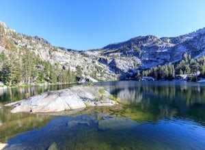
4.59.18 mi / 2251 ft gainHiking or backpacking to the Velma Lakes area is a must do if you want to explore and escape the summer crowds of South Tahoe. There are 3 lakes, Upper, Middle, and Lower Velma Lake. The trek out to Middle Velma is 9+ miles roundtrip, but you can add to it depending on how many other lakes you wa...Read more -
South Lake Tahoe, California
Eagle Lake Trail
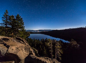
4.02.35 mi / 571 ft gainThe trailhead starts (and ends) by the beautiful Emerald Bay of Lake Tahoe, and goes west. The trail is well-marked and composed of mostly granite steps. Once you get to the lake, you can swim: it's cold but beautiful. If you keep following the path to the wooded areas (to the left), there are s...Read more -
South Lake Tahoe, California
Eagle Falls Vista Loop
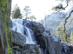
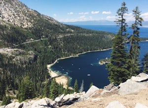
0.56 mi / 138 ft gainEagle falls is a short walk from the main Emerald Bay vista point. The top of the falls are cool to look at themselves, with great views of the lake.Read more -
South Lake Tahoe, California
Photograph Lake Tahoe’s Inspiration Point
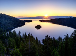
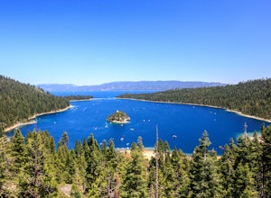
4.7Lake Tahoe’s Emerald Bay is a national natural landmark and is one of the prettiest parts of the lake. Inspiration Point is located along route 89 on the Southwest side of Tahoe about 10 miles from South Lake Tahoe or about 33 miles South from Truckee. It is very easy to get to, and its high va...Read more -
South Lake Tahoe, California
Maggie's Peaks
5.03.85 mi / 1663 ft gainThis hike starts from the Bayviews Campground Trailhead. This day use area is usually pretty crowded so arrive early to get a parking spot. There is parking a quarter of a mile into the campground near the trail head, but if there is no room there is overflow parking just outside of the camping a...Read more -
South Lake Tahoe, California
Cascade Falls
4.81.32 mi / 98 ft gainStarting out at the Bayview Trailhead you will make your way out through the campground towards the trail. Once you find the trail it is a simple way to the falls. It starts out as a wide trail and winds through the pine and fir trees. You will come to some stone steps as the trail narrows for th...Read more -
South Lake Tahoe, California
Backpack to Eagle Lake and Dick's Lake
4.513 mi / 1500 ft gainGet ready to get your lake on! This backpacking trip will take you 13+ miles through awesome scenery to several alpine lakes.Starting at the Bayview Campground, off of HWY 89, this hike follows the Granite Lake Trail along a difficult climb. Don't let the climb discourage you! As you climb, the v...Read more -
South Lake Tahoe, California
Hike to Snow Lake in Desolation Wilderness
5.05 miThis wonderful alpine lake is a relatively short hike in Desolation Wilderness and is a perfect introduction to off trail exploration. This area lacks the crowds that other lakes in Desolation garner because most maps don't show the trail leading to the lake. Although there is a rough trail, the ...Read more -
South Lake Tahoe, California
Lower, Middle, and Upper Velma Lakes
3.010.14 mi / 2316 ft gainThe hike starts at Bayview Trailhead (Latitude: 38.938619 | Longitude: -120.14197). A wooden sign points right to "Desolation" and left to Cascade Falls. Follow the sign towards Desolation. The first 3/4 mile is comprised of switch-backs that lead to a high point with a spectacular view of Lake T...Read more -
South Lake Tahoe, California
Swim in Granite Lake
5.01.25 mi / 900 ft gainGranite Lake is a pristine alpine lake near Lake Tahoe just off the Highway 89 above Emerald Bay. To get there park at the Bayview Campground Trailhead, which can be pretty crowded in peak season so get there early. The trail begins with an split: right takes you into the Desolation Wilderness (a...Read more -
Soda Springs, California
Hike to the Peter Benson Hut
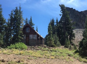
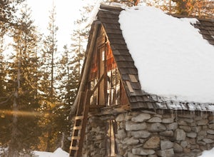
5.011.6 mi / 1800 ft gainDrive to the top of Donner Summit via the Old Hwy 40 and park at the Donner Summit PCT trailhead, just past the Sugar Bowl Academy Building. Begin hiking up-hill through a somewhat forested area for about 2 miles. Shortly after you pass the trail sign for the Mt. Judah Loop, you will come to a sm...Read more -
South Lake Tahoe, California
Hike Mount Tallac
4.99.5 mi / 3255 ft gainThe classic 9½ mile out-and-back day hike to Mount Tallac begins at the trailhead on the southwestern side of Lake Tahoe, between Emerald Bay and Camp Richardson. When driving to the trailhead, make a turn inland at Mt. Tallac Road and follow the well-signed route to the reasonably sized parking ...Read more -
Soda Springs, California
Snowshoe to the Peter Grubb Hut
5.08 miThe Peter Grubb Hut is located below Castle Peak in Round Valley, 3 miles north of the Castle Peak trailhead near I-80. Overnight parking is available at the California Sno-Park at the Boreal-Castle Peak exit on I-80. Park on the frontage road east of the Boreal Inn and walk back under the freewa...Read more -
Soda Springs, California
Summit Castle Peak
4.06 mi / 1800 ft gainThe trailhead is very easy to access as it is just off Highway 80 at the Boreal Mountain exit. When taking the exit, take a turn to the North, rather than to Boreal on the South side of the Highway. On busy summer weekends this trailhead can get quite crowded so you may have to park at the bottom...Read more -
Soda Springs, California
Hike to the Top of Andesite Peak
5 mi / 1000 ft gainFrom the trail map sign, follow the dirt path straight, following signs for the cross-country skiing route, not snowmobiling. Continue until you see a trail marker. You'll veer left to head over to the Hole in the Ground trail. Once you see another identical trail map board, you'll head left. Thi...Read more -
South Lake Tahoe, California
Bike to Star Lake
5.021 mi / 2300 ft gainStart out at the top of Corral Loop, in South Lake Tahoe, and begin the climb up Armstrong Pass. After the 4 mile ride up, you reach the split to either Mr. Toads or Star Lake. Continue another 2.5 miles up the steep and sandy climb to the saddle just below Freel Peak, the tallest peak in the bas...Read more

