Incline Village, Nevada
Looking for the best hiking in Incline Village? We've got you covered with the top trails, trips, hiking, backpacking, camping and more around Incline Village. The detailed guides, photos, and reviews are all submitted by the Outbound community.
Top Hiking Spots in and near Incline Village
-
Reno, Nevada
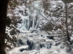
Hunter Creek Trail
3.06.43 mi / 1362 ft gainJust outside of Reno find a fun little hike through the hills along a creek, ending at a beautiful waterfall. The trail is heavily trafficked and easy to follow with two creek crossings. It is mostly a moderate but steady climb on the way out, with just a few steep spots. The parking lot has ...Read more -
Reno, Nevada
Quail Run and Flume Trail Loop
4.01.45 mi / 128 ft gainQuail Run and Flume Trail Loop is a loop trail that takes you past scenic surroundings located near Reno, Nevada.Read more -
Reno, Nevada
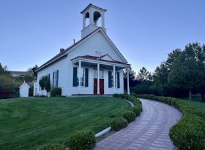
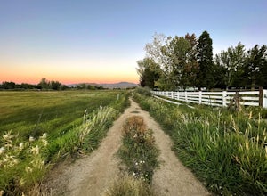
Anderson Park Loop
4.01.64 mi / 92 ft gainAnderson Park Loop is a popular trail for walking or running tucked away in a quiet neighborhood near Reno, Nevada. The trail loops around a pasture and connects up to Bartley Ranch for a longer or more scenic route. Take in scenic views of the surrounding mountains, but there may be some traf...Read more -
Reno, Nevada
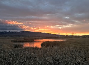
Damonte Ranch Wetland Loop
5.03.07 mi / 85 ft gainDamonte Ranch Wetland Loop is a loop trail that takes you by a lake located near Sparks, Nevada.Read more -
39.333252,-120.289482
Donner Lake Rim Trail: Johnson Canyon to Trout Creek
A perfect Sunday hike on your way back from a weekend at Lake Tahoe. Exit I-80 at Donner Lake and take the dirt road on the north side of I-80 to a large parking lot. A mild climb followed by a set of tougher switchbacks leads you to great views from Donner Ridge. Although adventuring out on t...Read more -
Reno, Nevada
Huffaker Park Lookout Trail
4.01.88 mi / 308 ft gainHuffaker Park Lookout Trail is a loop trail where you may see beautiful wildflowers located near Reno, Nevada.Read more -
Reno, Nevada
West Plateau Loop
3.03.15 mi / 312 ft gainWest Plateau Loop is a loop trail that takes you by a river located near Reno, Nevada.Read more -
Zephyr Cove, Nevada
Castle Rock Loop
5.02.84 mi / 630 ft gainThis hike is located near Stateline, Nevada. The trail joins the Tahoe Rim Trail for part of the hike. Be aware that there will be snow on the trail from November - late May, early June depending on snowfall. Bring snowshoes / appropriate boots if you wish to use the trail in the winter. Experien...Read more -
Tahoe City, California
Hike the Ellis Peak Trail
5.06.3 mi / 1660 ft gainThe Ellis Peak Trail is close to North Lake Tahoe. The trail features scenic wildflowers in the spring and summer. Dogs are allowed on the trail but must be kept on leash. Directions from Truckee: Take Highway 80 south and drive to Tahoe City - continue south on Highway 89 from Tahoe City for 4....Read more -
South Lake Tahoe, California
Hike the Rubicon Trail
5.07 mi / 400 ft gainThe Rubicon Trail is a through hike connecting D.L. Bliss State Park and Emerald Bay State Park. You can start at either point. I opted to start at D.L. Bliss State Park to avoid the long walk uphill to catch the Nifty Fifty shuttle. Also, there is more available parking at Bliss. Park your c...Read more -
South Lake Tahoe, California
Hike the Lighthouse Trail at D.L. Bliss State Park
4.82.3 mi / 505 ft gainThe Lighthouse Trail is a 2.3 mile loop located in D.L. Bliss State Park on the lower west side of world famous Lake Tahoe. To get the trail, enter the park through the main entrance ($10 parking fee), the follow the road until you see two parking areas of the left side with about 6 or 7 spots e...Read more -
Glenbrook, Nevada
Castle Rock via Tahoe Rim Trail
5.01.79 mi / 407 ft gainCastle Rock via Tahoe Rim Trail (The Bench) is an out-and-back trail that takes you through a nice forest located near Zephyr Cove, Nevada.Read more -
Reno, Nevada
Rattle Snake Mountain
4.01.49 mi / 371 ft gainRattle Snake Mountain is an out-and-back trail that takes you past scenic surroundings located near Reno, Nevada.Read more -
Truckee, California
Hike the Truckee Tunnels
5.0To get here, drive along Donner Pass Rd. There is a turnoff about 100 yards away from the Donner Summit Bridge where you can park. The hike begins at a plaque for the China Wall- a large retaining wall built by Chinese railroad workers. Hike up the trail towards the tunnels. Some spots may requi...Read more -
Stateline, Nevada
Hike the Lam Watah Trail
5.02.2 mi / 85 ft gainLam Watah Trail is a 2.2 mile out and back hike, that will take you through Lam Watah meadows and ends at Nevada Beach. I did the hike in December and although the best time to do it is May through October, I think it had more charm during the winter time. The trail head begins from the parking ...Read more -
Stateline, Nevada
Stroll through Rabe Meadows
1.5 miRabe Meadows is a tranquil and peaceful stroll next to Burke Creek as it flows to Lake Tahoe and Nevada Beach State Park. Very easy 1.5 mile paved trail. Perfect when there isn't any snow and a short easy hike is in need. Take in the scenery and peacefulness and be happy to be outside.Read more

