Carson City, Nevada
Top Spots in and near Carson City
-
Kyburz, California
Hike Pyramid Peak
5.0Although it stands only slightly higher than its neighbors, Pyramid Peak nonetheless dominates the Crystal Range atop which it sits. Great views from the summit make this a must-do.The Route: The route is fairly straightforward to Lake Sylvia (see map). Simply follow the well-defined Lyons Cr...Read more -
Alpine County, California
Hike Round Top Summit and Winnemucca Lake Loop
6.6 mi / 1272 ft gainThis hike begins near the Woods Lake campground. Start off by hiking towards Winnemucca Lake. You will begin your journey going through the forest beside a crystal-clear stream. Soon the trail opens up to become more open, full of all colours of wild flowers. You follow this breathtaking trail up...Read more -
Alpine County, California
Hike The Sisters in the Mokelumnee Wilderness
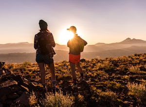
8 mi / 2500 ft gainThe Sisters offer a great day hike with fun scrambling and beautiful views of the Northern Sierra, Lake Tahoe, the Mokelumnee Wilderness, and the Carson River Canyon.The trail to The Sisters begins at Woods Lake (38.6855° N, 120.0095° W), at the end of Woods Lake Road off Highway 88, 1.5 miles we...Read more -
Markleeville, California
Caples Lake to Emigrant Lake
5.08.71 mi / 971 ft gainThis is an awesome out-and-back hike for the weekend warrior. The trail begins at the western-most point of Caples Lake, and takes you to Emigrant Lake. The first 2/3 of the trail is rather flat and appropriate for all skill levels. The last mile up to the lake schleps up the hill, and has some ...Read more -
Kyburz, California
Hike to Bassi Falls
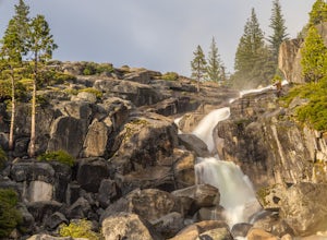
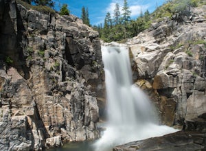
4.61.22 mi / 194 ft gain109' tall Bassi Falls is located in the Crystal Basin area of the El Dorado National Forest. These gorgeous falls at peak Springtime flow crash over enormous boulders and the water sheets over huge, flat slabs of granite. It is located off a rural, pot-holed dirt road (high clearance vehicles re...Read more -
Amador County, California
Hike to Thunder Mountain at Carson Pass
7 miThe trailhead begins on Rt 88 just past Kirkwood Resort or Silver Lake - depending on which way you are headed. There is plenty of parking but no other amenities. The trail begins at 7,900 ft and climbs steadily up Two Sentinels then along the ridge to Martins Point, ending at the 9,408ft summit ...Read more -
Truckee, California
Backpack the Palisades Creek Trail
4.015 mi / 2200 ft gainAfter driving out to Kidd Lakes and parking at the trailhead, you take off through some easy forest hiking past Cascade Lakes and Long Lake. Pay attention to the cairns marking the trail as you traverse across a large granite section with Devils Peak to your West. The trail is easy to follow and ...Read more -
Truckee, California
Swim at Long Lake near Truckee
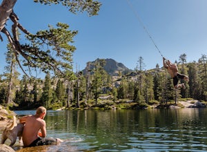
3.71.5 mi / 100 ft gainThe story goes that twenty or so years ago, long before the advent of the Royal Gorge Cross-Country Ski Area, some local Truckee boys decided to put a couple rope swings up on Long Lake near Soda Springs, CA, and they remain there to this day.Long Lake sits amongst a cluster of both man-made and ...Read more -
Markleeville, California
Backpack to Grouse Lake
4.711.43 mi / 2283 ft gainIt is a 6 mile hike to Grouse Lake. You begin at the trailhead which is right by Damsite Campground at Upper Blue Lake. Park in the dirt parking area and then cross the metal footbridge, and you will see the trailhead marker on your left. The trail takes you into the Mokelumne Wilderness. Follow...Read more -
Pioneer, California
Hike to Granite Lake
Take the road to Kit Carson Lodge. When the road turns to dirt, take this one-lane dirt road as far as you can go. The road terminates into a round parking area, however, as of the writing of this post, there was a large tree blocking the road about 250 ft before the end.The Trailhead is clearly ...Read more -
Pioneer, California
Camping at The Pots
4.2This fantastic camping or chilling spot has beautiful granite pools and slides of all sizes. The area consists of a river flowing over a granite slab creating pools some of which are over ten feet deep. The water cascades down the granite in small water falls. The area is located next to Silver L...Read more -
El Dorado County, California
Camp at Ice House Reservoir
4.01 mi / 1 ft gainDesolation Wilderness is just west of Lake Tahoe, a part of Eldorado National Forest. It's a very popular backpacking destination as the PCT and Tahoe Rim Trail both run through the area. There are what seems to be endless amounts of mountain lakes, creeks, and rivers that run through this area w...Read more -
Loch Leven Lakes Trailhead, California
Loch Leven Lakes Trail
4.47.6 mi / 1480 ft gainThe trail is easy to follow for the first half mile until you get to some large slabs of granite. As you continue up the trail look for stacked rocks, these will give you a an easy route as you continue up the mountain. The trail then starts to switch back eventually leading to a small bridge. Af...Read more -
Emigrant Gap, California
Loch Leven Viewpoint Trail
5.06.41 mi / 1522 ft gainLoch Leven Viewpoint Trail is an out-and-back trail to a viewpoint of the Loch Leven Lakes that is moderately difficult located near Truckee, California. This trail is just under 6.5 miles. If you're willing to add a little more than a mile to your adventure, you can head all the way to Upper Loc...Read more -
Emigrant Gap, California
33mi Loop to Donner Lake
33 miWe love this 33-mile loop on old Highway 40 from Cisco Grove to Donner Lake and back. It has just about everything: a few flats, a long slow pull, rollers, a screaming downhill, a tough Alpine climb and a long, cruising downhill. Not to mention altitude. The ride starts at a little above 6,000 fe...Read more -
Arnold, California
Climb Lookout Peak in the Carson-Iceberg Wilderness
5.04 mi / 1900 ft gainLookout Peak in the Carson-Iceberg Wilderness off Highway 4 provides solitude and wonderful views of the surrounding Sierra Nevada including the Mokelumnee and Emigrant Wildernesses. Even on summer weekends you'll likely have the peak and surrounding area all to yourself.Lookout Peak can be done ...Read more

