Somers, Montana
Top Spots in and near Somers
-
West Glacier, Montana
Hike to the Mt. Brown Lookout
5.0The trail is accessible (though sometimes covered in snow) year-round because the trailhead lies in the lower elevation area of the park. It begins at the Sperry Trailhead, located directly across the street from the lake McDonald Lodge. Follow the Sperry Trail for 1.6 miles until you reach the M...Read more -
West Glacier, Montana
Bike Going-to-the-Sun Road in Glacier National Park
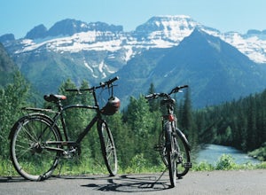
5.050.65 mi / 5036 ft gainEvery Spring (May - June) Going-to-the-Sun road remains closed to cars long after the snow has been plowed and melted. However, just past the Lake McDonald Lodge a sign declares the road open to Hikers and Bikers, providing one of Montana's best adventures. Follow Going-to-the-Sun Road in from ...Read more -
West Glacier, Montana
Backpack to Logging Lake
8.8 miBackcountry camping is the best plan if you’d like to visit Logging Lake, and the primitive campsites lay at the end of a four and a half mile hike through some of the most unspoiled sections of the park. The trail follows logging creek most of the way to the lake traversing through a variety of ...Read more -
Hungry Horse, Montana
Hike to the Blue Lakes
2 mi / 100 ft gainThe drive out to the trailhead where this hike starts is an adventure in and of itself. As the Forest Service website describes it. "Silvertip Trailhead is accessed from Highway 2. From the town of Hungry Horse, drive east on Highway 2 for ½ mile to the East Side Reservoir Road #38. Turn right (s...Read more -
West Glacier, Montana
Explore Avalanche Creek
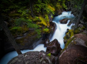
5.00.7 miAvalanche Creek is one of Glacier National Park's easiest features to access and also one of its most unique. The old-growth cedar forest is home to towering trees, moss-covered boulders, and a rushing stream of glacial water. A small loop trail winds through the lower forest and leads to a bri...Read more -
West Glacier, Montana
Trail of the Cedars
5.00.88 mi / 121 ft gainTrail of the Cedars Trail is a loop trail that takes you by a river located near Lake Mc Donald, Montana.Read more -
West Glacier, Montana
Avalanche Lake via Trail of Cedars
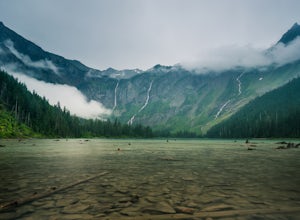
4.95.91 mi / 730 ft gainThis very scenic Glacier National Park hike off of Going-to-the-Sun road is 4.5 miles with a total elevation gain of 730 feet. The hike to Avalanche Lake begins from the Trail of the Cedars trailhead. Be prepared for a lot of incline. Approximately one half mile from the trailhead you’ll reach...Read more -
Condon, Montana
Climb Holland Peak
11 mi / 5200 ft gainAbout 2 mi. south of Condon, MT, take Rumble Creek Road east to Cooney Lookout and park at the trailhead at 4550 ft. Follow the trail for about 1 mi. and after about 100 yards after the third bridge, look for a well worn trail heading up the hill side. Take this steep, hard-packed trail and follo...Read more -
Glacier County, Montana
Explore Two Medicine Lake
5.0Two Medicine Lake sits in the southeastern part of Glacier NP away from the more popular Going-to-the-Sun Road. The 2-mile long lake has a 100 site campground that serves visitors on a first-come-first-serve basis; the campground opens mid-April and closes in November. From the main parking area...Read more -
Glacier County, Montana
Hike to Two Medicine Pass
7.9 mi / 2350 ft gainStarting at the South Shore trailhead on Two Medicine Lake (parking available), you'll follow the lake through alternating forest and meadows and eventually cross a small suspension bridge. Afterwards the trail forks. Take the "Two Medicine Pass" trail on the left rather than the Twin Falls/Upp...Read more -
Browning, Montana
Photography on Logan Pass
5.0Disclaimer: Glacier National Park has closed any off-trail activity in this area. The majority of the photos can be taken on-trail. Please be sure to adhere to the park's policy.With a short window of opportunity for visiting, Logan Pass offers a wealth of photographic options. As the winter sno...Read more -
Browning, Montana
Hidden Lake Overlook
5.02.83 miThe trail starts at the Logan Pass Visitor Center, which is right in the middle of Going-To-The-Sun Road. It can be very busy during the middle of the day, but early morning and early evening will have less of a crowd. It's a pretty short hike in a beautiful wide open alpine meadow. We were gree...Read more -
Browning, Montana
Hike Dragon's Tail Ridge
3.53 mi / 1800 ft gainStarting from Logan's Pass, make your way along the boardwalk that leads to the Hidden Lake Overlook. Depending on the previous winter, there may be quite a bit of snow covering large portions of the boardwalk and trail that leads to Dragon's Tail, so it is suggested that you take any necessary p...Read more -
Browning, Montana
Reynolds Mountain
4.511 mi / 2500 ft gainReynolds Mountain stands high above the Logan Pass Visitors Center. Because of it's easy location, be prepared to get caught in the heavy rush of tourists on the way up. Though most will not be going to Reynolds Mountain, you will still need to "wade" through heavy tourism to reach the trail he...Read more -
Browning, Montana
Summit Reynolds Mountain via the North Face Ascent Route
7.9 mi / 2500 ft gainMt. Reynolds is a premier peak in Glacier National Park (GNP). The views from the beginning to the summit are incredible all the way around. Reynolds offers those who are starting to climb an introductory climb with little technicality and a reward that is well earned at the top. GNP requires an ...Read more -
Glacier County, Montana
Hike to Scenic Point in Glacier National Park
5.07.74 mi / 2205 ft gainPark at the trailhead and begin the hike. The trail starts out relatively flat until you reach a small waterfall. Then, hike up the switchbacks for about 4 miles while gaining around 2300 feet. From the top, you can see both Upper Two Medicine Lake and Two Medicine Lake. The views are stunning. ...Read more

