Montana
Looking for the best running in Montana? We've got you covered with the top trails, trips, hiking, backpacking, camping and more around Montana. The detailed guides, photos, and reviews are all submitted by the Outbound community.
Top Running Spots in and near Montana
-
West Glacier, Montana
Trail of the Cedars
5.00.88 mi / 121 ft gainTrail of the Cedars Trail is a loop trail that takes you by a river located near Lake Mc Donald, Montana.Read more -
Missoula, Montana
Blue Mountain Lookout Deadman Ridge Trail
5.04.79 mi / 840 ft gainBlue Mountain Lookout Deadman Ridge Trail in Missoula, Montana is a moderately challenging hiking trail. The trail spans approximately 4.79 miles, offering a round-trip hike that takes about 3 to 4 hours to complete. The trail is marked by a steady incline, with an elevation gain of 840 feet. T...Read more -
Helena, Montana
Continental Divide Trail: MacDonald Pass to Priest Pass
5.010.8 mi / 2500 ft gainThe CDT trail is a popular trail with thru-hikers, and is considered one of the three Crown Jewels. The Appalachian Trail and the Pacific Crest Trail being the other two. This section of the Continental Divide Trail starts 25-minutes to the West of Helena just off Highway 12 at the CDNST Trailhe...Read more -
Great Falls, Montana
North Shore Rivers Edge Trail East
6.9 mi / 700 ft gainThe North Shore Rivers Edge Trail East is a moderate trail that has been created mostly by the local biking associations. The trail follows the bluffs on the edge of the river with plenty of twists and turns to keep it interesting. To access the East section of the North Shore Rivers Edge trail,...Read more -
Great Falls, Montana
Hike or Bike the South Shore River's Edge Trail
10 mi / 975 ft gainThe South Shore River's Edge Trail runs along the Missouri River. The trail is rated as moderate and is perfect for hiking, trail running, and mountain biking. It's an out-and-back, so you can go as far as you like. To start, park at the South Shore Trail Trailhead (click the Get Directions link ...Read more -
Helena, Montana
Prospect Shaft Trail
2.4 mi / 800 ft gainThe Prospect Shaft Trail is a lightly used trail used to reach the summit of Mt Helena. The trail is rated as a 'moderate' trail due to its steep, loose, rocky surface. Due to these characteristics, it's rarely used for mountain biking and primarily used for hiking and trail running. The views a...Read more -
Thompson Falls, Montana
Blossom Lakes Trail
4.05.73 mi / 1299 ft gainBlossom Lakes Trail is an out-and-back trail that takes you by a lake located near Saltese, Montana.Read more -
Helena, Montana
Mount Ascension
3 mi / 950 ft gainMount Ascension is a popular trail in Helena. It's used for hiking, trail running, and mountain biking. It can be accessed year-round, but can get icy and slippery during the winter. The path for Mount Ascension is a network of trails that that can be done as an out-and-back, or a lollipop trail...Read more -
Helena, Montana
1906 Trail
3 mi / 1000 ft gainLocated just outside of Helena, the 1906 Trail starts at the Mt Helena Parking Lot. The path is wide enough to share with hikers, trail runners, or mountain bikers. Note: this is an uphill-only trail for mountain biking. It's a very popular trail due to its wide trail and awesome views from the t...Read more -
Kalispell, Montana
Western Larch and Cliff Trail Loop
2.77 mi / 656 ft gainWestern Larch and Cliff Trail Loop is a loop trail that takes you through a nice forest located near Kalispell, Montana.Read more -
Gallatin Gateway, Montana
Beehive Basin Trail No. 40
5.07.01 mi / 1601 ft gainBeehive Basin Trail No. 40 is an out-and-back trail that takes you by a lake located near Big Sky, Montana.Read more -
White Sulphur Springs, Montana
Kings Hill Pass Trail
5.9 mi / 1800 ft gainThe Kings Hill Pass Trail is located off Highway 89 in the Little Belt Mountains of the Helena-Lewis & Clark National Forest. Kings Hill is considered a scenic byway and climbs to an elevation just over 7,200 feet at the pass. Kings Hill Pass Trail is considered a more difficult trail and se...Read more -
Big Sky, Montana
Run the Rut
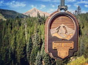
17.4 mi / 7800 ft gainThunderdome. That's the only way to describe it. Eight months later and I'm still thinking about it on a regular basis. My half-way grown out black toenail is a constant reminder of the epic-ness of that brutal race day. The Rut is held the first weekend of September in Big Sky, MT -- a pretty r...Read more -
Rising Sun, Montana
Baring Falls via Piegan Pass Trail
1.96 mi / 246 ft gainBaring Falls via Piegan Pass Trail is an out-and-back trail to a waterfall located near the southern end of St. Mary Lake in East Glacier Park Village, Montana.Read more -
Helena, Montana
Rodney Ridge Trail
2.6 mi / 300 ft gainWith it's easy access from Rodney Street, Rodney Ridge Trail is a locals favorite. The trail heads up the ridge and provides fantastic views of Helena below. The trail is rated as moderate, and is used primarily for mountain biking and hiking. Dogs are allowed, so, you'll most like encounter a 4...Read more

