Lewis and Clark County, Montana
Looking for the best hiking in Lewis and Clark County? We've got you covered with the top trails, trips, hiking, backpacking, camping and more around Lewis and Clark County. The detailed guides, photos, and reviews are all submitted by the Outbound community.
Top Hiking Spots in and near Lewis and Clark County
-
Augusta, Montana
Devil's Glen - Dearborn 206
5.06.19 mi / 554 ft gainDevil's Glen - Dearborn 206 is an out-and-back trail that takes you by a river located near Augusta, Montana.Read more -
Augusta, Montana
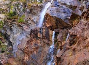
Hike to Cataract Falls
5.00.5 miLocated in the Lewis and Clark National Forest on the Rocky Mountain Front, this hike will give the best bang for your buck -- it's about as easy as they come but still boasts outstanding views. The falls are roaring in the spring with snow melt, tranquil in the summer and fall, and permit some d...Read more -
Lincoln, Montana
Hike the Continental Divide Trail via Roger Pass
2.33 mi / 665 ft gainAfter driving over Rogers Pass more times than I can count, we finally made it a point to stop and check out the Continental Divide Trail No. 440 -- glad we did. If you've driven the pass, you've seen the trail head about 66 miles west of Great Falls -- the wooden stairs off the right side of th...Read more -
Augusta, Montana
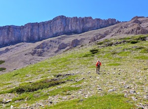
Hike Crown Mountain, Augusta
8 mi / 4200 ft gainLocated an hour and forty minutes east of Great Falls Montana, Crown Mountain is a fun day hike, and you'll see few if any other people. The nearest town is Augusta and a great place to stop for a burger and beer at Buckhorn Bar afterward. From Augusta, head West on Benchmark Road for 20 miles. ...Read more -
Augusta, Montana
Hike to Willow Creek Falls
5.04.5 mi / 1000 ft gainThe hike up Willow Creek Gorge is one of my favorites so far. Unfortunately, because of the terrain and elevation gain, I wouldn't recommend taking young kids but if you do, make sure they're attached to you in some way. There are no services at the trail head, so make sure to bring everything yo...Read more -
Helena, Montana
Four Wheel Drive and then Hike to Historic Mann Gulch
2.4 mi / 1535 ft gainIn 1949, a fire started in a remote area of the Gates of the Mountains wilderness, a gulch east of the Upper Missouri River. Fifteen smokejumpers were dropped in to fight it. Thirteen died. The United States Forest Service drew lessons from the tragedy of the Mann Gulch fire by designing new trai...Read more -
Teton County, Montana
Hike toward Ear Mountain on the Rocky Mountain Front
10 miEar Mountain's trailhead is located about 125 miles north of Helena. Besides being a hefty hike, Ear Mountain's unique shape draws attention to it every year. It has a flat top while also having sheer cliffs on either side. It sticks out from the main walls on the Rocky Mountain Front, and if you...Read more -
Sun River, Montana
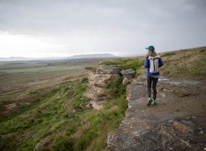
Hike the First Peoples Buffalo Jump Loop
5.03 mi / 400 ft gainWhile the trail doesn't offer the typical scenery of a Montana hike, the views are spectacular. At the top of the jump, you're at one of the highest points of the basin, allowing you to take in the full magnitude of the surrounding mountains, which include the Big Belt, Little Belt and Highwood R...Read more -
Helena, Montana
Explore Refrigerator Canyon
0.5 mi / 100 ft gainThe Refrigerator Canyon Trail is a scenic trail that leads into the Gates of the Mountains Wilderness. While this trail goes back for up to 16 miles, for this adventure, we will focus on the first half-mile of the trail. The first half-mile of Refrigerator Canyon Trail is the most scenic and uniq...Read more -
Choteau, Montana
Hike Jones Creek
5.04 mi / 300 ft gainThe trail head to Jones Creeks is just off of Teton River Road (the road that takes you up to Teton Pass Ski Area) and is marked with a sign, however it's only visible when you're coming down from Teton Pass. If you miss the sign, keep in mind it's about two miles past the Cave Mountain Forest Se...Read more -
Condon, Montana
Hike to Morrell Falls
4.02.7 mi / 150 ft gainFrom the town of Seeley Lake, travel 0.5 mile north on Highway 83. Turn east (right) on Morrell Creek Road (small green street sign) which becomes Forest Service Road #477/Cottonwood Lakes Road, and travel 1.1 miles. Turn north (left) on West Morrell Road #4353 and travel about 6 miles. Turn east...Read more

